Fanes-Sennes-Braies Natural Park
Parco Naturale Fanes-Sennes-Braies / Naturpark Fanes-Sennes-Prags
South Tyrol / Alto Adige (San Vigilio di Marebbe / Val Badia / Lago di Braies) · Italy
Photo: Alberto Restifo albertorestifo · CC0 · Wikimedia Commons
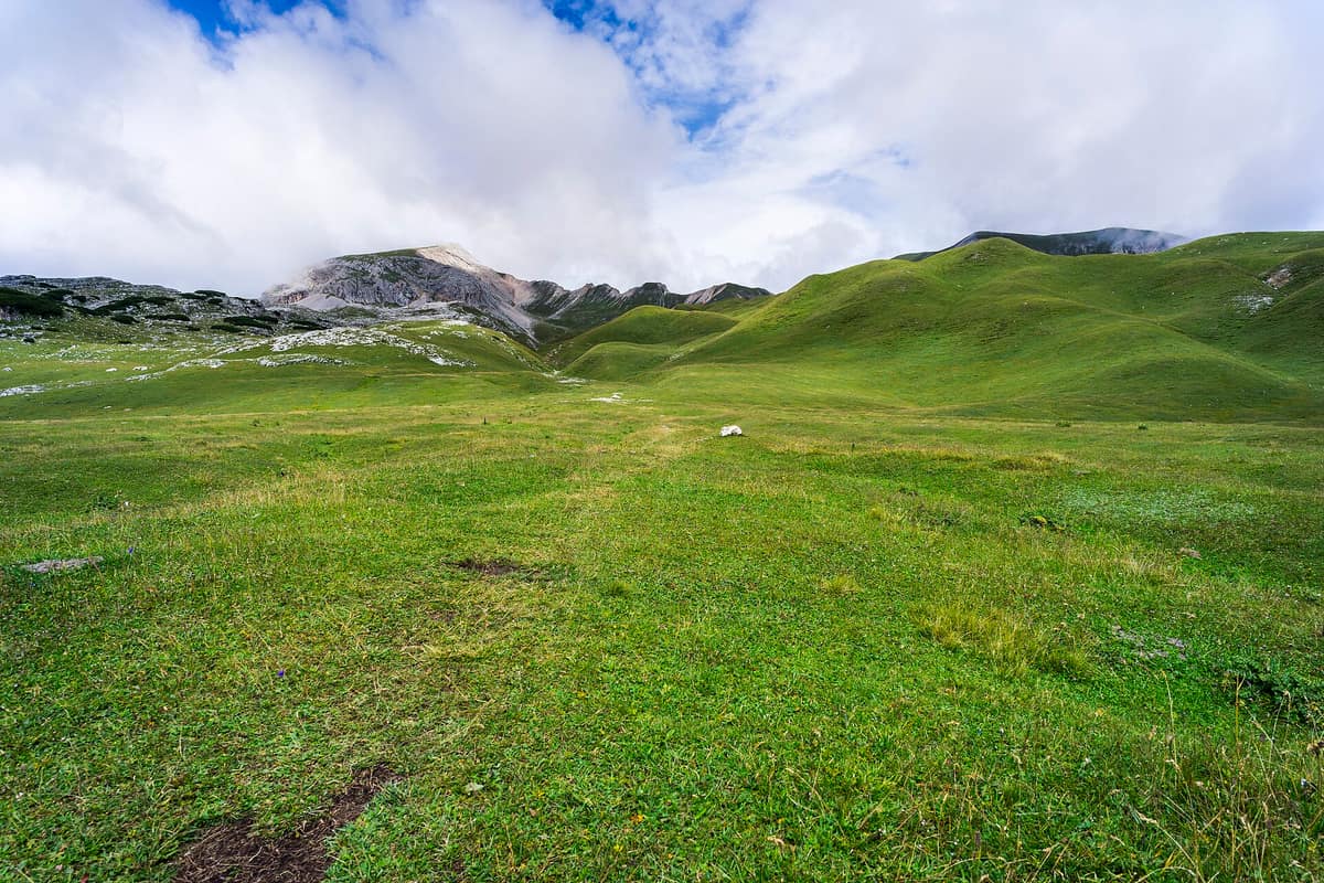
The idyllic turquoise waters of Lago di Braies and the desolate karst plateaus of Fanes and Sennes encircled by dolomitic amphitheatres.
In 1987, a hiker from Corvara stumbled upon an unprecedented find inside a cave on the Conturines: a prehistoric bear necropolis. There, at roughly 2.800 m, lay the skeletal remains of some 60 animals of a previously unknown species, the Ladin cave bear. That cave encapsulates the spirit of the Fanes-Sennes-Braies Natural Park: elevated limestone plateaus in the Dolomites, shattered by karst formations, beneath peaks approaching 3.000 m and photographic icons like Lake Braies.
What makes it unique
A cave here conceals the burial ground of an extinct bear unknown to science until recently, and Ladin legends tell of rowing across a mountain lake into the subterranean kingdom of Fanes.
The place
Nature
The landscape
Picture a giant staircase. Below in the valleys, the park borders the Pusteria valley to the north and Val Badia to the west, meeting the Tre Cime Natural Park to the east. High above, nestled among peaks hovering around 3.000 m, stretch the vast undulating plateaus of Fanes, Sennes, Fosses, and Prato Piazza. The highest point is the Hohe Gaisl, reaching 3.146 m to the southeast.
The rock is predominantly Jurassic and Cretaceous limestone, hollowed out by subterranean waters: across Fanes and Sennes, karstification has gouged ruts, crevices, and sinkholes. The lakes originated from catastrophic landslides. Lake Braies, resting at 1.496 m with a surface of 33 hectares and a maximum depth of 36 m, exists because a massive rockfall formed a natural dam. Lake Dobbiaco formed in antiquity through multiple rockslides tumbling from its western slopes.
Vegetation ascends with topography: coniferous woodlands dominated by Norway spruce occupy lower elevations, mingling with larch and Swiss stone pine higher up. At the timberline, mountain pine dominates, while between 2.000 and 2.800 m calciphilous alpine grasslands of blue moor-grass and evergreen sedge prevail.
Wildlife and seasons
The alpine marmot is the park's mascot and is ubiquitous. You will hear its piercing alarm whistles long before spotting it. Between the Fanes and Lavarella mountain huts lies a natural limestone hollow known as the «parliament of the marmots», and across the meadows of Fanes, Sennes, and Plätzwiese they are easily watched from the paths. In summer, herds of chamois graze in high glacial cirques. Alpine ibex, mountain hares, pine martens, and stone martens also inhabit the territory.
Coniferous woods provide an ideal haven for roe deer, and red deer have returned in recent decades. Avian fauna features black grouse, hazel grouse, western capercaillie, Eurasian eagle-owl, Eurasian pygmy owl, and the golden eagle. Wetland meadows around the southern edge of Lake Dobbiaco provide nesting habitat for diverse waterfowl.
Brown bears and lynx no longer dwell here, having been extirpated in the nineteenth century.
Species
With a page in the atlas
Being mentioned in a source doesn't guarantee sightings: check with the people who manage the area.
Memory and protection
History and conservation
The park was founded in 1980, joining the UNESCO Dolomites World Heritage Site in 2009 as part of the Northern Dolomites component. It is integrated into the Natura 2000 network. War relics remain scattered throughout the terrain, including the Austro-Hungarian fortification at Prato Piazza dating to the First World War.
Before you set off
Visiting
How to visit
Several access portals serve the park. You can enter via both branches of the Braies valley—from the lake or Prato Piazza—, through the Col de Locia pass from San Cassiano in Badia, or via the Marebbe valley.
The essential starting point is the visitor centre in San Vigilio di Marebbe, housed in a contemporary timber pavilion with free admission. It interprets the geology, paleontology, and traditional culture of the park, including the Conturines cave bear, fragile alpine habitats, and Ladin legends. For a gentle walk, the Lärchensteig is an undemanding route of about one kilometre featuring two general and seven themed stations on larch meadows, pastures, and streams. Around Lake Dobbiaco, another nature trail taking roughly two hours features eleven interpretive panels on local ecology.
Two classic circuits offer full-day trekking. From Lake Braies to Le de Fojedöra and back requires six to seven hours, with 800 m of elevation gain at a moderate grade. From Capanna Alpina to the Fanes hut and Pederü spans four to five hours, with 600 m of ascent at an accessible grade, traversing the parliament of the marmots. For history buffs, the «Peace Trail» follows Austro-Hungarian troop lines from World War I: five to six hours, 900 m of ascent, passing fortified wartime positions along a via ferrata route.
Before you go
Lake Braies is one of the most visited destinations in South Tyrol, yet apart from a historic hotel, a wooden boathouse, and footpaths, it retains a wild character. Check with the park authority regarding visitor centre operating hours, mountain road access, and hut opening dates prior to your trip.
Check access, rules and visiting conditions in the official information from the managing body before you set off.
Location
Where it is and how far it reaches
Boundary of Parco naturale Fanes - Sennes e Braies · IUCN IV · © EEA, CDDA (CC-BY) The coordinate is estimated; it isn't a verified access point.
Transparency
Sources
The research data with its sources, and the official links for this place, are in the Spanish version of this page. See the Spanish version
Around it
The Parque Natural Puez-Odle lies roughly four kilometres away as the immediate neighbouring park; Parco Naturale Paneveggio - Pale di San Martino is twenty-seven kilometres away and Parco Nazionale delle Dolomiti Bellunesi twenty-eight kilometres away.
What else to explore nearby
Approximate straight-line distance between the edges of each area. It doesn't indicate access, routes or driving times.
- Puez-Odle Natural Park / Naturpark Puez-Geisler
South Tyrol (Val Gardena / Val di Funes / Santa Cristina)
About 4 km away
The razor-sharp dolomitic spires of the Odle/Geisler towering above the alpine pastures of Val di Funes.
JFMAMJJASONDJune – October · Crowding moderate
- Paneveggio - Pale di San Martino Natural Park
Trentino (San Martino di Castrozza / Predazzo / Tonadico)
About 27 km away
The 'Forest of the Violins' (resonance spruce harvested by Stradivarius) beneath the spectacular dolomitic spires of the Pale di San Martino.
JFMAMJJASONDJune – October · Crowding low
- Belluno Dolomites National Park
Veneto (Belluno / Feltre / Agordo)
About 28 km away
The wildest and southernmost sector of the Dolomites (UNESCO World Heritage), carved by deep karst ravines such as the Cadini del Brenton.
JFMAMJJASONDMay – October · Crowding very low
If you like this place, elsewhere in Europe
Distant places with uncommon wildlife and habitats in common. The most widespread species don't count. Sharing species doesn't imply a corridor or guaranteed presence.
- Maritime Alps Natural Park
Piedmont (Cuneo / Valdieri / Entracque)
In common: Alpine marmot · Sea trout · Chamois — high mountain, old-growth forest
United with France's Mercantour National Park, it forms a massive cross-border Alpine-Mediterranean wilderness crowned by Mount Argentera (3.297 m).
JFMAMJJASONDJune – October · Crowding low
- Aigüestortes and Lake Saint Maurici National Park
Catalonia (Lleida)
In common: Alpine marmot · Sea trout — high mountain, lake, old-growth forest
The only National Park in Catalonia, a glacial circus wonderland harboring over 200 tarns (estanys) beneath the iconic twin summits of Els Encantats.
JFMAMJJASONDJune – October · Crowding moderate
- Dachstein Nature Reserve — Gosau, Hallstatt and Obertraun
Upper Austria — Gmunden; Gosau, Hallstatt and Obertraun
In common: Alpine marmot · Chamois — high mountain, lake, old-growth forest
Karst topography, glaciers, alpine meadows and old-growth mountain forests above the Gosau lakes.
JFMAMJJASONDMarch – November · Crowding no data
- Queyras Regional Natural Park
Hautes-Alpes (Guillestre / Saint-Véran)
In common: Alpine marmot · Chamois — high mountain, old-growth forest
A high alpine larch valley dominated by Mount Viso and punctuated by Saint-Véran, the highest inhabited village in Europe.
JFMAMJJASONDJune – October · Crowding low
Entry #539 of the original atlas.