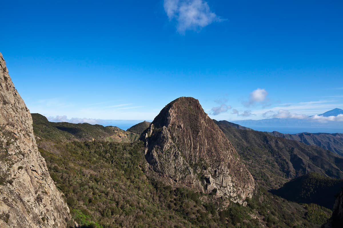
Garajonay National Park
Parque Nacional de Garajonay
Canary Islands (La Gomera / Vallehermoso / Agulo / Hermigua) · Spain
Photo: Diego Delso · CC BY-SA 3.0 · Wikimedia Commons
The best-preserved relic of subtropical fossil laurisilva in Europe (UNESCO World Heritage), a forest continually kept humid by the mist of the trade winds.
There is a forest that covered nearly all of Europe in the Tertiary period and today survives on La Gomera. It is the laurisilva, and Garajonay National Park preserves the finest known example in the Old World. Climb to the island's highest point, the Alto de Garajonay at 1487 m, and you will see a landscape often draped in mist, sculpted from basalt, with volcanic plugs and fortress-like massifs. The park encompasses 3984 hectares, reaching into every municipality across the island while containing no permanent human settlements within its borders.
What makes it unique
Here the sea of clouds maintains almost constant moisture, and beneath that humidity flourishes the most complete laurisilva cloud forest in the Old World.
The place
Nature
The landscape
The laurisilva depends entirely on climate: annual temperature variation remains minimal, precipitation is generous, and humidity stays almost perpetual thanks to the sea of clouds. Under these conditions, the Canarian laurel woodland blankets more than 85 % of the park, encompassing nearly 50 tree species.
There are two forest belts. In the wettest valleys the lush laurisilva dominates, composed of Azores laurel, Canary laurel, stinkwood, small-leaved holly, ironwood, and wild viburnum. Drier slopes support the heath forest (fayal-brezal), where firetree and tree heather reach up to 20 m in height, arguably among the tallest specimens of their kind in the world. Tree trunks are swathed in mosses and lichens, and ferns carpet the woodland floor: unmistakable signs of perpetual moisture.
Beneath it lies ancient basalt. The park rests upon basalt flows and pyroclastic layers, with its dramatic roques and fortalezas standing as exposed volcanic necks. From viewpoints you can observe stacked lava strata, horizontal columnar basalt, and, on clear days, waterfalls of cloud spilling over ridges toward the south. Along mature laurel ravines, the largest trees line stream courses; down the Barranco del Cedro flows the park's most abundant permanent brook.
Rare flora clings to crags and sheer rock walls. Flowering vegetation counts around 120 Canarian endemics, several exclusive to the park, showcasing classic island evolutionary phenomena such as botanical gigantism.
Wildlife and seasons
The park is home to around 1000 species of invertebrates and 30 vertebrate species, dominated by reptiles and birds. The flagship birds are island endemics: the laurel pigeon and Bolle's pigeon, which personify the ancient laurisilva. The Bailadero viewpoint along the ridgeline is an ideal vantage point to watch them glide between valleys.
The Rejo viewpoints offer premier perches to observe chasmophytic plants clinging to vertical basalt walls. In May and June, painted lady and red admiral butterflies frequently flutter through clearings feeding on nectar. The park can be visited year-round, sustained by the constant sea of clouds that nourishes the cloud forest.
Species
With a page in the atlas
Being mentioned in a source doesn't guarantee sightings: check with the people who manage the area.
Memory and protection
History and conservation
The area was declared a national park on 25 March 1981, inscribed as a UNESCO World Heritage site in 1986, and recognized as a Biosphere Reserve in 2012. That same year, on 4 August, a wildfire penetrated the park after five days of advancing flames and scorched nearly 750 ha over the course of two weeks.
Before you set off
Visiting
How to visit
Begin at the Visitor Centre in Juego de Bolas, situated in La Palmita (Agulo), 3 km from the park boundary. It features three exhibition rooms, an audiovisual screening area, and landscaped gardens highlighting native Canarian flora and traditional medicinal herbs. The adjoining Casa de la Memoria displays the interior of a traditional peasant homestead, farming implements, terraced farming heritage, a pre-Hispanic burial cave, and exhibits on Gomero whistle language (silbo) and traditional drum dances. The information station at Laguna Grande features a self-guided nature trail and displays, operating year-round.
Walking trails follow ancient pathways originally trodden by Gomero islanders out of necessity, easily linked for longer circuits. Circular options include Laguna Grande, Los Barranquillos, Las Creces, Cañada de Jorge, and Contadero–Alto Garajonay; linear routes include El Bailadero, Ermita de Lourdes, La Meseta de Hermigua (the three waterfalls), and Agando–La Laja. The shortest route is Ermita de Lourdes: easy difficulty, 40 minutes, 0.7 km, and 43 m of elevation change, equipped with numbered posts keyed to the audio guide through mature laurisilva.
Download the audio guide in advance, as mobile reception within the park is virtually absent. Guided walking tours led by park rangers are free every Friday throughout the year and also on Wednesdays in summer, bookable online. Organised groups can arrange dedicated ranger talks, and the hamlet of El Cedro hosts a specialized Nature Learning Centre.
The lookout atop Alto de Garajonay, the island's highest summit, provides sweeping panoramas toward neighbouring islands and showcases restored pre-Hispanic archaeological sites.
Before you go
Wild camping and bivouacking are strictly prohibited. Do not smoke inside the woodland or light fires, except within authorized hearths in recreation areas. The primary picnic area at Laguna Grande occupies an open clearing that can collect standing water after intense rainfall; other facilities exist at Ermita del Cedro, Las Creces, and Chorros de Epina. From Tenerife, ferries reach San Sebastián de La Gomera in 45 minutes to an hour and a half, with the park conveniently accessible by road from all across the island.
Check access, rules and visiting conditions in the official information from the managing body before you set off.
Location
Where it is and how far it reaches
Boundary of Garajonay · IUCN II · © EEA, CDDA (CC-BY) The coordinate is estimated; it isn't a verified access point.
Transparency
Sources
The research data with its sources, and the official links for this place, are in the Spanish version of this page. See the Spanish version
Around it
Far across the waters, Parque Rural de Anaga on Tenerife also shelters the laurel pigeon and Bolle's pigeon, the two quintessential pigeons of the Macaronesian laurisilva.
If you like this place, elsewhere in Europe
Distant places with uncommon wildlife and habitats in common. The most widespread species don't count. Sharing species doesn't imply a corridor or guaranteed presence.
- Madeira Natural Park - Primeval Laurisilva Forest
Autonomous Region of Madeira (Madeira Island / Ribeiro Frio / Fanal / Porto Moniz)
In common: Laurus novocanariensis · Ocotea foetens — primary forest, old-growth forest, high mountain
The largest surviving tract of relict Tertiary subtropical laurel forest in the world (UNESCO World Heritage).
JFMAMJJASONDAll year · Crowding low
- Anaga Rural Park
Canary Islands (Tenerife / Santa Cruz de Tenerife / La Laguna / Taganana)
In common: Laurel pigeon · Bolle's pigeon — primary forest, old-growth forest, high mountain
Volcanic massif anchored 7 to 9 million years ago in north-eastern Tenerife, draped in laurel rainforest, razor-sharp ridges and isolated hamlets.
JFMAMJJASONDAll year · Crowding low
Entry #643 of the original atlas.