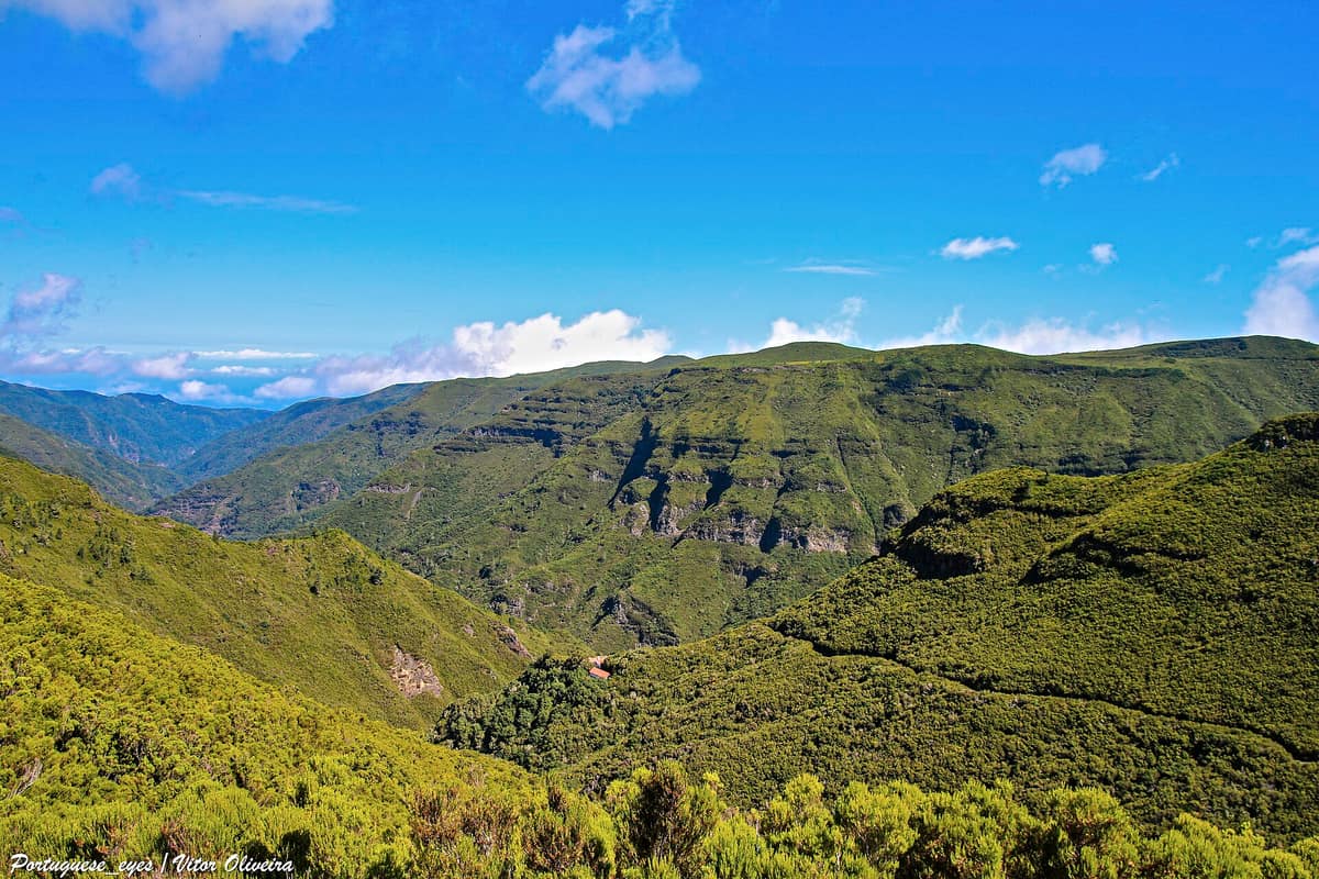
Madeira Natural Park - Primeval Laurisilva Forest
Parque Natural da Madeira - Floresta de Laurissilva
Autonomous Region of Madeira (Madeira Island / Ribeiro Frio / Fanal / Porto Moniz) · Portugal
Photo: Vitor Oliveira from Torres Vedras, PORTUGAL · CC BY-SA 2.0 · Wikimedia Commons
The largest surviving tract of relict Tertiary subtropical laurel forest in the world (UNESCO World Heritage).
Beneath the swirling mountain mists of Madeira thrives a forest that already existed at least 1.8 million years ago. This is the laurisilva, covering roughly 15000 hectares concentrated mainly along the island's steep northern coast. UNESCO inscribed it as a World Heritage property and estimates that fully 90% is primary forest, making it the largest surviving tract of laurel forest on the planet. You enter via a footpath or alongside a levada canal, and within a few paces the surroundings become lush, moisture-laden, and profoundly ancient.
What makes it unique
In a single forest live some forty-six species of land snails, twenty-nine of which exist nowhere else on Earth outside Madeira.
The place
Nature
The landscape
Everything begins with the volcanic ground beneath your boots. The island of Madeira represents the exposed summit of a massive shield volcano, its bedrock dominated by dark basalt and volcanic ash layers. On this porous foundation, the laurel forest thrives where relative humidity and precipitation reach their highest levels: hence the persistent sea mists, hence the dense carpets of ferns. At the 25 Fontes geosite, you discover the other half of the hydrogeological story—a perched aquifer explaining why spring water gushes continuously from basalt cliffs.
Vegetation reigns supreme. Century-old trees stand as monuments of the woods, yet smaller plants claim their share of glory: understorey ferns carpet the green expanse, while epiphytic lichens drape rockfaces, banks, and branches. Their abundance reflects pristine air and freshwater quality.
Botanists classify three primary forest associations: the barbusano laurisilva, the til forest, and the vinhático woodland. Key tree and shrub species include Ocotea foetens, Laurus novocanariensis, Clethra arborea, and Picconia excelsa. At Ribeiro Frio you can search for the endemic rock orchid Dactylorhiza foliosa, while other endemic botanical treasures include pride of Madeira (Echium candicans) and Madeira foxglove (Isoplexis sceptrum).
Wildlife and seasons
The native fauna unfolds across three distinct chapters: insects, terrestrial molluscs, and forest birds, replete with Madeira and Macaronesian endemics. Land snails are biologically the most astonishing group, though rarely the most conspicuous.
Among birds, park rangers highlight the endemic Trocaz pigeon, locally known as the pombo-trocaz, and the Madeira firecrest, affectionately dubbed the bis-bis (Regulus maderensis). The local chaffinch (Fringilla maderensis) is likewise unique to the island.
The laurisilva rewards visits throughout the year, with its most iconic atmosphere found at Fanal when thick cloud wraps around centuries-old til trees. At Ribeiro Frio, look closely at damp mossy banks to find the native orchid.
Species
With a page in the atlas
Being mentioned in a source doesn't guarantee sightings: check with the people who manage the area.
Memory and protection
History and conservation
The laurel forest is protected within the Madeira Natural Park, its territory regulated under the Plano de Ordenamento e Gestão da Laurissilva da Madeira. It is fully designated within the Natura 2000 network.
Climate pressure represents the most concerning future challenge, as shifting rainfall regimes can compound existing anthropogenic stresses on island ecology.
Before you set off
Visiting
How to visit
Thousands of hikers travel the trails of the Laurisilva each year to discover this primeval wilderness. A well-maintained network of paths and footpaths exists, with several officially designated on the regional walking register.
Three iconic routes provide three varied introductions. The Vereda dos Balcões sets out from regional road ER 103 at Ribeiro Frio, measuring 1.5 km out and another 1.5 km back. The Levada das 25 Fontes (PR 6) departs from Rabaçal near road ER105, requiring about 3 hours of walking. The PR 14, Levada dos Cedros, links Fanal with Curral Falso. One cross-island route also traverses both the central mountain massif and the indigenous laurisilva, two vital Natura 2000 habitats.
To better understand what you are exploring, three visitor facilities are available. The Centro de Receção do Rabaçal in Calheta features permanent exhibits on local history and forest ecology. At Casa das Queimadas, the ground floor serves as an information centre interpreting the laurel woods. And the Centro Florestal da Macaronésia showcases ongoing forest conservation initiatives.
Before you go
Park conduct rules are straightforward: do not collect plants, flowers, geological specimens, or shells, and never approach, chase, or feed wild animals. Check the official park website for updated trail statuses and reservation guidelines before setting out.
Check access, rules and visiting conditions in the official information from the managing body before you set off.
Location
Where it is and how far it reaches
Boundary of Parque Natural da Madeira · IUCN VI · © EEA, CDDA (CC-BY) The coordinate is estimated; it isn't a verified access point.
Transparency
Sources
The research data with its sources, and the official links for this place, are in the Spanish version of this page. See the Spanish version
How it fits into the territory
Calculated from the Atlas boundaries. «Part of» is only stated with an official boundary; an estimated area only means that they overlap.
Within this area · 1
- Ponta de São Lourenço Nature Reserve
Autonomous Region of Madeira (Madeira Island / Caniçal / Machico)
Inside its official boundary
Narrow, arid volcanic peninsula at the eastern tip of Madeira with red and black tuff cliffs and a haven for the Mediterranean monk seal (Monachus monachus).
JFMAMJJASONDAll year · Crowding moderate
Around it
The Reserva Natural Marina de Rocha do Navio lies roughly 2 km away, with the Islas Desertas visible further out across the open ocean. Further afield within Macaronesia, Parque Nacional de Garajonay on La Gomera shares with Madeira related laurel forest formations and species such as Ocotea foetens and Laurus novocanariensis, alongside mature primeval woodland and cloud forest habitats.
What else to explore nearby
Approximate straight-line distance between the edges of each area. It doesn't indicate access, routes or driving times.
- Desertas Islands Nature Reserve (Madeira)
Autonomous Region of Madeira (Deserta Grande / Bugio / Ilhéu Chão)
About 18 km away
Uninhabited archipelago of three narrow volcanic islands (Deserta Grande, Bugio, and Chão), a strict sanctuary for the Mediterranean monk seal (Monachus monachus).
JFMAMJJASONDMay – September · Crowding none
If you like this place, elsewhere in Europe
Distant places with uncommon wildlife and habitats in common. The most widespread species don't count. Sharing species doesn't imply a corridor or guaranteed presence.
- Garajonay National Park
Canary Islands (La Gomera / Vallehermoso / Agulo / Hermigua)
In common: Ocotea foetens · Laurus novocanariensis — primary forest, old-growth forest, high mountain
The best-preserved relic of subtropical fossil laurisilva in Europe (UNESCO World Heritage), a forest continually kept humid by the mist of the trade winds.
JFMAMJJASONDAll year · Crowding low
Entry #514 of the original atlas.