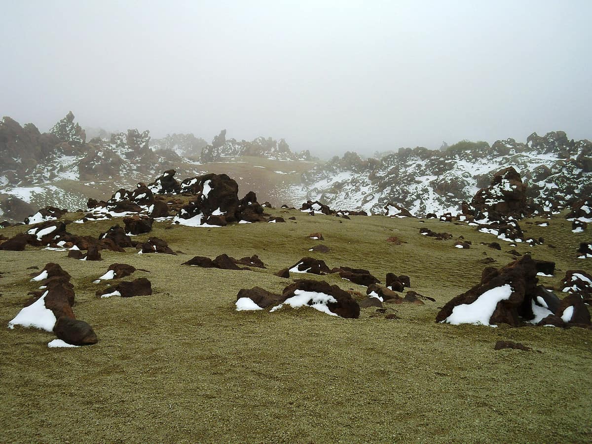
Teide National Park
Parque Nacional del Teide
Canary Islands (Tenerife — Las Cañadas) · Spain
Photo: kallerna · Public domain · Wikimedia Commons
A stratovolcano of 3,715 metres rising above a giant caldera: high-altitude volcanic landscape with endemic Canarian flora.
Almost the entire national park lies above 2,000 metres: a high-mountain realm with severe climate in the middle of the Atlantic Ocean. Two vast depressions, Las Cañadas, embrace Mount Teide, the highest peak in the Canary Islands, in Spain and across all islands of the Atlantic. Across this basin spread lava flows of successive eruptions, cinder cones and a landscape naturalists have explored for centuries: Alexander von Humboldt visited the island in 1799 and pioneered the study of its botanical zoning. The area was declared a national park on 22 January 1954.
What makes it unique
A sacred volcano for the indigenous Guanches, encircled by fields of lava, volcanic monoliths and plants that thrive nowhere else.
The place
Nature
The landscape
The rim of Alto de Guajara, the plain of Llano de Ucanca, Siete Cañadas, the escarpment of La Fortaleza, the Roques de García and Pico Viejo (Chahorra) shape this distinctive amphitheatre. Along the Roques de García path lies La Cascada, a frozen cascade of pahoehoe lava; nearby La Catedral forms an imposing phonolitic volcanic pipe exhumed by weathering. In 1798 the final major eruption occurred at the Narices del Teide on the flanks of Pico Viejo. At the base of Teide lie giant accretion balls, black basaltic bombs that rolled down the slopes.
Vegetation clings to volcanic rubble. The park sustains 194 higher plant species, 58 of which are Canary Island endemics, finding shelter in the crags and hollows of Las Cañadas. Chief among them is the red bugloss (Echium wildpretii), whose flower spires sometimes exceed two metres in height, alongside the Las Cañadas rockrose, Teide wallflower, flixweed and Teide white broom. The park preserves 11 habitats of community interest, covering 75% of its total surface. Above 3,400 metres plant life thins out dramatically, though the Teide daisy and the delicate Teide violet ascend almost to the crater rim.
Wildlife and seasons
Fauna is adapted to extreme exposure. Emblematic avifauna includes the blue chaffinch, common kestrel, Sardinian warbler and spectacled warbler; along the trail flats, Berthelot's pipit, kestrel and Canary common chiffchaff are frequently seen. Reptiles include the Tenerife lizard and Delande's gecko, accompanied by the Canary big-eared bat, introduced European mouflon, Algerian hedgehog and the endemic darkling beetle Pimelia ascendens. Rabbit management forms an essential pillar of park stewardship, complemented by native seed collection, nursery production and replanting programmes.
The seasons define mountain safety. In winter, extensive sections become sheeted in snow and treacherous ice. In spring, designated beehives are placed across the plain for honey production, and hikers should give foraging bees a wide berth.
Species
With a page in the atlas
Being mentioned in a source doesn't guarantee sightings: check with the people who manage the area.
Memory and protection
History and conservation
The indigenous Guanches revered Teide as a sacred mountain. According to myth, the evil demon Guayota trapped the sun god Magec inside the volcano until the supreme god Achamán intervened; Echeyde, the Guanche name for Teide, meant the abode of Guayota. Guanche pastoralists drove their goats up to Las Cañadas during the summer months, a transhumance tradition that persisted long after the Spanish conquest until 1954, when grazing was banned to protect recovering vegetation. Remnants of stone corrals, stone bothies and droveways remain scattered across the flats. Ice-gatherers ascended to Montaña Blanca and the Cueva del Hielo to harvest ice for coastal towns.
A protection proposal drafted by the Island Council of Tenerife in 1934 remained shelved for twenty years, fortunately averting a planned spiral motor road to the summit.
Before you set off
Visiting
How to visit
Begin at the visitor centres. The El Portillo centre interprets volcanology, high-mountain adaptations of flora and fauna, and alpine climate, featuring an adjoining botanical garden showcasing Tenerife endemics. In La Orotava, the Telesforo Bravo visitor centre charts the island from shore to summit. The traditional house of Juan Évora, the last permanent pastoral resident of Las Cañadas, functions as an information point and ethnographic shepherd museum.
Among the walking routes, the Roques de García trail is an easy loop of about two hours starting from the La Ruleta viewpoint. The Siete Cañadas route is trail number 4, accessible via a short spur at El Portillo. The ascent from Montaña Blanca to La Rambleta is the classic high-mountain route, steep and strenuous, while the climb along Lomo Tieso proves exceptionally demanding with slope gradients exceeding 60%. The Montaña de los Tomillos path provides the sole pedestrian breach through the caldera wall, tracing the historic Chasna highway. From the Degollada de Guajara pass, sweeping vistas take in the caldera basin and the southern slopes of Tenerife.
Before you go
Due to rarefied air, ascending to the summit can be hazardous for hikers with respiratory or cardiovascular conditions. Walking access from La Rambleta to the highest point of the summit requires a special mandatory advance permit. Wear sturdy walking boots and warm layered clothing even in summer, with sunscreen, sunglasses and a sun hat. Keep strictly to marked trails and avoid solo hiking. Check trail closures and centre timetables before departure.
Check access, rules and visiting conditions in the official information from the managing body before you set off.
Location
Where it is and how far it reaches
Boundary of El Teide · © EEA, CDDA (CC-BY) The coordinate is estimated; it isn't a verified access point.
Transparency
Sources
The research data with its sources, and the official links for this place, are in the Spanish version of this page. See the Spanish version
Around it
The Malpaís de Güímar Special Nature Reserve lies about twelve kilometres away, and Anaga Rural Park sits some twenty-seven kilometres distant.
What else to explore nearby
Approximate straight-line distance between the edges of each area. It doesn't indicate access, routes or driving times.
- Malpaís de Güímar Special Nature Reserve
Canary Islands (Tenerife / Güímar / Puertito de Güímar)
About 12 km away
Recent volcanic landscape of pahoehoe and aa lavas dominated by the Montaña Grande cone, colonized by endemic spurge communities.
JFMAMJJASONDAll year · Crowding very low
- Anaga Rural Park
Canary Islands (Tenerife / Santa Cruz de Tenerife / La Laguna / Taganana)
About 28 km away
Volcanic massif anchored 7 to 9 million years ago in north-eastern Tenerife, draped in laurel rainforest, razor-sharp ridges and isolated hamlets.
JFMAMJJASONDAll year · Crowding low
Entry #1021 of the original atlas.