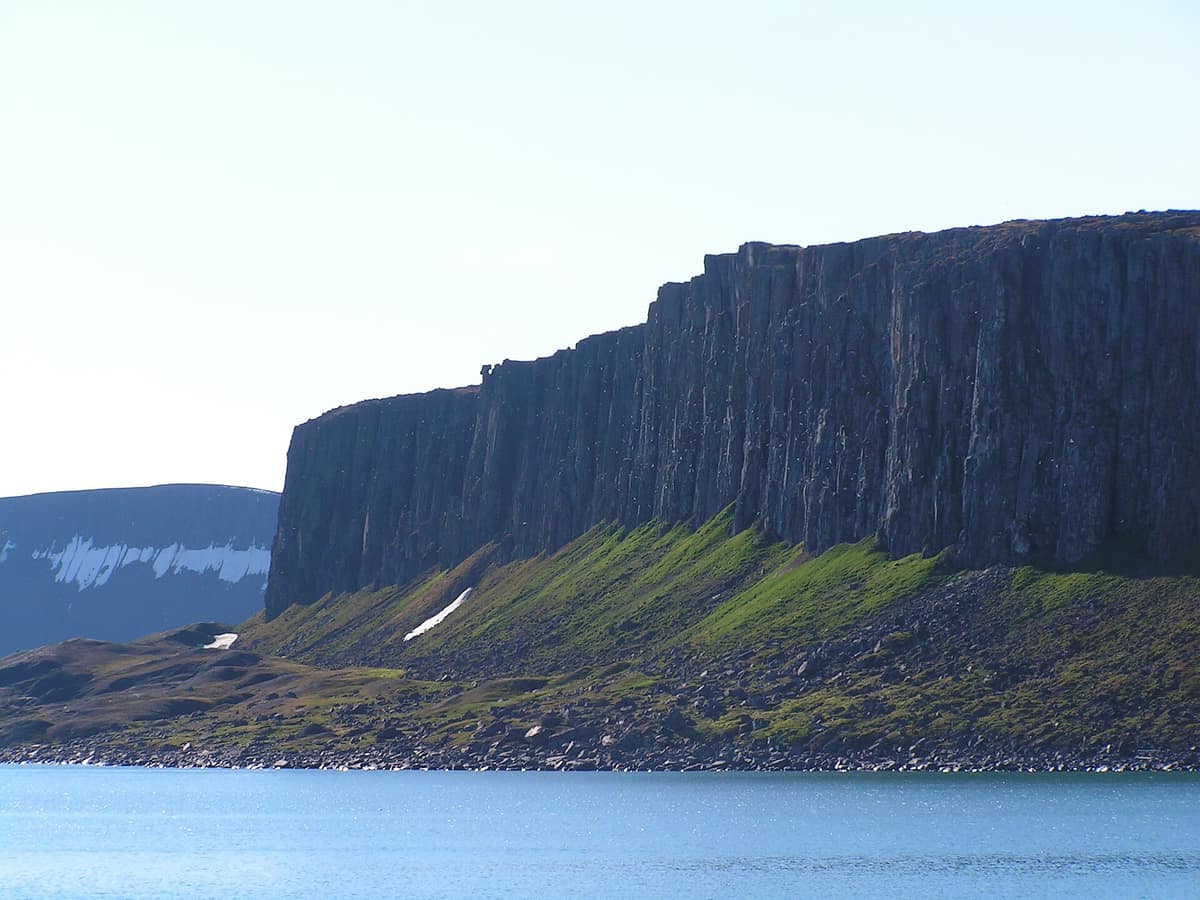
Søraust-Svalbard Nature Reserve
Svalbard Archipelago (Edgeøya and Barentsøya Islands) · Norway
Photo: Hermanhi · CC BY-SA 3.0 · Wikimedia Commons
The vast desert tundra islands of Edgeøya and Barentsøya (21.800 km²), a premier denning sanctuary for polar bears and massive walrus haul-outs.
On Edgeøya, ancient whale bones rest on dry land, clearly visible to anyone hiking along the elevated coastal terraces. That is the essence of Søraust-Svalbard Nature Reserve: a landscape where post-glacial isostatic rebound has elevated former seafloor into open subpolar air. The reserve encompasses all of Edgeøya and Barentsøya, together with smaller archipelagoes including Tusenøyane, Ryke Yseøyane, and Halvmåneøya. It encompasses 21.825 km², of which roughly 6.400 are dry land; it is Norway's second largest protected area, including national parks. To the north it borders the Nordaust-Svalbard reserve.
What makes it unique
Here post-glacial land uplift has raised ancient seabed so high that historic whale skeletons now lie completely high and dry.
The place
Nature
The landscape
The terrain is defined by stepped raised shorelines, periglacial patterned ground, and vast ice caps. Across Edgeøya, numerous coastal plains showcase distinct marine terraces where ancient whale skeletons weather on dry tundra. Geologically the island resembles central Spitsbergen: Mesozoic sedimentary strata, predominantly Triassic shales, carved by glacial erosion. In the east lies the massive ice cap Edgeøyjøkulen. Spanning 5.073 km², Edgeøya is the third largest island in Svalbard.
Lowlands along the eastern shores of Edgeøya and Barentsøya feature continuous moss tundra. Nurtured over centuries by accumulated reindeer droppings, this forms a rare and specialized subpolar vegetation community.
Wildlife and seasons
The reserve protects the most crucial walrus haul-out sites in the archipelago, where nursery pods with calves gather regularly. Polar bears are equally central: Edgeøya is a major maternity denning zone, and bears inhabiting this Barents Sea sector represent a distinct genetic subpopulation. An abundant endemic population of Svalbard reindeer also grazes the tundra.
In summer, migratory birds arrive in vast numbers. Tusenøyane forms a key sanctuary for red-throated divers, brent geese, and Arctic terns, and the reserve ranks as an Important Bird Area for its brent geese, king eiders, purple sandpipers, and glaucous gulls. Towering sea cliffs packed with black-legged kittiwakes and northern fulmars complete the Arctic canvas.
Species
With a page in the atlas
Being mentioned in a source doesn't guarantee sightings: check with the people who manage the area.
Memory and protection
History and conservation
The reserve has been protected since 1 July 1973. The region was historically exploited by whalers and trappers targeting polar bears and walruses; remnants of Russian and Norwegian trapper cabins survive at Ekrollhamna. Four Russian sailors were shipwrecked and marooned here from 1743 until September 1749; three survived their six-year Arctic ordeal, likely based on Halvmåneøya.
Before you set off
Visiting
How to visit
The most frequented expedition landings are Kapp Lee, Diskobukta, and Halvmåneøya. Edgeøya receives minimal human visitation, and strict reserve regulations prohibit any tourist infrastructure. All tourist landings occur exclusively at approved shore sites accompanied by certified polar guides.
Before you go
Year-round landing prohibitions protect Zieglerøya, Delitschøya, Spekkholmen, Haudegen, and large parts of Halvmåneøya. Visiting Nordaustlandet and Edgeøya (Zone A) requires notifying the Governor of Svalbard four weeks prior to landing, followed by post-expedition reporting. Anyone venturing outside settlements must carry polar bear deterrents and firearms; consult regulations from the Governor of Svalbard before traveling.
Check access, rules and visiting conditions in the official information from the managing body before you set off.
Location
Where it is and how far it reaches
Boundary of Søraust-Svalbard · IUCN Ib · © EEA, CDDA (CC-BY) The coordinate is estimated; it isn't a verified access point.
Transparency
Sources
The research data with its sources, and the official links for this place, are in the Spanish version of this page. See the Spanish version
Around it
Nordaust-Svalbard Nature Reserve borders the area directly to the north. Farther away, Northwest Spitsbergen National Park shares polar bear, walrus, and reindeer populations alongside glaciated fjords and Arctic coastlines.
What else to explore nearby
Approximate straight-line distance between the edges of each area. It doesn't indicate access, routes or driving times.
- Northeast Svalbard Nature Reserve
Svalbard Archipelago (Nordaustlandet Island / Kvitøya)
About 16 km away
Norway's largest strict nature reserve (55.000 km²), dominated by the Austfonna ice cap (Europe's largest ice cap outside Greenland).
JFMAMJJASONDJuly – August · Crowding none
If you like this place, elsewhere in Europe
Distant places with uncommon wildlife and habitats in common. The most widespread species don't count. Sharing species doesn't imply a corridor or guaranteed presence.
- Northwest Spitsbergen National Park
Svalbard Archipelago (Spitsbergen Island / Albert I Land / Haakon VII Land)
In common: Polar bear · Walrus · Caribou — wild coast, marine, glacial landscape
The ultimate spectacle of the European High Arctic (79° N), with colossal tidewater glacier fronts in Magdalena and Kongsfjorden and geothermal springs at Bockfjorden.
JFMAMJJASONDJune – August · Crowding very low
Entry #610 of the original atlas.