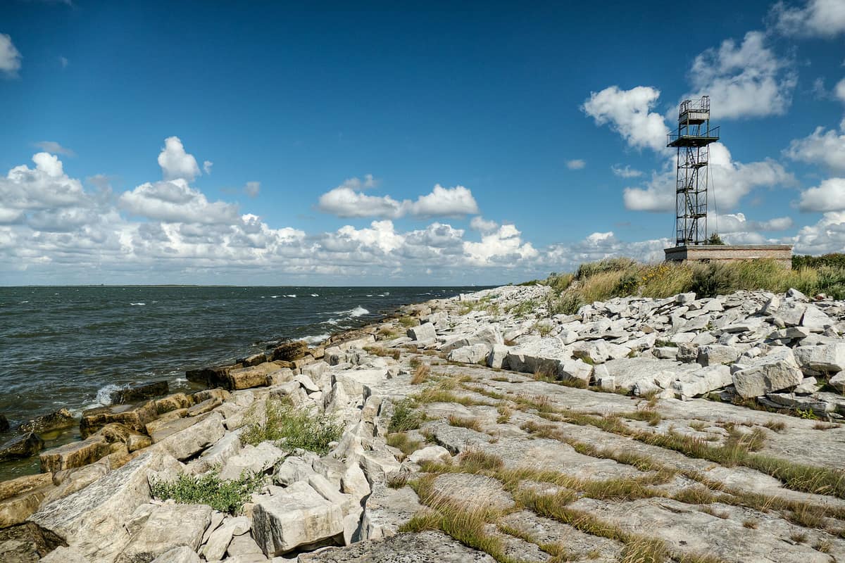
Vilsandi National Park and Coastal Cliffs of Saaremaa
Vilsandi rahvuspark
Saare County (Saaremaa Island / Kihelkonna / Tagamõisa) · Estonia
Photo: Amadvr · CC BY-SA 4.0 · Wikimedia Commons
The oldest marine bird sanctuary in the Baltic (1910), encompassing some 160 limestone islets and reefs off Saaremaa.
In 1933, the Kiipsaare lighthouse, 25 m high, was built 150 m inland. Today it stands over 50 m out into the sea, famously tilting: wave erosion swept away the ground beneath it. That is the clearest symbol of Vilsandi, a coastal national park continuously reshaped by the waves on western Saaremaa. Nearly a hundred islands, combined with the surrounding sea and coast of Saaremaa, cover 485.9 km², of which 393.5 km² are marine waters. It evolved from a bird sanctuary founded in 1910, making it the oldest conservation reserve in the Baltic.
What makes it unique
A low, windswept coastline rising from the sea for some seven thousand years, home to the oldest bird reserve in the Baltic.
The place
Nature
The landscape
The land has been gradually emerging from the sea for about seven thousand years, leaving relic coastal lakes cut off in former sheltered bays. Marine habitats encompass reefs, rocky skerries, shoals, shallow bays, and lagoons. On land, spring fens, rich fens, and calcareous fens flourish.
Alvar grasslands form the most distinctive landscape. These alvars develop over limestone bedrock with less than twenty centimetres of lime-rich, shallow soil. They represent a globally rare habitat, occupying thirteen percent of the park's dry land area.
On Harilaid, a teardrop-shaped peninsula tethered to the mainland by the narrow Harilaiu isthmus, sandy and gravelly beaches meet wind-sculpted coastal dunes. Having surfaced from the sea one or two millennia ago, it remains in perpetual drift: the shoreline migrates visibly with every gale. Harilaid has enjoyed formal protection since 1924 and was never permanently settled.
Wildlife and seasons
This is preeminently a realm of birds. Observers have recorded 247 species, 114 of them nesting. Common eider is the most abundant breeding waterbird, with more than 4,000 pairs. Migration brings masses of waterfowl, notably barnacle goose and Steller's eider. Rarity sightings include the white-tailed eagle and Eurasian eagle-owl. Hunting is strictly prohibited.
Mammals include moose, red deer, roe deer, and wild boar, alongside significant breeding haul-outs of grey seal. In the shallows and lagoons thrive Atlantic salmon, river lamprey, Baltic herring, natterjack toad, and medicinal leech.
A third of all protected plant species in Estonia occur within the park. Notable species include shoreweed, sea wormwood, sea holly, black bog-rush, and the endemic Saaremaa yellow-rattle. The park protects 32 species of orchids, including Dactylorhiza osiliensis.
Species
With a page in the atlas
Being mentioned in a source doesn't guarantee sightings: check with the people who manage the area.
Memory and protection
History and conservation
Baltic nature conservation began on the Vaika bird islets. The park's biological research station is situated on Vilsandi, and the territory is designated an Important Bird Area by BirdLife International.
Before you set off
Visiting
How to visit
The visitor centre occupies the historic Loona manor complex in Rootsiküla, providing interpretation on nature and local maritime heritage. It features a permanent fossil exhibit, nature documentaries, and reference library, open year-round with wheelchair access. Guided nature walks and educational programs are arranged upon advance notice.
On Harilaid, the Harilaiu hiking trail explores an untamed coast: low horizons, wind, golden sand, dunes, wind-flagged pines, calling seals and seabirds, derelict military remnants, and the tilted Kiipsaare lighthouse offshore. The full Harilaid loop measures eleven kilometres; a shorter nine-kilometre option visits Kiipsaare lighthouse and returns to the rest area, traversing designated bird and seal viewing points by the dunes and Laialepa Bay. Reaching the campsite at Laialepa Bay requires a walk of roughly 4 km along the path.
On Vilsandi, two marked trails (6 km and 8 km) branch out from the island center near the biological station's lookout tower. They reveal maritime heritage (harbors, captains' cottages, windmills), the Vaika bird islets where Baltic nature conservation was born, and an operational lighthouse over two centuries old. Boat transfers to Vilsandi are coordinated at the visitor centre, with parking at Papissaare harbor. During calm low water in summer, one can walk from Saaremaa to Vilsandi, wading through knee-deep water across shallows and islets to Väike-Vilsandi.
Before you go
Kiipsaare lighthouse is private property on unstable seabed; climbing it is dangerous and prohibited. On Harilaid the trail is marked with red stakes and motor vehicles are banned. The Käkisilma-Vilsandi wading trail is temporarily closed due to dredging of the Papisaare-Vikati fairway. Best visiting season: May to October.
Check access, rules and visiting conditions in the official information from the managing body before you set off.
Location
Where it is and how far it reaches
Boundary of Vilsandi rahvuspark · © EEA, CDDA (CC-BY) The coordinate is estimated; it isn't a verified access point.
Transparency
Sources
The research data with its sources, and the official links for this place, are in the Spanish version of this page. See the Spanish version
Around it
Vilsandi shares open coast, eider, and grey seal with distant marine relatives: Wadden Sea National Park (Denmark) and Słowiński National Park share barrier coastlines, eiders, and grey seals; Lake Peipus and Emajõgi River Delta shares wetland shores and moose; while Slītere National Park shares Baltic grey seals and coastal moose habitat.
If you like this place, elsewhere in Europe
Distant places with uncommon wildlife and habitats in common. The most widespread species don't count. Sharing species doesn't imply a corridor or guaranteed presence.
- Slītere National Park and Irbe Strait Coast
Courland / Kurzeme (Dundaga / Cape Kolka)
In common: Lampetra fluviatilis · Grey seal · Moose — wild coast, wetland
Cape Kolka where the currents of the Baltic Sea and the Gulf of Riga collide, ancient Livonian wooded dunes (Kangari), and clay coastal bluffs.
JFMAMJJASONDMay – October · Crowding low
- Wadden Sea National Park (Denmark)
South Jutland (Esbjerg / Fanø / Rømø / Ribe)
In common: Common eider · Grey seal — wild coast, marine, wetland
The world's largest unbroken system of intertidal sand and mud flats (UNESCO World Heritage), renowned for massive starling murmurations (Sort Sol).
JFMAMJJASONDApril – May · September – October · Crowding low
- Lake Peipus and Emajõgi River Delta
Tartumaa (Kallaste / Varnja / Luunja)
In common: Cottus gobio · Moose — wild coast, wetland
Europe's fifth-largest lake (3,500 km²) and the vast uninhabited wilderness wetland of the Emajõgi delta.
JFMAMJJASONDMay – October · Crowding very low
Entry #450 of the original atlas.