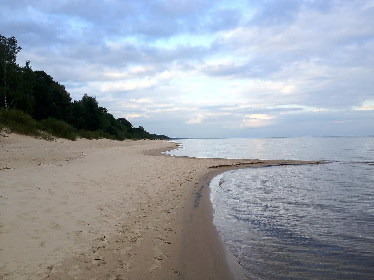
Lake Peipus and Emajõgi River Delta
Peipsi järv - Emajõe Suursoo
Tartumaa (Kallaste / Varnja / Luunja) · Estonia
Photo: Ainar Riigov · CC BY 3.0 · Wikimedia Commons
Europe's fifth-largest lake (3,500 km²) and the vast uninhabited wilderness wetland of the Emajõgi delta.
There is a lake so immense that it spans two countries, fed by a river that disappears before reaching it into a 13,000-hectare wetland. Lake Peipus covers 3,555 km² and is Europe's largest transboundary lake, shared between Estonia and Russia, and the continent's fifth largest lake overall. Its wetland, Emajõe-Suursoo, is Estonia's largest mire system, formed around the nation's biggest river delta. Between the two, along the south-western shore, the Peipsiveere nature reserve protects 34,430 hectares of bogs, marshes and wild forests.
What makes it unique
A wild, roadless marshland delta where migratory swans, geese and ducks traversing northern Europe stage and feed.
The place
Nature
The landscape
The lake is a remnant of a larger proglacial body of water from the ice ages, its current basin sculpted by the Weichselian glaciation that ended roughly 12,000 years ago. It is shallow: averaging just 7.1 m in depth. Consequently, it warms and cools quickly: freezing between late November and early December and thawing between late April and early May.
The shorelines vary remarkably. In the north and north-west stretch pine-clad dunes and sandy beaches. In the south, low peat shores prevail, bordered by floodplains and reedbeds that flood in spring across up to 1,000 km². The islands are low marshes, rising only 1-2 metres above the waterline, and also submerge during floods.
In the delta of the Emajõgi—meaning "Mother River" in Estonian, rising from Lake Võrtsjärv and crossing the university city of Tartu—85% of the mire is open fen, with peat layers reaching up to 5.8 m thick. Floodplain meadows, sedge fens and swamp birch woods can be explored on foot. The flora comprises 425 vascular plant species, 27 of which are protected, including botanical rarities like the marsh gentian, Siberian iris and wetland orchids.
Wildlife and seasons
Birds rule this vast landscape. Naturalists have recorded at least 176 species in Peipsiveere, 77 of them protected. Nesting raptors include the white-tailed eagle, osprey and golden eagle, alongside black grouse, spotted crake and the elusive Eurasian bittern. The shoreline wetlands provide critical feeding and staging habitat for migrating swans, geese and ducks; the lake is one of the premier staging grounds for Bewick's swan, arriving after flying some 1,600 km from the Russian Arctic.
Among mammals, the most common are the moose, wild boar, roe deer, red fox and raccoon dog; the grey wolf and Eurasian lynx also roam the woods, while the brown bear inhabits the reserve. Along the watercourses live the Eurasian otter, Eurasian beaver and American mink. Fish fauna includes European perch, zander, bream, roach, whitefish and smelt. Rare amphibians include the common spadefoot and green toad.
Species
With a page in the atlas
Being mentioned in a source doesn't guarantee sightings: check with the people who manage the area.
Memory and protection
History and conservation
Across the ice of this lake, on 5 April 1242, the historic Battle on the Ice was fought between the Novgorod Republic and the Teutonic Order. In modern ecological terms, eutrophication remains the primary environmental concern. The Peipsiveere nature reserve was created on 20 December 2013 by uniting the protected areas of Piirissaar, the Emajõgi estuary and Emajõe-Suursoo, forming a designated Natura 2000, Ramsar and IBA site. Ramsar designation took place on 5 June 1997.
Before you set off
Visiting
How to visit
The starting point is the Emajõe study trail, renovated in 2025/2026: a three-kilometre loop setting out from the former Emajõe-Suursoo nature centre at the historic Kantsi tavern. It traverses floodplain meadows, a sedge fen and bog birch woodland, returning to the river alongside a ditch. There are 700 m of 1.2 m wide boardwalk to the campfire site, another 1.3 km of narrower boardwalk, a bridge and a viewing platform. Interpretive signboards present the Emajõgi River, floodplain habitats and local wildlife. It begins beside the small car park, holding 20 cars, and the information board at the Kavastu entrance.
The Emajõgi is navigable along its entire length, so the delta can also be explored by water.
Before you go
All vehicles, motorized or non-motorized, are strictly banned along the trail. Campfires are permitted only at designated fire rings, and camping or open fire is forbidden on the starting green lawn. River flooding along the Emajõgi can render sections impassable. Park outside the gate. Best season: May to October.
Check access, rules and visiting conditions in the official information from the managing body before you set off.
Location
Where it is and how far it reaches
Boundary of Peipsiveere looduskaitseala · © EEA, CDDA (CC-BY) The coordinate is estimated; it isn't a verified access point.
Transparency
Sources
The research data with its sources, and the official links for this place, are in the Spanish version of this page. See the Spanish version
Around it
Peipsiveere has no close neighbours in the atlas, but shares habitats and species with distant northern nature reserves. Vilsandi National Park and Saaremaa Sea Cliffs shares maritime wetlands and moose; Ķemeri National Park and Curonian Spit National Park share vast waters, moose and white-tailed eagles; while Drava River and Floodplain shares dynamic wetlands and white-tailed eagles.
What else to explore nearby
Approximate straight-line distance between the edges of each area. It doesn't indicate access, routes or driving times.
- Ahja River Valley Landscape Reserve
Põlvamaa (Põlva / Taevaskoja)
About 18 km away
Ancient river canyon gouged into Devonian red sandstone featuring sacred cliff walls like Suur Taevaskoda (The Great Heavenly Hall).
JFMAMJJASONDMay – October · Crowding low
If you like this place, elsewhere in Europe
Distant places with uncommon wildlife and habitats in common. The most widespread species don't count. Sharing species doesn't imply a corridor or guaranteed presence.
- Soomaa National Park
Estonia (Pärnumaa / Viljandimaa)
In common: Iris sibirica · Moose — wetland
Expansive raised bogs severed by meandering rivers that overflow each spring: the «fifth season», when canoeists paddle between submerged trees.
JFMAMJJASONDMarch – May · September – October · Crowding very low
- Vilsandi National Park and Coastal Cliffs of Saaremaa
Saare County (Saaremaa Island / Kihelkonna / Tagamõisa)
In common: Cottus gobio · Moose — wetland, wild coast
The oldest marine bird sanctuary in the Baltic (1910), encompassing some 160 limestone islets and reefs off Saaremaa.
JFMAMJJASONDMay – October · Crowding very low
Entry #439 of the original atlas.