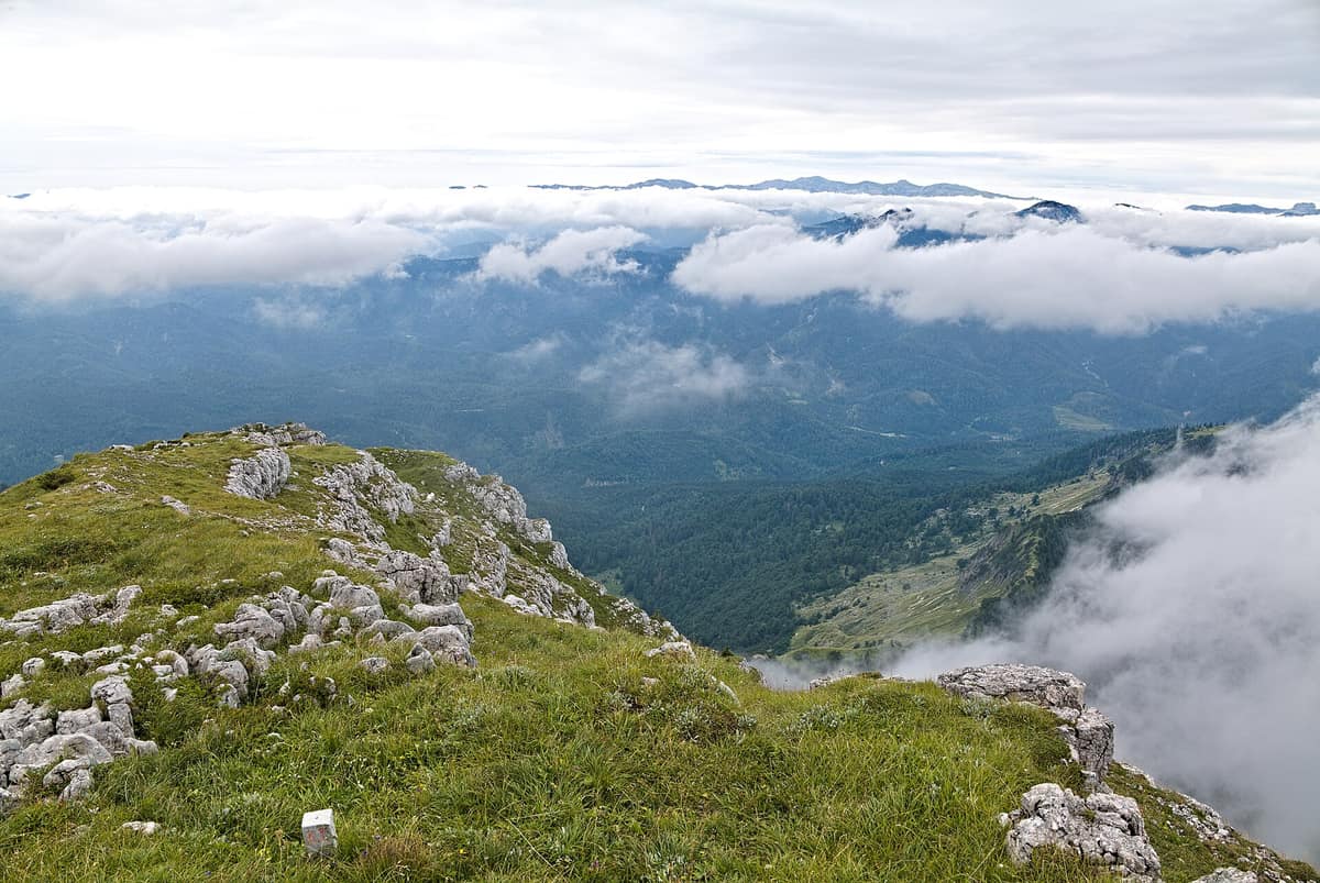
Dürrenstein-Lassingtal Wilderness Area
Wildnisgebiet Dürrenstein-Lassingtal
Lower Austria (Ybbstal Alps) · Austria
Photo: Leonhard Lenz · CC0 · Wikimedia Commons
The largest unmanaged primeval forest in the Central Alps (Rothwald), UNESCO World Heritage site.
There are forests managed by humans, and forests left completely in peace. In the Wildnisgebiet Dürrenstein-Lassingtal, straddling Lower Austria and Styria around the massifs of Dürrenstein and Hochkar, the choice was the latter. Here lies the Rothwald, the largest relict primeval forest in the entire Alpine arc, inscribed on the UNESCO World Heritage list in 2017. It is a wilderness area recognized under IUCN categories Ia and Ib, set aside so natural forest processes can unfold unimpeded. You enter on the forest's terms, not your own.
What makes it unique
It is the largest virgin forest remaining in the Alps, accessible only along marked perimeter trails or with an authorized guide.
The place
Nature
The landscape
The bedrock is predominantly limestone. The area's vegetation reflects the varied microclimates and site conditions typical of the Northern Limestone Alps, creating an intricate mosaic: each slope, valley bottom, and karst crag fosters its own distinct forest community. The climate helps explain this richness, being wet with copious snowfall. Today's landscape also represents post-glacial revegetation: the forest reclaimed the terrain as Pleistocene glaciers retreated.
Mature mixed stands of European beech, silver fir, and Norway spruce dominate the greatest area. Steep, shaded gullies favor broadleaf ravine forests of sycamore maple, European ash, and wych elm. The reserve shelters pristine raised bogs such as the Leckermoos, alongside transitional mires and floating quaking mats identified during initial European LIFE conservation inventories.
Then there are rocky sectors where trees cannot take root. Sheer cliffs and scree slopes remain naturally treeless. Above the closed forest canopy thrive hardy subalpine plants: mountain avens (Silberwurz), rue (Steinraute), wild thyme (Alpenquendel), and auricula (Petergstamm).
Wildlife and seasons
The first thing you should know is what roams these slopes: red deer, chamois, mountain hare, and wild boar. Occasionally a Eurasian lynx passes through, an occurrence commemorated by a long-distance trekking trail bearing its name: the Luchs Trail crosses Dürrenstein-Lassingtal and the neighboring Kalkalpen and Gesäuse national parks following lynx territory.
The forest shelters ecological specialists. Characteristic species include the alpine newt, alpine salamander, European adder, golden eagle, the scarce white-backed woodpecker, and the red-breasted flycatcher. Furthermore, the area hosts all four native Alpine galliform birds found in Austria: the western capercaillie, black grouse, hazel grouse, and rock ptarmigan.
Among invertebrates, the alpine longhorn beetle stands out as a priority Annex II species of the EU Habitats Directive. For owl enthusiasts, a dedicated trail exists: with patience along the Eulenweg, several owl species can be detected roosting among veteran hollow trees and limestone crags.
Species
With a page in the atlas
Being mentioned in a source doesn't guarantee sightings: check with the people who manage the area.
Memory and protection
History and conservation
These mountain forests share a long history of boundary disputes. The medieval monasteries of Gaming and Admont contested ownership of this territory, and nearby survive the historic Rothschildhäuser, traditional foresters' lodges distinctive to the region.
Formal legal protection began with an initial EU LIFE project that established the wilderness administration. Today the Rothwald forms part of the Natura 2000 site Ötscher–Dürrenstein, with Lower Austria classifying the eastern core under IUCN Category Ia. Forest management also looks ahead: gradual ecological conversion of secondary spruce stands into natural mixed woodland is authorized through 2032.
Before you set off
Visiting
How to visit
Outside of designated, signposted trails, you may only enter the wilderness area on guided ranger excursions. This strict rule governs all access, with the park management scheduling educational hikes, meeting points, and arrival information published directly on its website.
To explore independently without a guide, three thematic trails are maintained. The Wildnisweg starts right from the Steinbachtal car park, offering an initial introduction to primeval wilderness and its inhabitants. The Eulenweg focuses on forest owls. The Moorweg circles the raised bog of Leckermoos near the former Jausenstation Ablass, where public guided tours depart every Tuesday morning at 9:30. Those seeking multi-day treks can connect directly with the regional Luchs Trail.
Before or after heading into the mountains, stop in Lunz am See. There stands the Haus der Wildnis, housing an exhibition dedicated to the relationships between primeval forests, wilderness, and water. It features virtual reality experiences and interactive exhibits, all designed with complete barrier-free accessibility.
Before you go
Access is strictly regulated. Wandering off marked trails is forbidden unless participating in an official guided tour. Check the park administration website for meeting points and scheduled excursions. If you wish to cool off in the Lassing river, bathing is permitted solely at designated access points.
Check access, rules and visiting conditions in the official information from the managing body before you set off.
Location
Where it is and how far it reaches
Boundary of Wildnisgebiet Dürrenstein · IUCN Ib · © EEA, CDDA (CC-BY) The coordinate is estimated; it isn't a verified access point.
Transparency
Sources
The research data with its sources, and the official links for this place, are in the Spanish version of this page. See the Spanish version
Around it
The Hochschwabgruppe is the closest neighbouring massif in the atlas, followed by Nationalpark Gesäuse - Enns Gorge. The latter is one of three protected areas connected across the Alps by the Luchs Trail.
What else to explore nearby
Approximate straight-line distance between the edges of each area. It doesn't indicate access, routes or driving times.
- Hochschwab Group
Styria (Aflenz / Mariazell)
About 14 km away
Vast, desert-like karst plateau above 2,000 m hosting the largest concentration of chamois in the Alps.
JFMAMJJASONDJune – October · Crowding low
- Gesäuse National Park - Enns Gorge
Styria (Admont / Hieflau)
About 22 km away
Vertical limestone precipices towering over 1.000 m above the thundering whitewater of the Enns river.
JFMAMJJASONDMay – October · Crowding low
Entry #25 of the original atlas.