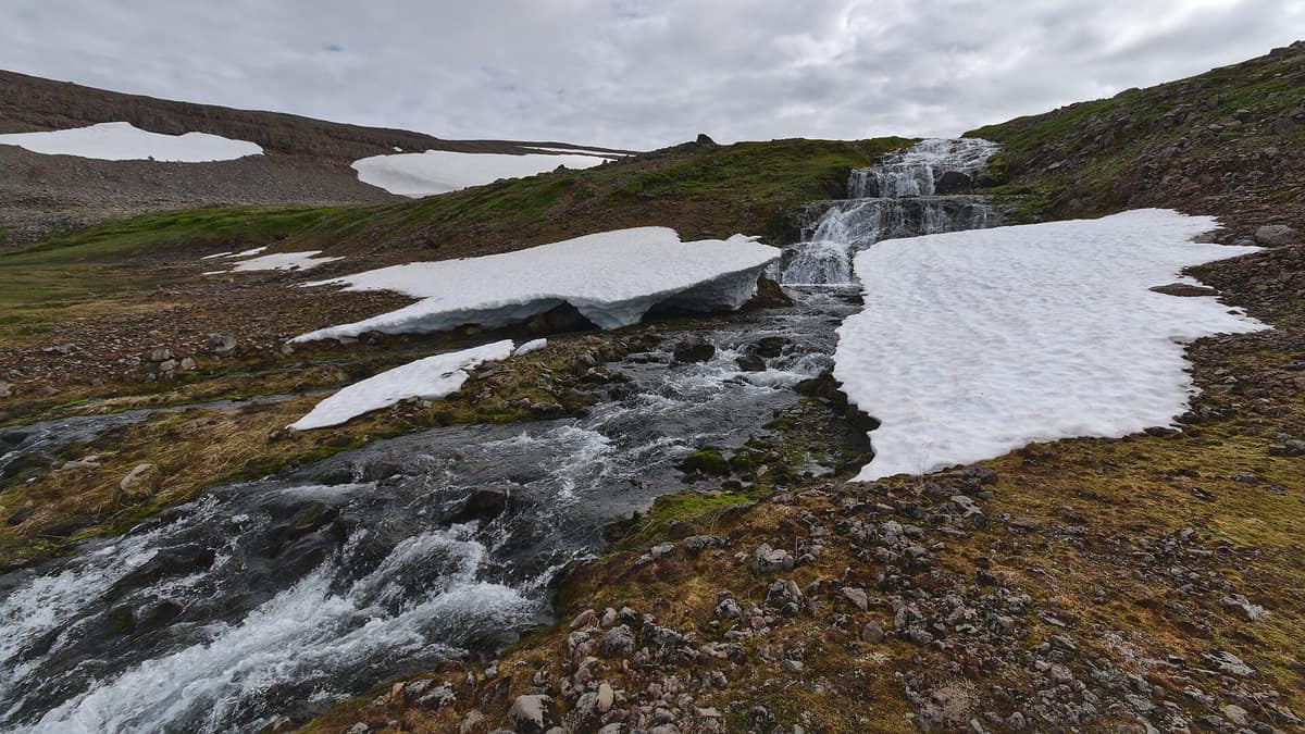
Hornstrandir Nature Reserve
Friðland á Hornströndum
Westfjords (Ísafjörður) · Iceland
Photo: Rob Oo from NL · CC BY 2.0 · Wikimedia Commons
An arctic peninsula abandoned in the fifties, without roads, where the arctic fox lives without hunting and without fear.
Here there is virtually no infrastructure and very few tourists. Hornstrandir is the northernmost peninsula of Iceland, on the northern tip of the Westfjords, northwest of the Drangajökull glacier. It spans some 580 km² of tundra, fjords, glacial remnants, and alpine terrain with rich yet fragile vegetation. You arrive by boat, navigate by map, and sleep in a tent. Whoever ventures here brings away total silence, cliffs bustling with seabirds, and, with a little luck, an arctic fox looking right back at you.
What makes it unique
You can walk for days without seeing anyone, and the arctic fox, protected by a ban on hunting, is very likely to be seen.
The place
Nature
The landscape
Hornstrandir is defined by three interconnected attractions. The first is the sheer bird cliffs encircling Hornvík bay, soaring over 500 metres high on the eastern side, acting as a colossal magnet for nesting seabirds. Hornstrandir boasts three great seabird cliffs: Hornbjarg, Hælavíkurbjarg, and Riturinn. The second is an untamed, serene wilderness with an overwhelming sense of remoteness, given the absence of roads and the sparse number of visitors in such a vast tract. The third arises from both factors combined with an absolute ban on hunting: the arctic fox.
To the south, Jökulfirðir, the «glacier fjords», comprise five distinct fjords and bays; four outline the entire southern shore of Hornstrandir, while the fifth, Leirufjörður, cuts just to the south. It is among the most deeply indented coastlines on the entire peninsula.
Wildlife and seasons
The teeming bird colonies on these cliffs include Atlantic puffins, common murres, razorbills, and northern fulmars. Boats are legally barred from approaching closer than 115 m to seabird cliffs, and seafarers are advised to stay at least one kilometre away from the rock faces.
The arctic fox is the iconic resident. The reserve protects one of the most vital arctic fox strongholds in all Europe. Should you encounter an active den, keep a distance of at least 40 m, remain no longer than 20 minutes, never position yourself between a vixen and her cubs, and never feed the foxes.
Species
With a page in the atlas
Being mentioned in a source doesn't guarantee sightings: check with the people who manage the area.
Memory and protection
History and conservation
Hornstrandir was once an inhabited frontier. A modest human population resided here in previous centuries before communities vanished by the mid-twentieth century, with the lighthouse keeper at Hornbjarg lighthouse remaining until 1995. Around Hornvík bay stood three homesteads: Horn (abandoned in 1946), Höfn, and Rekavík bak Höfn (both in 1944). Decades later, several descendants returned to restore historic houses, and extensive land parcels remain private.
The nature reserve was established in 1975, enacting some of Iceland's strictest environmental protections. It is designated IUCN Category Ib: a vast wilderness largely unmodified by human intervention, preserving its natural processes. Its guiding ethos is to safeguard a peaceful realm where natural dynamics operate without anthropogenic interference.
Before you set off
Visiting
How to visit
Arrival is predominantly by boat, with scheduled boat transfers departing from Ísafjörður, Bolungarvík, and Norðurfjörður. Helicopter landings within the reserve are prohibited, and the two unpaved landing strips at Látrar and Fljótavík are unregistered and unserviced.
Before setting out, stop by Hornstrandastofa, the visitor centre in Ísafjörður, where wardens provide route planning advice alongside an exhibit on historic life in Hornstrandir. Out in the field, the environmental agency posts rangers at Höfn in Hornvík and at Hesteyri to assist travelers.
Main trails are marked with stone cairns, which can easily be lost in poor visibility; carrying a topographic map and compass or GPS is indispensable. Dense fog frequently blankets the peninsula, complicating navigation; glacial rivers can become impassable after heavy rain, and snowdrifts linger year-round, with steep snow gullies persisting well into early summer.
Before you go
Due to the vulnerability of mosses and paths, all independent trekking must be registered online with the environmental agency in spring and autumn; check exact registration dates before traveling. Camping is strictly restricted to designated sites: there are fourteen public campsites managed by the environmental agency and two private sites, with a maximum stay of one week in any single spot. Guided groups may not exceed 30 people in the western sector or 15 in the eastern sector.
Open campfires, dogs (except landowners' working dogs, kept leashed), bicycles, and unauthorized drones are banned. Pack out all rubbish, refrain from erecting cairns or shifting rocks, and stick to the footpaths. You can log your travel itinerary with Safetravel.
Check access, rules and visiting conditions in the official information from the managing body before you set off.
Location
Where it is and how far it reaches
Boundary of Hornstrandir · © EEA, CDDA (CC-BY) The coordinate is estimated; it isn't a verified access point.
Transparency
Sources
The research data with its sources, and the official links for this place, are in the Spanish version of this page. See the Spanish version
Around it
Hornstrandir has no immediate neighbors in the atlas, but shares seabird breeding cliffs with other oceanic outposts: the Vestmanna Bird Cliffs and the Isle of Kalsoy and Kallur Lighthouse share northern fulmar and Atlantic puffin, while Cap Fréhel and the Sept-Îles Nature Reserve share razorbills and common murres.
If you like this place, elsewhere in Europe
Distant places with uncommon wildlife and habitats in common. The most widespread species don't count. Sharing species doesn't imply a corridor or guaranteed presence.
- Fair Isle Bird Sanctuary
Scotland (Shetland Islands)
In common: Northern fulmar · Common murre · Razorbill — wild coast
The isolated island midway between Orkney and Shetland, historic mecca for migratory vagrant birds and traditional knitwear.
JFMAMJJASONDMay – October · Crowding very low
- Cap Fréhel
Brittany (Côtes-d'Armor — Plévenon)
In common: Northern fulmar · Common murre · Razorbill — wild coast
Heather moorlands and pink sandstone cliffs rising over 70 metres sheltering vital seabird breeding colonies.
JFMAMJJASONDApril – June · August – September · Crowding moderate
- Sept-Îles Nature Reserve
Brittany (Côtes-d'Armor — Perros-Guirec)
In common: Common murre · Razorbill · Atlantic puffin — wild coast
France's largest colony of northern gannets and the puffin's last refuge on the French coast.
JFMAMJJASONDApril – July · Crowding low
Entry #1047 of the original atlas.