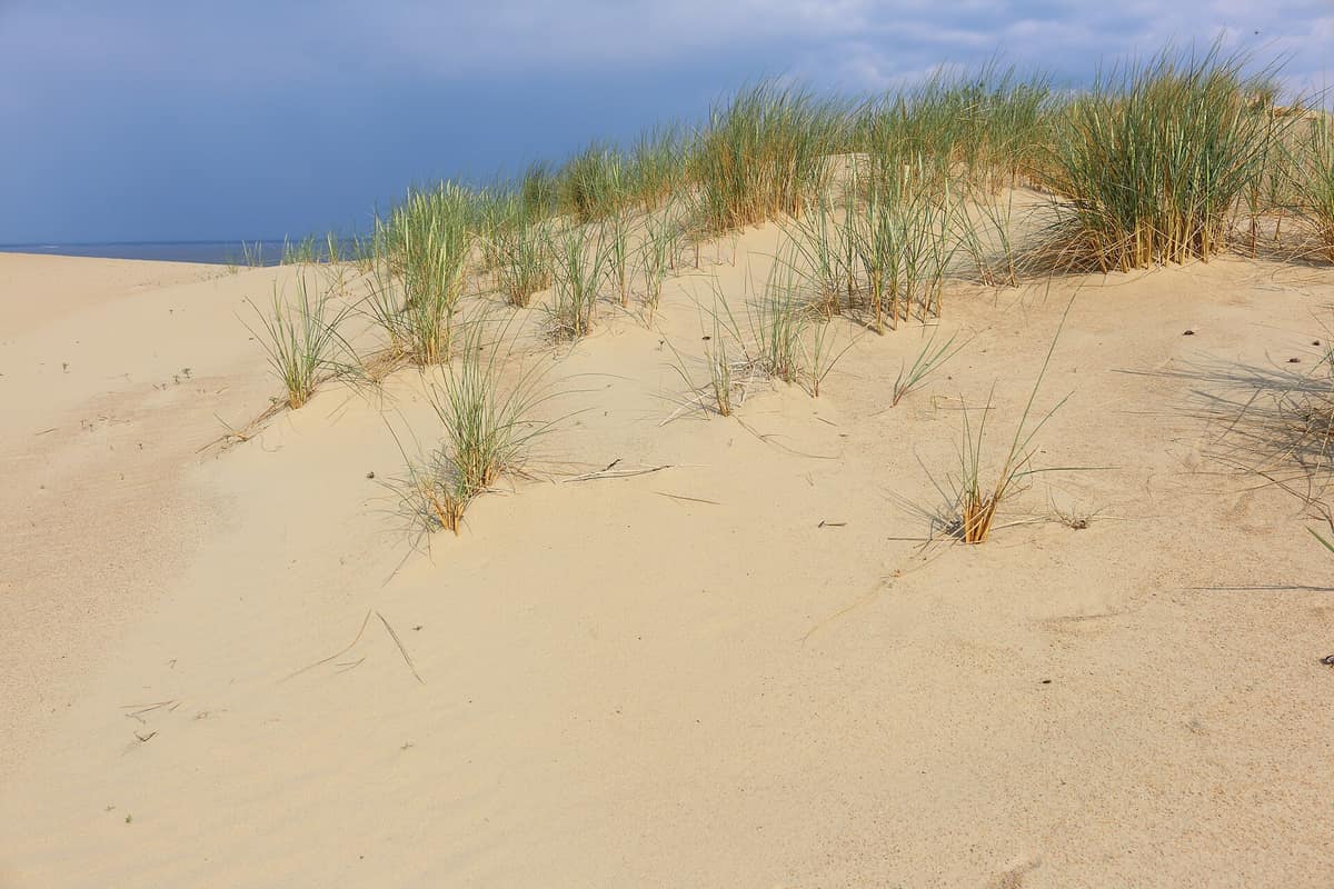
Curonian Spit National Park
Kuršių nerijos nacionalinis parkas
Klaipėda (Neringa — Nida / Juodkrantė) · Lithuania
Photo: FrDr · CC BY-SA 4.0 · Wikimedia Commons
A sandy spit nearly a hundred kilometres long between the Baltic and the Curonian Lagoon, boasting some of Europe's highest dunes.
Imagine a ninety-eight-kilometre strip of sand that the Baltic Sea and a lagoon have contested for roughly five thousand years. That is the Curonian Spit, and the Curonian Spit National Park protects its Lithuanian half: a narrow ribbon, between four hundred metres and almost four kilometres wide, where dunes drift, pines hold them in place and millions of birds stream past each autumn. Baltic folklore tells that it was shaped by an extraordinarily strong giantess named Neringa playing along the shore. The scientific reality is sand swept along by currents, constantly evolving.
What makes it unique
Here Europe's highest dunes, shifting and alive, coexist with a forest planted to tame them and one of the busiest bird migration flyways in the Baltic.
The place
Nature
The landscape
The spit is a geologically youthful landscape. Between the Curonian Lagoon and the sea, sand carried by marine currents forms wind-driven dunes, humid hollows and beaches. The dunes average thirty-five metres in height, with some reaching sixty. Parnidis dune beside Nida rises to fifty-two and has historically drifted over the village more than once.
That the spit survives at all owes much to human perseverance. Widespread deforestation left the sand uncontrolled and migrating dunes buried entire villages. In 1825 large-scale reforestation began. Today, forest covers seventy-two per cent of the park, with Scots pine as the dominant species, and UNESCO inscribed it in 2000 onto the World Heritage List: its preservation depends entirely on enduring stabilization and afforestation efforts.
The park safeguards eleven natural monuments, including the dunes of Vecekrugas, Agila, Karvaičiai, Skirpstas and Vingis, and the capes of Lydumas and Nagliai. Alongside mobile dunes lie relict parabolic dunes at Juodkrantė, now stabilized, and paleosols buried deep beneath the sand. In mature woodland, especially near the sea, trees lean inland sculpted by prevailing winds.
Wildlife and seasons
The prime season is migration. The spit serves as a crucial segment of the White Sea–Baltic flyway, along which roughly fifteen million birds travel in spring and autumn, and about thirty kilometres from Klaipėda stands a dedicated bird ringing station. It was no coincidence that the historic Rossitten bird observatory was established here, honouring the spit's stature as a migratory highway. During the warm months around two hundred and forty species breed, and into autumn up to three hundred can be recorded.
Near Juodkrantė, nesting in pines and spruces, is a mixed colony of Great cormorant and Grey heron: in 2020 around three thousand five hundred cormorants and about two hundred pairs of herons nested. Between two and four pairs of White-tailed eagle also nest annually. Observation towers are stationed on Avinas hill, in the grey dunes of the Nagliai reserve, in the Pervalka dunes and atop Parnidis dune at Nida.
Forests and shores shelter moose, wild boar and roe deer. Occasional grey seals haul out on the Baltic shore, while bats are well represented with fourteen species. beavers and otters inhabit suitable waters. Along the coastal margin grow rare coastal plants absent elsewhere in Lithuania, such as sea holly, alongside Baltic endemics like Linaria loeselii.
Species
With a page in the atlas
Being mentioned in a source doesn't guarantee sightings: check with the people who manage the area.
Memory and protection
History and conservation
Human history on the spit has been an unceasing contest against drifting sand. Between the years 800 and 1016 the site hosted Kaup, a major pagan trade centre that remains unexcavated. In the late nineteenth century the dramatic dunes of Nida drew painters from the Königsberg Academy of Arts.
The national park was established in 1991 to safeguard Lithuania's most distinct coastal natural and cultural landscape, characterized by a dune ridge unique in Europe, and is designated within the Natura 2000 network. Today vigilance extends to non-native flora: around sixteen invasive plant species have been identified, including Rosa rugosa and Acer negundo.
Before you set off
Visiting
How to visit
Start with the simplest option: the fifty-three-kilometre cycle path traverses the spit, and you can walk along the coast from Nida to Juodkrantė, excluding the strict nature reserve sector, or from Nida to Pervalka along the lagoon shore. The Nagliai reserve features a dedicated walking trail, and local outfitters arrange canoe outings along the lagoon fringe.
The scenic viewpoints justify every detour: Garnių kalnas, Nagliai, the dunes of Parnidis and Vecekrugas, Pervalka bay and the Meškos galva dune. To delve deeper into the region's heritage, the park nature museum and the Smiltynė marine museum and aquarium provide rich context. In Nida and Juodkrantė the park also protects ethnographic fishermen's homesteads and historic villas dating from the end of the nineteenth century and the early twentieth century.
Before you go
To protect the fragile spit, destroying dunes, pitching tents and lighting fires are strictly forbidden, and within nature reserves you may only walk on designated interpretation trails; in Grobštas and Nagliai straying from the paths is prohibited. If any access point or sector is essential to your trip, confirm current access conditions in advance with park management.
Check access, rules and visiting conditions in the official information from the managing body before you set off.
Location
Where it is and how far it reaches
Boundary of Kuršių nerijos nacionalinis parkas · IUCN II · © EEA, CDDA (CC-BY) The coordinate is estimated; it isn't a verified access point.
Transparency
Sources
The research data with its sources, and the official links for this place, are in the Spanish version of this page. See the Spanish version
Around it
Seven kilometres away lies Nemuno Deltos Regioninis Parkas, the closest Lithuanian counterpart. Further afield, sharing comparable coasts and lagoons, Słowiński Park Narodowy shares grey seals, beavers and white-tailed eagles; Ķemeru nacionālais parks shares moose, beavers and white-tailed eagles; and Slīteres nacionālais parks shares grey seals and moose.
What else to explore nearby
Approximate straight-line distance between the edges of each area. It doesn't indicate access, routes or driving times.
- Nemunas Delta Regional Park
Klaipėda County (Šilutė / Rusnė / Ventė)
About 7 km away
Inland delta and floodplain estuary on the Curonian Lagoon, the primary ringing hotspot for migratory birds along the Baltic.
JFMAMJJASONDApril – June · September – October · Crowding low
If you like this place, elsewhere in Europe
Distant places with uncommon wildlife and habitats in common. The most widespread species don't count. Sharing species doesn't imply a corridor or guaranteed presence.
- Skuleskogen National Park (High Coast of Sweden)
Västernorrland (Höga Kusten / Örnsköldsvik / Kramfors)
In common: Grey seal · Moose · Eurasian beaver — wild coast, old-growth forest
The heart of Sweden's High Coast (Höga Kusten), the site of the world's greatest post-glacial isostatic rebound (286 m of land uplift after the ice), featuring the Slåttdalssvackan canyon.
JFMAMJJASONDMay – October · Crowding low
- Slītere National Park and Irbe Strait Coast
Courland / Kurzeme (Dundaga / Cape Kolka)
In common: Grey seal · Moose — wild coast, old-growth forest
Cape Kolka where the currents of the Baltic Sea and the Gulf of Riga collide, ancient Livonian wooded dunes (Kangari), and clay coastal bluffs.
JFMAMJJASONDMay – October · Crowding low
- Vilsandi National Park and Coastal Cliffs of Saaremaa
Saare County (Saaremaa Island / Kihelkonna / Tagamõisa)
In common: Grey seal · Moose — wild coast
The oldest marine bird sanctuary in the Baltic (1910), encompassing some 160 limestone islets and reefs off Saaremaa.
JFMAMJJASONDMay – October · Crowding very low
Entry #1037 of the original atlas.