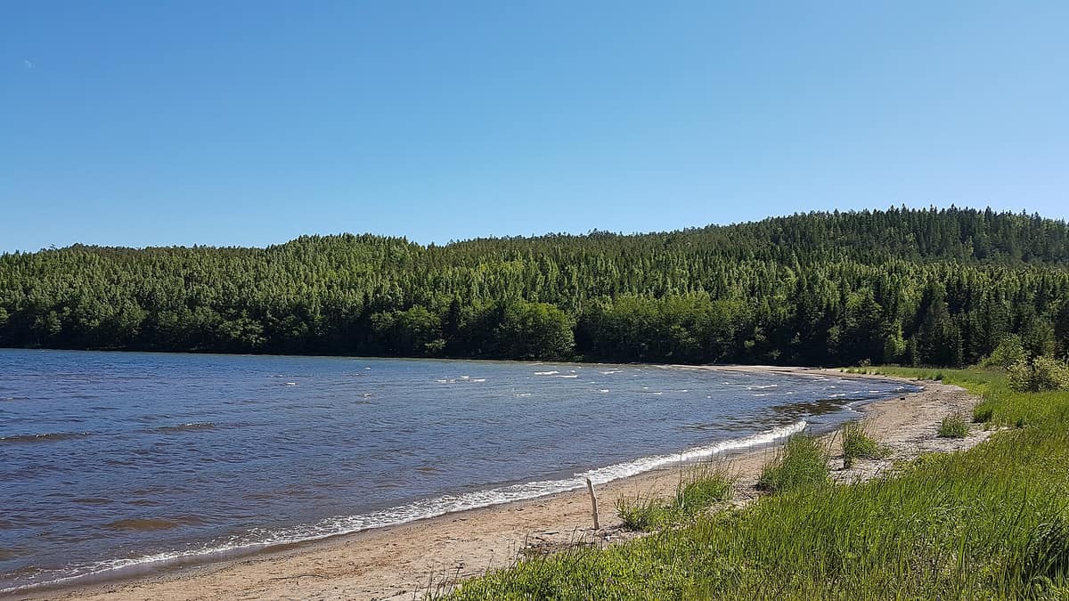
Skuleskogen National Park (High Coast of Sweden)
Skuleskogen National Park
Västernorrland (Höga Kusten / Örnsköldsvik / Kramfors) · Sweden
Photo: Jan Ainali · CC BY-SA 4.0 · Wikimedia Commons
The heart of Sweden's High Coast (Höga Kusten), the site of the world's greatest post-glacial isostatic rebound (286 m of land uplift after the ice), featuring the Slåttdalssvackan canyon.
This land rises. Some 20,000 years ago, at the height of the last ice age, the centre of the ice sheet lay in the sea just off the High Coast; as it melted, the land began to rebound, and today it rises by about 8 mm per year. Skuleskogen is the place where this phenomenon is most dramatic: ancient forests, bare bedrock, and deep fissure valleys by the Baltic, where mountaintops were once islands and marine bays are turning into freshwater lakes.
The park covers 3,062 hectares along the coast, 282 of which are marine. Its highest peak, Slåttdalsberget, rises to 280 metres almost directly from the sea.
What makes it unique
Here you can walk along a coastline that continues to emerge: the island of Tärnättholmarna is slowly transforming into a peninsula.
The place
Nature
The landscape
The bedrock is dominated by Nordingrå granite, a rapakivi granite formed some 1,500 million years ago. It is nutrient-poor; thus the diabase in the northeast, which creates fertile ground and far richer vegetation, makes all the difference. Diabase also explains the park's most celebrated feature: Slåttdalsskrevan began forming 1,200 million years ago when magma welled up into a fracture, solidifying into diabase that gradually eroded away over eons. Today the gorge measures 200 metres long, 30 deep, and seven wide.
Post-glacial rebound did the rest. In that epoch the park's summits stood as isolated islands, and some hills still preserve caps untouched by the sea after the ice receded: Nylandsruten is one such "kalottberg" (capped mountain). The climate adds its own nuances: it is damp, with about 700 mm of annual precipitation, over a third falling as snow that blankets the ground for an average of 175 days. Maritime influence keeps early summer cooler than inland, but softens autumn frosts.
About 36 % of the park consists of exposed bedrock with sparse vegetation, while the remainder is predominantly coniferous forest.
Wildlife and seasons
Skuleskogen marks the northern range limit for several plant species. Its botanical symbol is a rare hanging lichen: Dolichousnea longissima, endangered in Sweden. Along the trail at Krypenbranten near the north entrance, you can spot another rare beard lichen, "långskägg". In summer, an alpine meadow blooms at Näskebodarna with moonwort, mountain everlasting, yarrow, and tormentil.
Mammals include the Eurasian lynx, brown bear, red fox, badger, pine marten, moose, Eurasian beaver, and grey seal. The local lynx population has dwindled, likely owing to habitat fragmentation caused by highway E4. Birds of conservation concern in Sweden include Siberian jay, three-toed woodpecker, and red-throated diver; there are also strong populations of grey-headed woodpecker, common crane, and grey heron. The area is also the county's richest sanctuary for wood-boring beetles.
The seasons transform the park completely. October paints the canopy in vibrant autumn hues. May, June, and the period from mid-August onward see fewer visitors than July and early August, while in winter the trek to Slåttdalsskrevan calls for snowshoes.
Species
With a page in the atlas
Being mentioned in a source doesn't guarantee sightings: check with the people who manage the area.
Memory and protection
History and conservation
Bronze Age burial cairns dot the ancient shoreline of that era, with 28 located inside the park boundaries. During the mid-nineteenth century, logging swept across almost the entire forest, but cutting ceased toward the end of the century; today mature forest older than 100 years covers the landscape. Until around 1900, a summer shieling operated at Skrattabborrtjärn with up to ten cabins.
In earlier times this wilderness was one of the most feared passages along the coastal merchant route, notorious as a lair of outlaws and bandits. The national park was established in 1984 and in 2000 joined the UNESCO World Heritage list alongside the rest of the High Coast.
Before you set off
Visiting
How to visit
The park is located on the High Coast beside the sea east of the E4, between Örnsköldsvik and Härnösand, and has three entrances: west, south, and north. The Naturum Höga Kusten visitor centre lies about ten kilometres from the south and west entrances, adjacent to Skuleberget and the E4. It offers interpretation on the national park and World Heritage Site, running guided walks, hikes, and children's activities year-round.
For an accessible start, the west entrance offers an adapted trail leading to the Nylandsruten viewpoint, accessible to wheelchairs and prams, with expansive panoramas over the park, Skags lighthouse, the Trysunda reserve, and the Ulvöarna archipelago.
The most celebrated hike leads to Slåttdalsskrevan. Accessible from all three entrances: roughly 6 km from the west, 4.5 from the north, and 3.5 from the south. The path from the west entrance is rugged in stretches, passing over rocky pine barrens with island vistas.
To follow the shore, the Kuststigen links the south and north entrances: it is gentler than other trails, hugging the sea and passing several sandy bays. From the south entrance it is 5.5 km to Tärnättholmarna. Näskebodarna, a historic coastal summer farm, lies 3.8 km from the south entrance along the Kuststigen.
Before you go
Camping is permitted only in designated areas and for a maximum of three consecutive nights between 1 May and 30 September, and campfires are allowed only at designated hearths during that same period. There are no drinking water taps: stream water cannot be guaranteed safe for drinking, and during dry summers many creeks dry up completely.
Check access, rules and visiting conditions in the official information from the managing body before you set off.
Location
Where it is and how far it reaches
Boundary of Skuleskogen · IUCN II · © EEA, CDDA (CC-BY) The coordinate is estimated; it isn't a verified access point.
Transparency
Sources
The research data with its sources, and the official links for this place, are in the Spanish version of this page. See the Spanish version
If you like this place, elsewhere in Europe
Distant places with uncommon wildlife and habitats in common. The most widespread species don't count. Sharing species doesn't imply a corridor or guaranteed presence.
- Gutulia National Park
Innlandet (Engerdal / Femundsmarka)
In common: Perisoreus infaustus · Three-toed woodpecker · Moose — old-growth forest
Norway's smallest National Park (23 km²), protecting an untouched primeval forest of Scots pine and centuries-old spruces.
JFMAMJJASONDJune – September · Crowding very low
- Urho Kekkonen National Park
Finnish Lapland (Saariselkä / Inari / Sodankylä)
In common: Perisoreus infaustus · Three-toed woodpecker · Moose
Finland’s second largest national park (2.550 km²), rounded arctic tundra fell-tops (tunturi), and wild trekking under the shadow of Sokosti (718 m).
JFMAMJJASONDJune – April · Crowding low
- Curonian Spit National Park
Klaipėda (Neringa — Nida / Juodkrantė)
In common: Grey seal · Moose · Eurasian beaver — wild coast, old-growth forest
A sandy spit nearly a hundred kilometres long between the Baltic and the Curonian Lagoon, boasting some of Europe's highest dunes.
JFMAMJJASONDMay – June · September – October · Crowding moderate
- Ķemeri National Park
Latvia (Jūrmala / Tukums)
In common: Common crane · Moose · Eurasian beaver — wild coast, old-growth forest
Raised bogs, swamp forests and coastal lagoons half an hour from Riga, featuring the Great Ķemeri Bog boardwalk.
JFMAMJJASONDApril – June · September – October · Crowding low
Entry #577 of the original atlas.