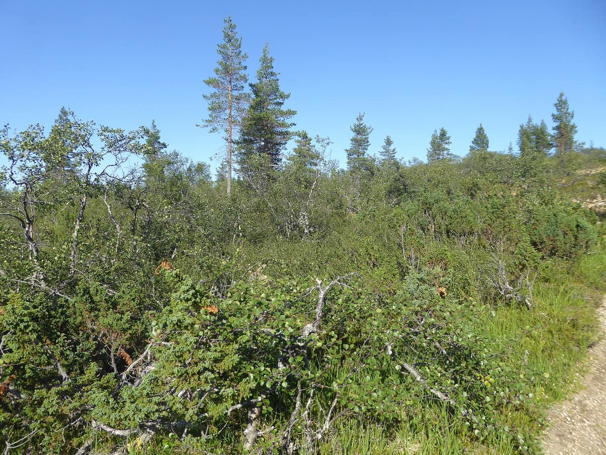
Urho Kekkonen National Park
Finnish Lapland (Saariselkä / Inari / Sodankylä) · Finland
Photo: Nemo bis · CC BY-SA 4.0 · Wikimedia Commons
Finland’s second largest national park (2.550 km²), rounded arctic tundra fell-tops (tunturi), and wild trekking under the shadow of Sokosti (718 m).
Forested Lapland could almost fit entirely inside this single park. Established in 1983, Urho Kekkonen covers 2.550 km² across the municipalities of Savukoski, Sodankylä, and Inari, ranking as Finland's second largest national park and its second most visited. Luxuriant vegetation is rare here: vast, nearly virgin pine and spruce forests stretch endlessly alongside immense mires, bisected from east to west by a chain of fells. It is a realm made for those seeking deep solitude and long distances.
What makes it unique
A chain of open fells divides the park’s waters: some rivers flow to the Baltic Sea and others to the Arctic Ocean.
The place
Nature
The landscape
A park on this scale revolves around a single central spine: the fells traversing it from east to west. This uplands region forms a major watershed: to the south rise the Luirojoki, Kopsusjoki, and Repojoki, flowing via the Kemijoki down to the Baltic Sea, whereas to the north and east the Suomujoki, Luttojoki, and others empty into the Arctic Ocean. Sokosti is the highest peak at 718 metres, followed by Ukselmapää at 698 and Vuomapää at 689. Every fell landscape in the park recounts an austere tale of the Ice Age.
Down below lies the forest. Most of the park is pine woodland spreading across the sandy soils of low esker ridges, largely untouched old-growth. The continuous spruce belt of eastern Lapland reaches the Vongoiva-Sokosti-Lupukkapää sector. On the hillsides, mountain birch marks the tree line, forming dense thickets across summits where pine and spruce can barely survive, through which you must push your way; most of Finland's mountain birch stands are preserved within this park. Higher still, on the windswept fell tops, only dwarf shrubs, sedges, and alpine clubmoss cling to life.
After woodlands, mires and wetlands cover the largest extent, with expansive aapa bogs in the south. Up to thirty sphagnum moss species can be found among them. Posoaapa, roughly 16 km long and 7.000 hectares, was once Finland's grandest aapa mire before being mostly submerged under the Lokka reservoir. The bedrock is nutrient-poor, limiting plant diversity, while the continental climate brings sharp temperature swings unchecked by oceanic moderation.
Wildlife and seasons
More than twenty mammal species inhabit the park. Large predators include the brown bear, wolverine, wolf, and Eurasian lynx, finding refuge in this sanctuary where they are strictly protected. You are far more likely to encounter semi-domesticated reindeer, mountain hares, moose, and red foxes. Along watercourses, look for the Eurasian otter or its tracks, and certain rivers harbour the endangered freshwater pearl mussel.
The golden eagle serves as the park's official emblem: eleven territories exist here, out of an estimated 362 to 496 breeding pairs across all Finland. The park provides nesting grounds for over a hundred bird species. Old-growth forests shelter the Siberian jay, grey-headed chickadee, and the three-toed woodpecker. Larvae of the northern dart moth grow nearly to full size in their first summer but do not emerge as adults until their third summer, having overwintered twice; thus the adult moth appears at any given spot only every two years.
The year features two distinct peak seasons: skiing in March and April, and hiking in summer and autumn. Winter journeys demand serious wilderness skills: temperatures can plummet to minus 40 degrees, accompanied by merely a couple of hours of twilight at midwinter.
Species
With a page in the atlas
Being mentioned in a source doesn't guarantee sightings: check with the people who manage the area.
Memory and protection
History and conservation
Reindeer herding, along with its ancient culture and traditions, remains a vital livelihood for local communities. Around 80 % of the park's territory lies within the Sámi homeland; seidas (sacred natural sites) are revered by them and must be approached with utmost respect. Historic herding has left wild reindeer pitfalls, fences, log cabins, and restored Skolt Sámi seasonal homesteads throughout the landscape.
The park, together with five neighbouring protected tracts, constitutes a single unified Natura 2000 site.
Before you set off
Visiting
How to visit
Most hiking tours start from the Kiilopää fell centre, Lake Aittajärvi along the Suomujoki, or Raja-Jooseppi, with many backpackers heading towards the base of Sokosti. Marked trails in the west are accessible even to novices; the wild backcountry lends itself to long, self-sufficient wilderness treks. Many hikers spend nights in wilderness huts beside Lake Luirojärvi beneath Sokosti.
If you prefer a gentler introduction, the Kiirunapolku nature trail loops around Kiilopää fell with interpretive boards explaining fell ecology, plants, birds, and adaptations. Cycling in summer is restricted to designated tracks, such as the route connecting Kakslauttanen to Kopsusjärvi; in winter you can fatbike outside prepared ski tracks.
Before you go
In the recreational zone, campfires are permitted only at designated campfire rings shown on maps, using provided firewood; in the remote backcountry you may gather dry fallen wood, except in restricted zones. Dogs are welcome but must remain leashed at all times. Entering the border zone without a formal permit is strictly forbidden, even for a single step. Mobile network reception is generally adequate but suffers from dead zones in valleys. During March and April open wilderness huts fill quickly, so book a reservable hut or carry a sturdy tent.
Check access, rules and visiting conditions in the official information from the managing body before you set off.
Location
Where it is and how far it reaches
Boundary of Urho Kekkosen kansallispuisto · IUCN II · © EEA, CDDA (CC-BY) The coordinate is estimated; it isn't a verified access point.
Transparency
Sources
The research data with its sources, and the official links for this place, are in the Spanish version of this page. See the Spanish version
Around it
The Sarek National Park shares high mountain landscapes, wolverine, moose, and brown bear with Urho Kekkonen. Gutulia National Park shares primeval taiga, mires, moose, Siberian jay, and three-toed woodpecker, while Stabbursdalen National Park shares moose, Siberian jay, and brown bear. Hossa National Park shares wolverine, reindeer, and wolf.
If you like this place, elsewhere in Europe
Distant places with uncommon wildlife and habitats in common. The most widespread species don't count. Sharing species doesn't imply a corridor or guaranteed presence.
- Sarek National Park - Europe's Last Great Wilderness
Swedish Lapland / Norrbotten (Jokkmokk / Kvikkjokk / Ritsem)
In common: Xestia borealis · Wolverine · Moose — high mountain
Peaks, glaciers, and the Ráhpavuobme valley in Sarek National Park, part of the Laponia World Heritage site.
JFMAMJJASONDJuly – September · Crowding very low
- Vindelfjällen Nature Reserve
Västerbotten (Ammarnäs / Tärnaby)
In common: Wolverine · Caribou · Moose — high mountain, wetland
One of the largest nature reserves in Europe: high-alpine massifs, birch valleys, and the free-flowing Vindel River running wild to the Baltic.
JFMAMJJASONDMarch – April · June – September · Crowding very low
- Gutulia National Park
Innlandet (Engerdal / Femundsmarka)
In common: Perisoreus infaustus · Three-toed woodpecker · Moose — primary forest, wetland
Norway's smallest National Park (23 km²), protecting an untouched primeval forest of Scots pine and centuries-old spruces.
JFMAMJJASONDJune – September · Crowding very low
- Stabbursdalen National Park
Finnmark (Porsanger / Lakselv)
In common: Perisoreus infaustus · Moose · Brown bear — high mountain, primary forest
Shelters the northernmost Scots pine forest (Pinus sylvestris) on Earth (Stabbursnes), tucked at 70° N along the shores of Porsangerfjorden.
JFMAMJJASONDJune – September · Crowding very low
Entry #580 of the original atlas.