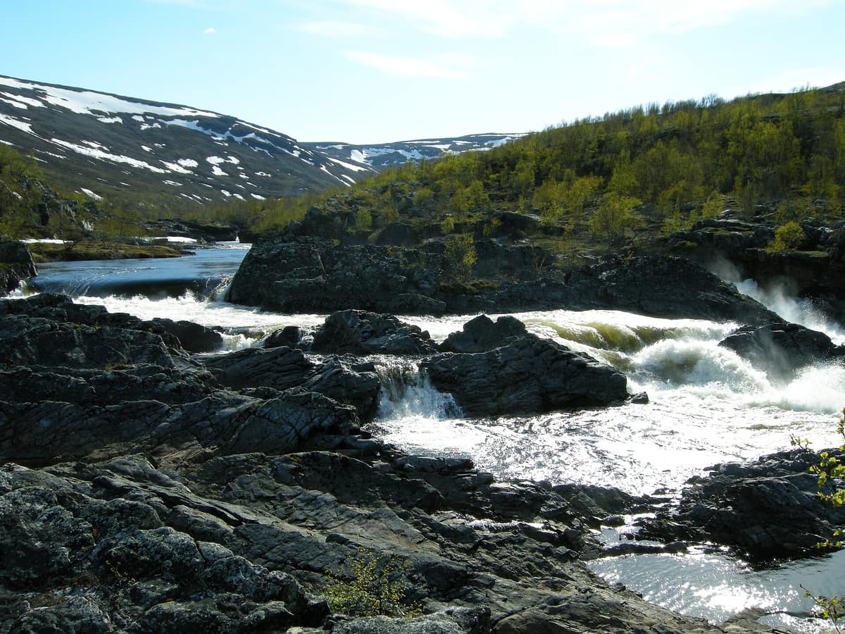
Stabbursdalen National Park
Finnmark (Porsanger / Lakselv) · Norway
Photo: Arnstein Rønning · CC BY-SA 3.0 · Wikimedia Commons
Shelters the northernmost Scots pine forest (Pinus sylvestris) on Earth (Stabbursnes), tucked at 70° N along the shores of Porsangerfjorden.
At nearly 70° north latitude, where arctic winds clip back almost everything that grows, a sheltered glacial valley protects a forest that seemingly defies the elements. These are low, gnarled Scots pines up to 500 years old, forming the northernmost pine forest in the world. Stabbursdalen National Park flanks the Stabburselva river and its valley west of Porsangerfjorden in Finnmark. It was established in 1970 to protect some 98 km² of riverside pine woodland, and in 2002 it was expanded to 747 km².
What makes it unique
Here survives the world's northernmost pine forest, an ancient relict from a warmer post-glacial climate.
The place
Nature
The landscape
The pine forest tells a paleoclimatic story. Thousands of years ago, when the post-glacial climate was warmer, pine forests extended far into the interior. As temperatures cooled, the forest retreated, persisting only in protected microclimatic valleys like this one. Stabbursdalen lies almost perpendicular to Porsangerfjorden, shielded from freezing maritime winds by northern mountain ranges, explaining how the trees survived here. The canopy is open and stunted, where dry, nutrient-poor podzolic soils support a sparse understory of lichens and heather.
The valley shifts character as you follow the river downstream. High up, the landscape is open tundra with mountain birch along the water. It then narrows between birch-clad canyon slopes before broadening at Stabbursfossen where the river enters primeval pine woods. Within the pine zone, the valley deepens into a ravine with waterfalls, rapids, and glacially polished bedrock from the era when the river carried the meltwater of all inland Finnmark. Downstream lies a terrace plateau at 60-70 m elevation. At Luobbal (Lompola), wide river wetlands form a lush oasis amidst an otherwise arid arctic terrain.
To the southeast, the rugged massifs of Gáissene provide dramatic relief. The range culminates in Čohkarášša at 1139 m, the highest peak in this part of Finnmark. These mountains represent geological thrust nappes: remnants of ancient seabed slabs thrust over the mainland between 400 and 600 million years ago.
Wildlife and seasons
Stabbursdalen marks the northern range limit for numerous boreal species. The western capercaillie maintains its northernmost global population here, while the Siberian jay, red squirrel, and pine grosbeak also reach their geographic limits in these pines. Black grouse and osprey breed here as well. The wetlands provide vital nesting grounds, especially for diving ducks.
Among mammals, moose, semi-domesticated reindeer, and wolverine are widespread.
At the river mouth lies the Stabbursnes Nature Reserve, one of Norway's premier coastal wetland complexes for waterbirds, sheltering 23 species of waterfowl, six of them geese, and 25 wader species. It is of international importance as a staging stopover for the threatened lesser white-fronted goose during spring and autumn passage. An observation hide south of Stabbursneset overlooks the extensive saltmarsh of Valdakmyra.
Species
With a page in the atlas
Being mentioned in a source doesn't guarantee sightings: check with the people who manage the area.
Memory and protection
History and conservation
For coastal Sami communities, the natural resources of Stabbursdalen were vital for survival. At Lompola, sedges were cut as winter fodder for cattle, and timber for boats and dwellings was floated down the Stabburselva; sustainable use left few visible scars. Pitfall trap systems survive from ancient wild reindeer hunting, which during the XVII century transitioned into semi-domestic reindeer herding. In pre-Christian Sami religion, mountains, lakes, and sacrificial stones (sieidi) were revered as sacred.
A missionary named the valley «Tabors dal» in the XVIII century after Mount Tabor; local linguistic evolution transformed it into Stabbursdalen. Modern preservation aims to safeguard an expansive roadless wilderness with the northernmost pine forest on Earth.
Before you set off
Visiting
How to visit
The park is set up for straightforward hiking, featuring waymarked trails, wilderness cabins, and open traditional turf huts (gammes). Visitors park near the bird-feeding station at Lombola, with main trailheads starting from the car park at the end of Lombolaveien. The shortest trail, under 1 km, leads to Rørkulpen, a picturesque bend in the pine woods by the river with a campfire ring and benches. The Stabbursfossen trail runs for roughly 5,5 km through pine, birch, and open terraces, where lucky visitors can spot jumping salmon. The trail to Stuorra Biŋalvárri, a fell on the park boundary, measures about 7,5 km each way with an ascent from 60 to 528 m, offering expansive views over the valley, Stabbursneset, and Porsangerfjorden. For a wilderness trek, the Okselv–Stabbursnes route passes the open turf shelter Bastingammen and the cabin Ivarstua; from Ivarstua to Stabbursnes is roughly 25 km.
The bird feeder at the main entrance regularly attracts Siberian tits, Siberian jays, great tits, and squirrels. In summer access is by car; in winter reaching the trailheads requires 7 km on skis or snowshoes.
The Stabbursnes Naturhus and Museum features exhibits on Finnmark's habitats from arctic coast to inland plateau, along with Sami culture and traditional reindeer husbandry.
Before you go
You are free to hike and ski anywhere and camp responsibly, carrying out all litter. A general ban on open fires in forests applies from 15 April to 15 September. Dogs must be kept on a leash from 1 April to 20 August.
Check access, rules and visiting conditions in the official information from the managing body before you set off.
Location
Where it is and how far it reaches
Boundary of Stabbursdalen · IUCN IV · © EEA, CDDA (CC-BY) The coordinate is estimated; it isn't a verified access point.
Transparency
Sources
The research data with its sources, and the official links for this place, are in the Spanish version of this page. See the Spanish version
Around it
Stabbursdalen has no adjacent neighbors in the atlas. Farther away, Urho Kekkonen National Park in Finland and Gutulia National Park in Norway share ancient pine taiga, moose, brown bear, and Siberian jays.
If you like this place, elsewhere in Europe
Distant places with uncommon wildlife and habitats in common. The most widespread species don't count. Sharing species doesn't imply a corridor or guaranteed presence.
- Urho Kekkonen National Park
Finnish Lapland (Saariselkä / Inari / Sodankylä)
In common: Perisoreus infaustus · Moose · Brown bear — primary forest, high mountain
Finland’s second largest national park (2.550 km²), rounded arctic tundra fell-tops (tunturi), and wild trekking under the shadow of Sokosti (718 m).
JFMAMJJASONDJune – April · Crowding low
- Gutulia National Park
Innlandet (Engerdal / Femundsmarka)
In common: Perisoreus infaustus · Moose · Brown bear — primary forest
Norway's smallest National Park (23 km²), protecting an untouched primeval forest of Scots pine and centuries-old spruces.
JFMAMJJASONDJune – September · Crowding very low
- Skuleskogen National Park (High Coast of Sweden)
Västernorrland (Höga Kusten / Örnsköldsvik / Kramfors)
In common: Perisoreus infaustus · Moose · Brown bear
The heart of Sweden's High Coast (Höga Kusten), the site of the world's greatest post-glacial isostatic rebound (286 m of land uplift after the ice), featuring the Slåttdalssvackan canyon.
JFMAMJJASONDMay – October · Crowding low
- Vilsandi National Park and Coastal Cliffs of Saaremaa
Saare County (Saaremaa Island / Kihelkonna / Tagamõisa)
In common: Atlantic salmon · Moose
The oldest marine bird sanctuary in the Baltic (1910), encompassing some 160 limestone islets and reefs off Saaremaa.
JFMAMJJASONDMay – October · Crowding very low
Entry #584 of the original atlas.