Slovak Paradise National Park
Národný park Slovenský raj
Eastern Slovakia (Spišská Nová Ves / Hrabušice / Dedinky) · Slovakia
Photo: Zdenek Svoboda from Prague, Czech Republic · CC BY 2.0 · Wikimedia Commons
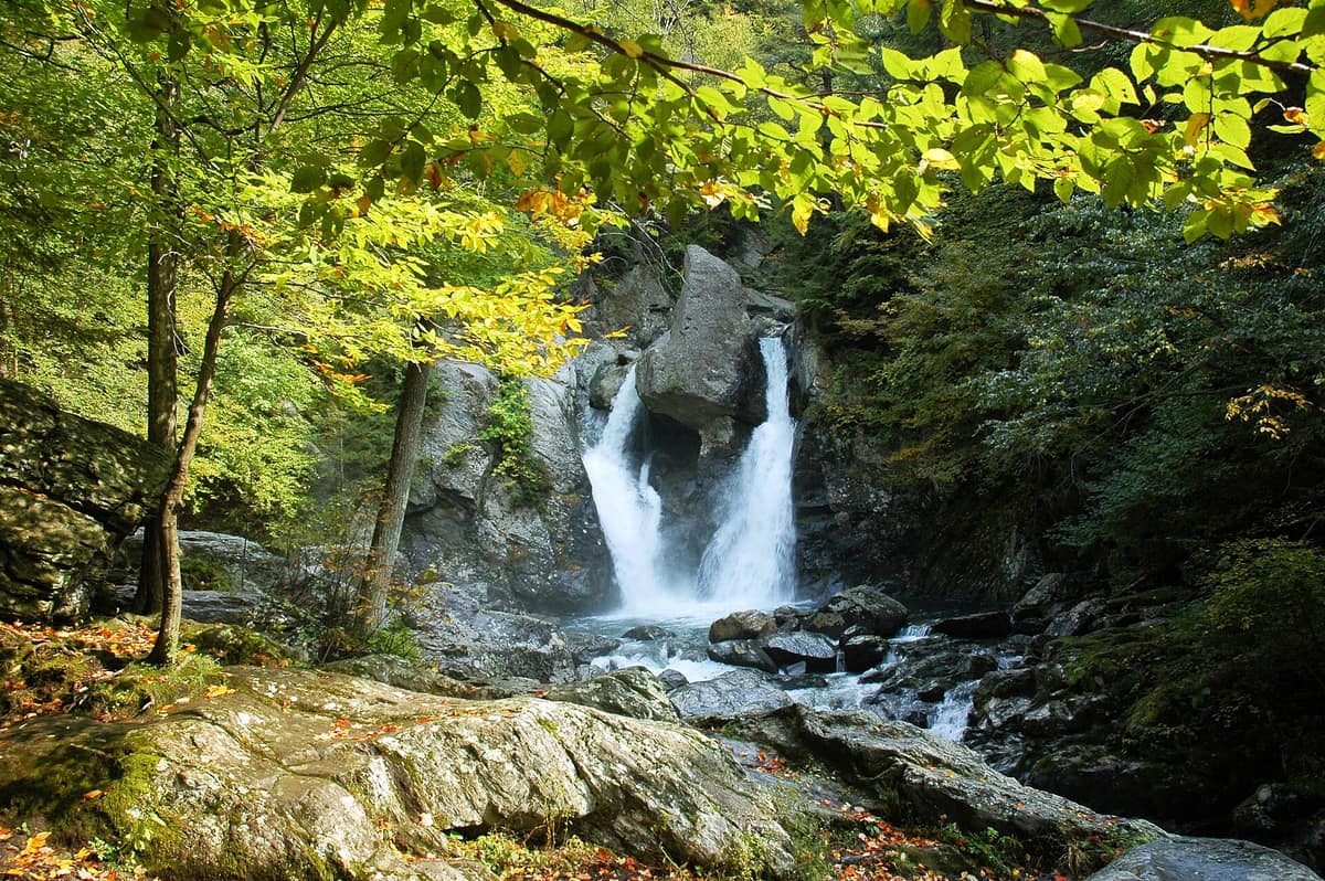
Limestone plateaus cut by narrow gorges climbed via ladders and footbridges over waterfalls.
Hiking here feels like scaling the inside of a waterfall. In Slovenský raj, rivers have carved a limestone plateau into pieces, leaving gorges so narrow and sheer that footpaths climb them via ladders, chains, metal rungs, and footbridges, always heading against the current. It is the national park of waterfall-filled ravines: a maze of canyons, caves, and forests covering 90 % of the territory and, for decades, the first place in Slovakia deemed worthy of landscape protection.
What makes it unique
You walk inside the rock, climbing waterfalls, and end the day in an ice cave declared a World Heritage Site.
The place
Nature
The landscape
The park's core is a karst plateau dissected into smaller tablelands by deep ravines. The explanation lies in the rock: nearly the entire territory is Mesozoic sedimentary rock, dolomite and sandstone, which karstifies readily as carbonate stone. These mountains rose during the Tertiary and Quaternary, and the drainage network carved steep, narrow valleys. The protagonist is the Hornád river, which together with its tributaries shaped canyons, gorges, waterfalls, and caves.
The most renowned gorges are Veľký Sokol, the longest at 4,5 km, Suchá Belá, Piecky, and Kyseľ, all adorned with cascades. The Prielom Hornádu is the longest canyon, at 11,7 km, and boasts the highest species diversity. The tallest cascade is Závojový vodopád, tumbling 70 m. And the highest peak in the park is Predná hoľa, rising to 1545 m.
Underground, the karst endures: around 350 caves exist, but only the Dobšiná Ice Cave, a World Heritage site since 2000, is open to the public.
Woodland blankets nearly everything. Beech, Norway spruce, silver fir, and Scots pine prevail. In the Kopanecké lúky meadows, more than 75 species of vascular plants thrive within a single square metre.
Wildlife and seasons
This is a park of large mammals and intricate micro-details. Forty species of mammals occur, among them the brown bear, the grey wolf, the Eurasian lynx, the European wildcat, the chamois, and the alpine marmot. It also shelters 65 endangered species, including the saker falcon, the Eurasian otter, and the European ground squirrel.
On a smaller scale, Slovenský raj holds Slovakia's greatest concentration of butterflies, with over 2100 species. The common viper is one of few snakes present: it avoids people and strikes only when provoked. As for plants, 930 species are documented, 35 of them protected, six endemic exclusively to the area, and 19 endemic to the Western Carpathians.
The park remains open year-round, though heavy rain and high water can lead to gorge closures. The main season spans May to October, and visitor traffic in Suchá Belá is high in summer.
Species
With a page in the atlas
Being mentioned in a source doesn't guarantee sightings: check with the people who manage the area.
Memory and protection
History and conservation
The name was bestowed by Carthusian monks, who established a monastery here in 1299 and christened it "paradisus" in Latin. The name Slovenský raj, as you know it, first appeared in 1921 in the journal Krásy Slovenska. This landscape represents what remains of the "Silva nigra", the Black Mountain, a vast forest tract between the Hornád and Slaná rivers. Traces of human presence date back to the Stone Age, while copper, iron, and silver mines later spurred metallurgy, forestry, and charcoal production.
Conservation came early: the first reserve was created in 1890, the first protected plant was the edelweiss in 1936, Slovakia's first protected landscape area was established on 21 August 1964, and on 18 January 1988 it became a national park. Since 2004, parts of the park have been integrated into the Natura 2000 network.
Before you set off
Visiting
How to visit
Two tourist hubs open up the park's northern flank: Čingov and Podlesok, joined by a marked 15 km route tracing the Hornád canyon. From there, the Prielom Hornádu ranks among the most visited routes. Another highly popular vantage point is the rocky viewpoint of Tomášovský výhľad, celebrated for its panoramic vista. To the south lies Dedinky on the shores of the Palcmanská Maša reservoir, where boating and water sports are permitted, with the exception of motorboats and speedboats.
Gorges are strictly hiked in an upstream direction, against the current, for safety. Metal ladders and rungs are installed, requiring good fitness and sturdy footwear. For a gentler outing, the Geravy nature circuit, which incorporates the Zejmarská gorge, is moderately easy. The park features 13 nature trails totalling nearly 89 km, forming one of the densest networks of marked trails in Slovakia.
For cyclists, there are 110 km of signposted bike trails, 65 of them within the park; off these trails, cycling is allowed only with a guide.
Before you go
Pedestrian access is permitted only along marked trails, from one hour after sunrise until one hour before sunset. Dogs must be kept on a leash and muzzled, and cannot tackle the gorge ladders. Check trail conditions before setting out, as high water levels can cause gorges to close.
Check access, rules and visiting conditions in the official information from the managing body before you set off.
Location
Where it is and how far it reaches
Boundary of Slovenský raj · © EEA, CDDA (CC-BY) The coordinate is estimated; it isn't a verified access point.
Transparency
Sources
The research data with its sources, and the official links for this place, are in the Spanish version of this page. See the Spanish version
Around it
9 km away lies Muránska Planina National Park, and at 18 km Tatranský národný park. Around 30 km off, across in Poland, is Tatrzański Park Narodowy. Further afield, the Gorges du Doubs along the Franco-Swiss border share gorge and karst habitats, as well as the lynx, with Slovenský raj.
What else to explore nearby
Approximate straight-line distance between the edges of each area. It doesn't indicate access, routes or driving times.
- Muránska Planina National Park - Primeval Forest Remnants
Banská Bystrica Region
About 9 km away
Karst plateau with limestone chasms, primeval beech woods, and meadows grazed by semi-feral mountain horses.
JFMAMJJASONDMay – October · Crowding very low
- Tatra National Park (Poland)
Lesser Poland (Zakopane)
About 30 km away
The only alpine-type high-mountain massif in the Carpathians: sharp granite ridges, glacial tarns, Tatra chamois, and brown bear.
JFMAMJJASONDJune – September · Crowding high
If you like this place, elsewhere in Europe
Distant places with uncommon wildlife and habitats in common. The most widespread species don't count. Sharing species doesn't imply a corridor or guaranteed presence.
- Călimani National Park - Volcanic Forest Massif
Suceava, Mureș, Bistrița-Năsăud, and Harghita Counties
In common: White-throated dipper · Eurasian lynx · Brown bear — old-growth forest
The largest extinct volcanic crater in Europe (10 km in diameter) covered with high-mountain fir and spruce forests.
JFMAMJJASONDJune – October · Crowding very low
- Sagittario Gorge Nature Reserve
Abruzzo (Anversa degli Abruzzi / Scanno)
In common: White-throated dipper · Brown bear · Grey wolf — gorge and canyon, karst and caves
An awe-inspiring karst canyon carved by the Sagittario River between vertical limestone cliffs hundreds of metres high.
JFMAMJJASONDMay – October · Crowding very low
Entry #1028 of the original atlas.