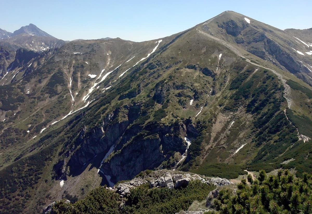
Tatra National Park (Poland)
Tatrzański Park Narodowy
Lesser Poland (Zakopane) · Poland
Photo: August kazimierz · CC BY 3.0 · Wikimedia Commons
The only alpine-type high-mountain massif in the Carpathians: sharp granite ridges, glacial tarns, Tatra chamois, and brown bear.
From the summit of Rysy at 2,499 metres, the highest point in Poland, you look down upon two alpine tarns that reveal almost everything essential about this park: Czarny Staw and Morskie Oko. Rysy rises in the Polish Tatras, the sole alpine-type high-mountain range in the Carpathians, a world of knife-edge granite crests, glacial cirques, and clear mountain lakes.
Tatra National Park preserves the Polish portion of the range, divided into two distinct sections: the High Tatras and the Western Tatras. Together with the adjoining Slovak national park, it forms a UNESCO transboundary biosphere reserve designated in 1992. It is also the most visited national park in Poland.
What makes it unique
Tatra chamois and Tatra marmot live here side by side, strictly protected since the mid-nineteenth century amidst soaring peaks, tarns, and deep caves.
The place
Nature
The landscape
The park ascends through distinct altitudinal zones. Up to 1,250 m, silver fir and European beech dominate the lower montane belt; higher up, to 1,550 m, Norway spruce forests take over before yielding to dwarf pine scrub and subalpine meadows up to 1,800 m. Above that line lies the true alpine tundra, home to Swiss stone pine, edelweiss, and stemless carline thistle. In spring, the Kościeliska Valley turns purple with blooming crocuses. Forest covers 151.91 km² of the park, with the remainder predominantly alpine meadows and rock.
Water manifests in more than 30 alpine lakes, known locally as stawy: Morskie Oko and Wielki Staw Polski are the largest. The highest waterfall is Siklawa at 70 m, followed by Czarny Staw waterfall at 40 m and Siklawica at 24 m; the Mickiewicz waterfalls are among the most frequented.
Underground, some 650 caves honeycomb the limestone and dolomite. The Wielka Śnieżna cave system is the longest and deepest, extending 23.7 km with a vertical range of 808 m, and six caves in the park are open to visitors.
Wildlife and seasons
Endemic and endangered species include the Tatra chamois, Tatra marmot, brown bear, Carpathian lynx, grey wolf, Eurasian otter, and lesser spotted eagle. Strict protection reserves encompass 115.14 km².
Timing depends on terrain and crowds. Summer is the season for traversing the high ridges; September brings thinner crowds. In July and August, Morskie Oko and Kasprowy Wierch become heavily congested, whereas the western valleys remain tranquil out of peak season.
Species
With a page in the atlas
Being mentioned in a source doesn't guarantee sightings: check with the people who manage the area.
Memory and protection
History and conservation
The first conservation appeals for the Tatras emerged in the late nineteenth century. In 1937 the park was formally established on state forestry land, and in 1954 the Polish government officially created the national park.
Human exploitation long predated conservation. In summer, herds of sheep, goats, and cattle grazed the alpine meadows, exacerbating erosion, while throughout the eighteenth and nineteenth centuries iron mines and smelters consumed vast amounts of timber. From that alpine heritage grew the distinctive culture of the Podhale Gorals, who preserve their regional dialect, folk music, wooden architecture, sheep milk cheeses, and artisan crafts.
Today the primary threats stem from the rapid urban growth of nearby Zakopane and regional air pollution drifting from industrial hubs like Kraków.
Before you set off
Visiting
How to visit
The park offers over 270 km of marked mountain trails. Begin at the Natural Education Centre in Zakopane: it houses Poland's largest three-dimensional topographical model of the Tatras with multimedia presentations, an interactive discovery room, cinema auditoriums screening films on Tatra fauna from the perspective of native animals (bears, marmots, chamois), dioramas illustrating the human impact on meadows and forests, and a walk-through simulated cave. Admission to the nature exhibition is free, though online reservation is required.
For hiking, the park provides data for classic routes. The standard ascent is Palenica Białczańska–Morskie Oko and back, covering 11.60 km with an average gradient of 7 %; the park indicates 4 h for the ascent and 1 h 30 min for the descent, rated suitable for beginners. An extended 20.00 km traverse climbs via Wodogrzmoty Mickiewicza, the Valley of the Five Polish Lakes, and Świstówka Roztocka, averaging a 25 % slope. The loop from Kuźnice via Hala Gąsienicowa and Czarny Staw Gąsienicowy spans 14.00 km with an average incline of 20 %. In the western valleys, the Dolina Chochołowska trail from Siwa Polana to Polana Chochołowska extends 15.00 km with a gentle 5 % grade; the loop from Kiry through Wąwóz Kraków and the Ornak refuge measures 14.00 km; and the Dolina Strążyska trail covers 8.20 km.
Before you go
The park issues a daily tourist bulletin detailing mountain safety and trail conditions. A visitor information centre is located on Chałubińskiego Street in Zakopane. Motor traffic is banned on the road section between the roundabout and Kuźnice. Always verify trail openings before departing into the high peaks.
Check access, rules and visiting conditions in the official information from the managing body before you set off.
Location
Where it is and how far it reaches
Boundary of Tatrzański Park Narodowy · © EEA, CDDA (CC-BY) The coordinate is estimated; it isn't a verified access point.
Transparency
Sources
The research data with its sources, and the official links for this place, are in the Spanish version of this page. See the Spanish version
Around it
Directly adjoining the border without any gap lies the Tatra National Park (Slovakia). Fifteen kilometres away are the Prosiecka and Kvačianska Valleys; nineteen kilometres away is Pieniny National Park - Dunajec River Gorge; and thirty kilometres away lies Slovenský raj National Park. Farther afield, Retezat National Park and Aigüestortes i Estany de Sant Maurici National Park share alpine marmots, golden eagles, and high-mountain granite scenery.
What else to explore nearby
Approximate straight-line distance between the edges of each area. It doesn't indicate access, routes or driving times.
- Slovak Paradise National Park
Eastern Slovakia (Spišská Nová Ves / Hrabušice / Dedinky)
About 30 km away
Limestone plateaus cut by narrow gorges climbed via ladders and footbridges over waterfalls.
JFMAMJJASONDMay – October · Crowding moderate
If you like this place, elsewhere in Europe
Distant places with uncommon wildlife and habitats in common. The most widespread species don't count. Sharing species doesn't imply a corridor or guaranteed presence.
- Retezat National Park
Hunedoara County (Hațeg)
In common: Alpine marmot · Chamois · Eurasian lynx — high mountain, old-growth forest, glacial landscape
The realm of the granitic and glacial Retezat, with over 80 crystal tarns and the Gemenele scientific reserve.
JFMAMJJASONDJune – October · Crowding low
- Bucegi National Park - Western Slopes
Dâmbovița, Argeș, and Prahova Counties
In common: Silver fir · Chamois · Eurasian lynx — high mountain, old-growth forest, karst and caves
Dramatic conglomerate cliffs rising toward the plateau of the Babele and Sphinx wind-sculpted rock formations.
JFMAMJJASONDJune – October · Crowding low
- Aigüestortes and Lake Saint Maurici National Park
Catalonia (Lleida)
In common: Alpine marmot · Silver fir · Golden eagle — high mountain, old-growth forest, glacial landscape
The only National Park in Catalonia, a glacial circus wonderland harboring over 200 tarns (estanys) beneath the iconic twin summits of Els Encantats.
JFMAMJJASONDJune – October · Crowding moderate
- Gran Paradiso National Park
Aosta Valley / Piedmont (Cogne / Valsavarenche / Ceresole Reale)
In common: Alpine marmot · Chamois · Golden eagle — high mountain, alpine meadow, old-growth forest, glacial landscape
Italy's oldest national park (1922): the last surviving Alpine ibex population held out here and repopulated the entire range.
JFMAMJJASONDJune – September · December – January · Crowding moderate
Entry #1001 of the original atlas.