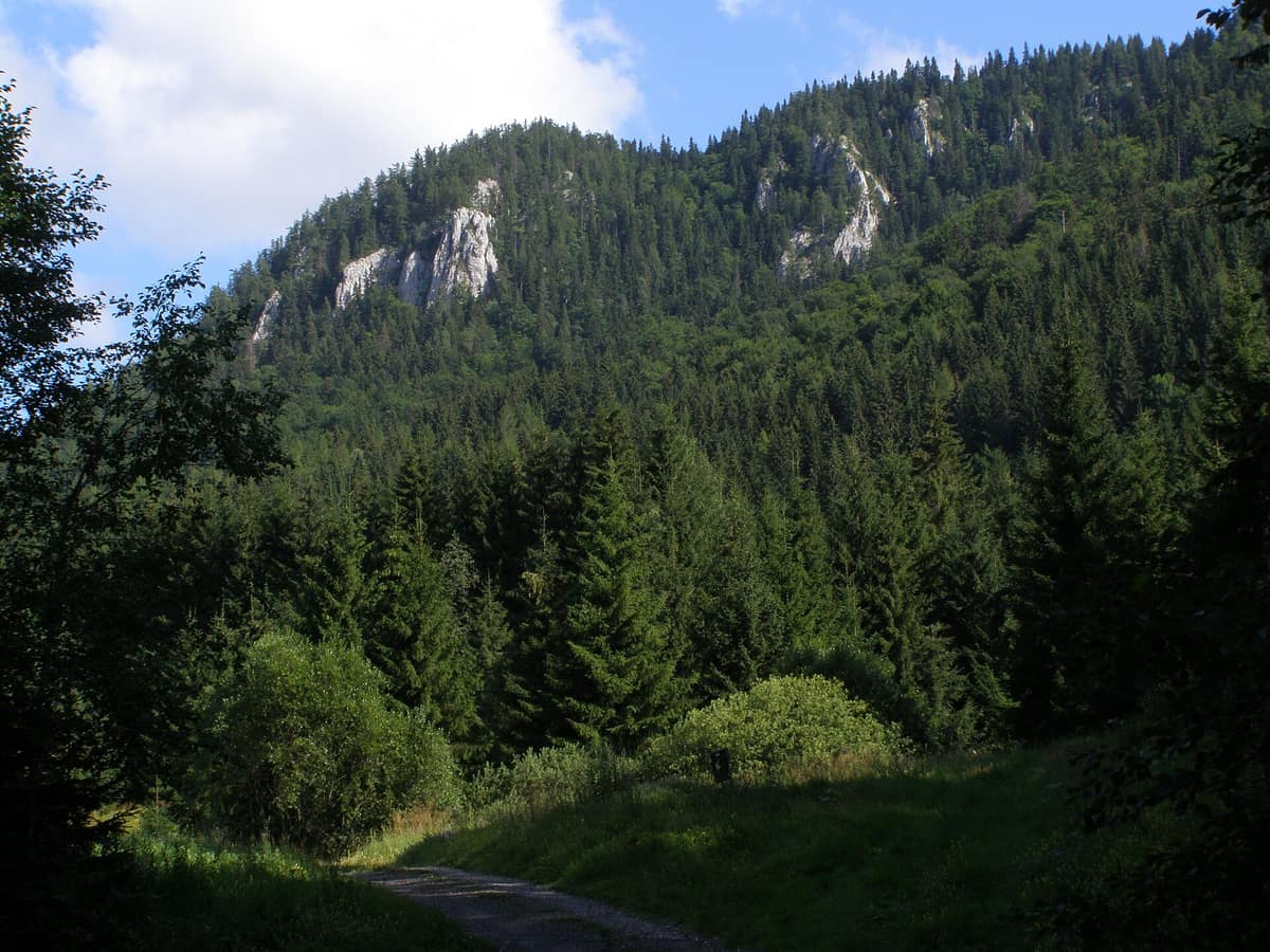
Muránska Planina National Park - Primeval Forest Remnants
Národný park Muránska planina - Pralesové zvyšky
Banská Bystrica Region · Slovakia
Photo: Daniel Baránek · CC BY-SA 3.0 · Wikimedia Commons
Karst plateau with limestone chasms, primeval beech woods, and meadows grazed by semi-feral mountain horses.
For centuries, the forest here was burned to produce charcoal and create pasture for livestock. Yet in the most inaccessible nooks of the Muránska planina plateau, uncut trees remain. Since 1997, the national park has protected a limestone and dolomite plateau in the western Slovenské rudohorie mountains, hosting a mosaic of beech woods, fir groves, and rocky bluffs roamed by the grey wolf, the brown bear, and the Eurasian lynx, under whose soil nearly 500 caves and chasms have been discovered.
What makes it unique
A forest logged and burned for centuries that still preserves, in its roughest corners, ancient trees of full age and dead logs nurturing the next generation.
The place
Nature
The landscape
The plateau has a three-act history. In the Tertiary, the sea submerged the area and left its sediment. Later, a volcano kilometres high rose northwest of Tisovec. Finally, erosion by water, wind, and Quaternary ice finished the work, leaving a limestone platform of some 160 km². Because limestone dissolves, the plateau is riddled with karren, towers, and rock gates, over 50 sinkholes and resurgences, and nearly 500 caves and chasms. The park climbs from 400 m to 1439 m at Fabová hoľa, its highest summit.
The forest arrived in stages. After the last ice age the woods thickened, and some five to six thousand years ago, during a warm, damp climate, beech and silver fir took hold. Today beech forests are the plateau's most extensive woodland: they carpet the lower southern slopes and, mixed with other trees, reach up to about 1300 m. The finest stands grow in the Hrdzavá valley, Martinova valley, Šarkanica, and below Šiance. Norway spruce, by contrast, is native only on the crests of Fabová hoľa and Kľak; lower-elevation spruce stands were planted.
Cliffs along the edge of the plateau shelter relict stands of larch and Scots pine, among which lives the Muráň daphne, the territory's rarest plant: an endemic tertiary relict that survived even glaciation. In addition, peat bogs thrive atop Tŕstie.
Wildlife and seasons
What defines this plateau is its ancient woodland. A primeval forest reveals itself through massive trees, deadwood in every phase of decay, and intricate natural architecture. Intact remnants persist: the best preserved in the Javorníková valley, and others at Stožky, Poludnica, and the Hrdzavá valley.
This deadwood and these tree cavities support wildlife. The woods are home to the wolf, the brown bear, the lynx, and the European wildcat. In the running streams of nearly every valley lives the Eurasian otter, which at times contends for territory with the black stork. Old forests and rocky crags shelter nesting golden eagles, peregrine falcons, and Ural owls, while western capercaillies live in high-altitude fir woods.
Underground, another fauna thrives: of Slovakia's 28 bat species, 26 inhabit the plateau, finding inaccessible caves for winter hibernation. Among the most frequent are the greater horseshoe bat and the greater mouse-eared bat. Invertebrates surpass 2700 species, including endemics such as the cave beetle Duvalius szaboi.
The forest regenerates on its own when left alone. After the windstorm of 2004, fallen fir stands were left untouched: bark beetles flourished, and a new generation featuring rowan replaced the ancient firs. The visiting season runs from May to October.
Species
With a page in the atlas
Being mentioned in a source doesn't guarantee sightings: check with the people who manage the area.
Memory and protection
History and conservation
Vlach shepherds felled and burned woodland to clear pasture for their flocks, and iron mining completed the transformation using charcoal produced right on the mountain slopes in hearths carved into hillsides. The territory gained protection as a national park in 1997. Portions of the forests are now left completely without intervention, subject only to natural processes, to safeguard natural woodland species.
Before you set off
Visiting
How to visit
The gateway town is Muráň. The information centre is located there, offering a permanent exhibition on park history and wildlife with mounted animal specimens. From the village, the Muráň Castle nature trail departs: 6,5 km and 530 m of elevation gain to the Veľká lúka meadow, featuring 14 panels and 2 information points about nature and the castle.
Other nature trails branch out across the park. The Hronec valley trail leaves from Závadka nad Hronom, spans 13,5 km, and ends beneath the Stožky massifs. From Tisovec depart the Hradová trail (about 3,12 km, 475 m of climb, in serpentines) and the Tŕstie trail (6 km and 720 m). The Zbojská loop, covering 4 km, starts and finishes at the mountain farmstead and negotiates the Čertova dolina gorge.
At Burda pass there is a field outpost without electricity or running water. Camping is permitted only at three designated spots; one lies at the southwestern end of Veľká lúka. In the centre of the plateau, at Nižná Kľaková, stands a free shelter, open year-round with no reservations: first come, first served.
Before you go
Driving into the park requires a permit, valid only along the Muráň–Veľká lúka stretch, bookable by phone or email for a single day; it must be displayed behind the windscreen. Check opening hours of the Muráň visitor centre before travelling. Since October 2024, a new visitor regulation has been in effect, specifying areas for horse riding and horse-drawn carriages; review it before planning your trip.
Check access, rules and visiting conditions in the official information from the managing body before you set off.
Location
Where it is and how far it reaches
Boundary of Muránska planina · IUCN V · © EEA, CDDA (CC-BY) The coordinate is estimated; it isn't a verified access point.
Transparency
Sources
The research data with its sources, and the official links for this place, are in the Spanish version of this page. See the Spanish version
Around it
9 km away lies Slovenský Raj National Park. At 14 km stands Dobročský Prales Primeval Forest, and somewhat further toward the Tatras, Tatranský národný park.
What else to explore nearby
Approximate straight-line distance between the edges of each area. It doesn't indicate access, routes or driving times.
- Slovak Paradise National Park
Eastern Slovakia (Spišská Nová Ves / Hrabušice / Dedinky)
About 9 km away
Limestone plateaus cut by narrow gorges climbed via ladders and footbridges over waterfalls.
JFMAMJJASONDMay – October · Crowding moderate
- Dobročský Prales Primeval Forest
Banská Bystrica (Čierny Balog / Brezno)
About 14 km away
Strict Nature Reserve designated in 1913, one of Slovakia's oldest and best-protected mixed fir-beech primeval forests.
JFMAMJJASONDMay – October · Crowding none
If you like this place, elsewhere in Europe
Distant places with uncommon wildlife and habitats in common. The most widespread species don't count. Sharing species doesn't imply a corridor or guaranteed presence.
- Domogled - Cerna Valley National Park
Caraș-Severin, Mehedinți, and Gorj Counties
In common: Greater horseshoe bat · European wildcat · Eurasian otter — primary forest, karst and caves, high mountain
Deep tectonic canyon flanked by Banat black pine and catchments with virgin montane beech woods.
JFMAMJJASONDMay – October · Crowding very low
- Krokar Primeval Forest
Southeast Slovenia (Borovška Gora Mountains / Kočevje Municipality / Kolpa River Basin)
In common: Ural owl · Peregrine falcon · European wildcat — primary forest, karst and caves
Primeval beech forest of Kočevsko, inscribed on the UNESCO World Heritage list, observed from the perimeter trail.
JFMAMJJASONDMay – October · Crowding very low
- Bukovské Vrchy Primeval Forest Complex - NP Poloniny
Prešov Region (Snina District)
In common: Ural owl · European wildcat · Eurasian otter — primary forest, high mountain
Slovakia’s largest tract of virgin primeval beech forests contiguous with subalpine ridge meadows (poloniny).
JFMAMJJASONDMay – October · Crowding very low
Entry #66 of the original atlas.