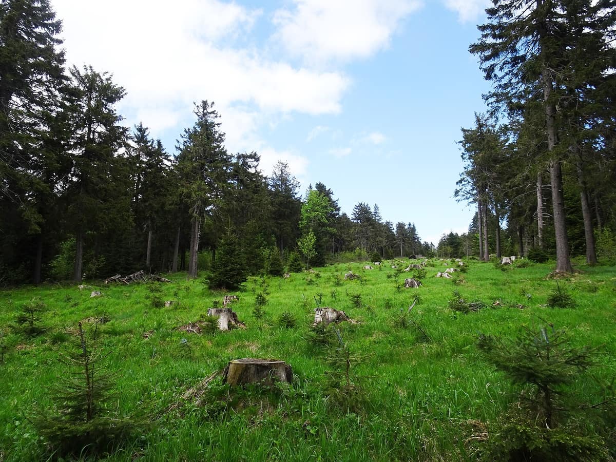
Eagle Mountains and Bystrzyckie Range
Orlické hory - Góry Bystrzyckie
East Bohemia (CZ) / Silesia (PL) (Deštné / Zieleniec) · Czechia / Poland
Photo: Palickap · CC BY-SA 4.0 · Wikimedia Commons
Gentle forested Sudetes ridge protecting raised bogs on the Czech-Polish border.
From a distance, Orlické hory looks like a wall of forest spread over Bohemia, a smooth, peak-free barrier. Draw closer and the wall opens: a flat ridge with no marked summits appears, cut by deep valleys filled with streams and rivers. This is the Czech edge of a border mountain that curves over the Divoká Orlice, and its protected landscape of 204 km² reaches 1115 metres across mosaics of bogs, flowering wet meadows, mountain pastures and forest. With such gentle relief and that mix of habitats, it is a mountain made for slow walking.
What makes it unique
A mountain of rounded ridges whose emblem is a flower, the spring snowflake, and where the wolf has returned to stay.
The place
Nature
The landscape
Forest dominates everything: it covers more than two thirds of the protected landscape. Without human intervention, what would grow here are beeches and, on higher ground, montane spruce forest; but the human use of the mountain changed that recipe.
History explains the rest. Landscape and nature bear the mark of resource use: glass, textile workshops and mining. A turning point was the expulsion of Bohemia's Germans after the war and the afforestation of abandoned farmland. In the eighties a pollution disaster brought down large areas of mountain forest, and in some places the original forest was poorly replaced by non-native species such as mountain pine or blue spruce. Today work is under way to restore the natural water regime and to create forests of more natural composition.
The flowers show that there are no alpine summits here. Unlike Krkonoše, Jeseníky or Králický Sněžník, the natural forest above the treeline is absent, and the flora has fewer endemics and glacial relicts. The meadows make up for it — they are human-made: without grazing or mowing they would fill with trees. And among all the flowers the spring snowflake stands out, growing in large expanses and serving as the emblem of the protected landscape.
Wildlife and seasons
Start with the water. The torrents of the Divoká Orlice, Bílá, Říčka and Zdobnice are home to the brook lamprey and the bullhead; above them the white-throated dipper and the kingfisher fly frequently, and the otter digs its burrow in the banks. In ponds and pools the moor frog, common toad and alpine newt breed.
Wet meadows are bird territory. You find the corncrake, whose call, a relentless «crex crex», is heard on summer nights, along with the common snipe, the red-backed shrike, the whinchat, the meadow pipit, the common rosefinch, the yellowhammer and the common crane. To protect the corncrake, the Orlické Záhoří bird area was designated. The marsh fritillary butterfly, protected across Europe, needs great burnet and Myrmica ants, and so depends on the meadows being mown carefully.
Deep in the forest the eagle owl and the black stork nest, and in tree cavities the black woodpecker, the Tengmalm's owl and the stock dove. Bats use those same cavities, above all the northern bat, the barbastelle, the brown long-eared bat and the Daubenton's bat.
The newcomer is the wolf: according to the management authority, it has settled permanently in Orlické hory since 2020, an animal that before belonged more to the world of legends. The authority asks for verifiable data — camera-trap images or tracks with location and date — for monitoring.
Species
With a page in the atlas
Being mentioned in a source doesn't guarantee sightings: check with the people who manage the area.
Memory and protection
History and conservation
The Natura 2000 network here covers five sites of community importance and one special protection area. The protected landscape coincides entirely with the CHOPAV natural water accumulation zone, designated in 1978. At Černý důl, a nature reserve, the core is an old-growth forest left to its own spontaneous development.
Before you set off
Visiting
How to visit
The backbone is the Jiráskova cesta, a marked route of 42 km along the main ridge of the protected landscape, passing close to the best spots on the mountain. It enters the protected area at Zelené údolí, near Olešnice v Orlických horách, and climbs to the Vrchmezí viewpoint. Near the border it crosses the Bukačka national nature reserve, called the botanical garden of Orlické hory for its mountain meadows, and passes the Velká Deštná viewpoint at 1115 m. Its final stretch crosses the Zemská brána nature reserve.
There are four nature trails. Zemská brána is under 2.5 km long and crosses the reserve through the Divoká Orlice valley; it has 10 stops with panels and interactive features for children, and is the only trail with panels up all year. Bedřichovka, under 3 km, is a bird trail: open to walkers and cyclists, it starts at the mountain hut of the same name, where the trail branches, with 8 stops about the Orlické Záhoří bird area, the wet meadows, the river and the history of settlement. Okolím Deštného covers about 17 km in two linked loops, mostly running alongside the tourist markings, with stops on the flora and the ancient forests of Sedloňovský vrch and Bukačka. And the ridge trail, about 15 km on foot and 19 km by bike, runs beside the Jiráskova cesta from the saddle below Šerlich to Mezivrší; in summer it is done by bike, in winter on cross-country skis.
Before you go
The management rules are specific. Throughout the protected landscape it is forbidden to enter or park with motor vehicles off roads, local streets and designated areas, and entry on forest tracks is prohibited. Blueberries, mushrooms and other forest produce may only be gathered outside the small protected areas. Reserve boundaries are marked with red stripes on trees: two stripes means you are entering; one stripe means you are leaving. Trail panels are installed only from spring to autumn, except at Zemská brána.
Check access, rules and visiting conditions in the official information from the managing body before you set off.
Location
Where it is and how far it reaches
Boundary of Orlické hory · IUCN V · © EEA, CDDA (CC-BY) The coordinate is estimated; it isn't a verified access point.
Transparency
Sources
The research data with its sources, and the official links for this place, are in the Spanish version of this page. See the Spanish version
Around it
Peklo nature reserve is about six kilometres away, and Králický Sněžník about seventeen.
What else to explore nearby
Approximate straight-line distance between the edges of each area. It doesn't indicate access, routes or driving times.
- Králický Sněžník - Masyw Śnieżnika
Pardubice / Olomouc (CZ) / Lower Silesia (PL) (Dolní Morava / Międzygórze)
About 17 km away
Summit of the "Royal Snow" (1.424 m) straddling the triple European hydrological divide of the North, Baltic, and Black Seas.
JFMAMJJASONDJune – October · Crowding low
If you like this place, elsewhere in Europe
Distant places with uncommon wildlife and habitats in common. The most widespread species don't count. Sharing species doesn't imply a corridor or guaranteed presence.
- Bukovské Vrchy Primeval Forest Complex - NP Poloniny
Prešov Region (Snina District)
In common: Corn crake · Grey wolf — high mountain
Slovakia’s largest tract of virgin primeval beech forests contiguous with subalpine ridge meadows (poloniny).
JFMAMJJASONDMay – October · Crowding very low
Entry #356 of the original atlas.