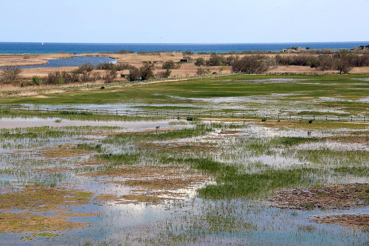
Aiguamolls de l'Empordà Natural Park
Parc Natural dels Aiguamolls de l'Empordà
Catalonia (Girona / Castelló d'Empúries / Sant Pere Pescador) · Spain
Photo: Maria planas aulet · CC BY-SA 4.0 · Wikimedia Commons
Coastal wetland and fluvial marsh reserve at the mouths of the Muga and Fluvià rivers on the Costa Brava.
In 1976 someone wrote the first text in defence of wetlands that were on the verge of becoming a housing estate. The 1974 plan for the Port Llevant residential marina envisaged 525 ha of navigable canals over the lagoons of Castelló d'Empúries, and from that threat grew a campaign that ended up saving what is today the Aiguamolls de l'Empordà Natural Park. They lie in the Empordà plain, between the mouths of the Fluvià and the Muga, and are one of the main wetlands of Catalonia, together with the Ebro and Llobregat deltas. They are the remains of a very extensive marsh system that gradually disappeared.
What makes it unique
One of the last wetlands of the Costa Brava, with the only remaining virgin beaches there and 338 observed bird species.
The place
Nature
The landscape
The story of water is in every corner. There was a time when the wetlands covered almost the entire plain of the Bay of Roses and the lower Ter; agricultural expansion first, then tourist construction, steadily reduced them. What survives was born from a deltaic system: the interaction between the flows of the Fluvià and the Muga and the marine dynamics created the wetland areas.
The marshes are transitional habitats, between the aquatic and the terrestrial, with borders that are hard to identify: they can be flooded, dry or in between, with fresh, brackish or slightly salty water. A living network of ditches, canals and gullies drains the floodable land, regulates the water of rice fields and meadows and carries irrigation water. Behind the beach are the llaunes, coastal brackish lagoons between the mouths of the Muga and the Fluvià. The freshwater ponds are remnants of the old Castelló pond; the most emblematic is that of Vilaüt. The closes are typical pasture meadows, surrounded by drainage ditches and riparian trees, occupying old ponds that flood in the rainy season. On the drier ground, the aspres, there are dryland crops and scrub.
The flora reflects this: there are psamophilous plants adapted to sandy soils and halophytes on salty soils, as well as species exclusive to or uncommon in the Catalan Countries. A total of 1,098 taxa have been recorded. Among the habitats, twelve are of community interest.
Wildlife and seasons
A total of 338 bird species have been observed, 82 of them regular breeders. The white stork, reintroduced, has bred here since 1987 and is very common. Among the breeding species are the great bittern, in lagoons with extensive reedbeds, the purple heron, the marsh harrier, the purple swamphen and the black-winged stilt. The glossy ibis and the spoonbill are seen during migration, always in small numbers, and groups of flamingos winter or stop over. The osprey passes through the park, and there are always some winterers on the Fluvià or in the glasswort areas. In dry terrain with woody crops the roller stands out, rare in the park and throughout Catalonia; in the breeding season the kingfisher and numerous bee-eater pairs nest.
Winter changes the pattern: thousands of herons including cattle egrets and thousands of mallards concentrate, and among the waders large groups of golden plover and lapwing winter. Counts place the Aiguamolls as the second wetland in Catalonia for wintering waterbirds, after the Ebro delta. The garganey, chosen as the park's emblem because it was the only waterbird on the peninsula that bred regularly only here, is now considered extinct as a breeder: its last breeding attempts were in 1997. On the Fluvià river, a stretch with the Caramany island is a partial reserve to protect the otter.
Species
With a page in the atlas
Being mentioned in a source doesn't guarantee sightings: check with the people who manage the area.
Memory and protection
History and conservation
The villages tell their own version of water. In the coastal area the traditional settlement is the corrals, enclosed livestock yards that later became farmhouses of the marshes. Rice, the crop most suited to these flood-prone lands, has recovered somewhat since the park was created, though today it is almost symbolic.
In the sixties, real-estate speculation put what remained in serious danger, with developments like Empuriabrava and campsites on the beaches of Sant Pere Pescador. In July 1976 the first defence text appeared, signed by Jordi Sargatal, and the Grup de Defensa dels Aiguamolls was formed. The area was declared on 28 October 1983, with a law approved unanimously. In 1987 it was designated a special protection area for birds and in 1993 it was included in the Ramsar list. Today there are also integral nature reserves, the highest level of protection in Catalan law: les Llaunes and els Estanys.
Before you set off
Visiting
How to visit
El Cortalet, an old livestock pen, beside the GIV-6216 road, is the information and interpretation centre and the starting point for the main routes; there are the nature classroom and the documentation centre. Between El Cortalet and Mas Matà there is a route of 4.5 km, out and back, taking an hour and a quarter and very easy. At Mas Matà, the Senillosa observatory is one of the four towers that served for drying rice; since 1996 it has been a viewpoint over the most coastal strip of the wetlands.
The park has set up 30 observation points, of which 14 are hides, from which wildlife can be seen without being seen or disturbing their peace. The best times to see birds are morning and evening, and there are more species during migration, from March to May and from August to October.
Before you go
More than 80 % of the territory is privately owned and much of it is agricultural: respect crops and neighbours. The capture or collection of animals and plants, wild camping and vehicle access to the routes are not permitted. Carry mosquito repellent all year, without picaridin, which is very toxic to amphibians. The opening hours of the centres change according to the season, so check before visiting.
Check access, rules and visiting conditions in the official information from the managing body before you set off.
Location
Where it is and how far it reaches
Boundary of Aiguamolls de l`Empordà · IUCN V · © EEA, CDDA (CC-BY) The coordinate is estimated; it isn't a verified access point.
Transparency
Sources
The research data with its sources, and the official links for this place, are in the Spanish version of this page. See the Spanish version
Around it
The Cap de Creus Natural Park is about ten kilometres away. Other wetlands share some of the Aiguamolls' birds: the Ebro Delta Natural Park also has glossy ibis and great bittern, s'Albufera de Mallorca Natural Park the marsh harrier, and Zwin Nature Park the white stork.
What else to explore nearby
Approximate straight-line distance between the edges of each area. It doesn't indicate access, routes or driving times.
- Cap de Creus Natural Park
Catalonia (Girona / Cadaqués / El Port de la Selva / Roses)
About 10 km away
The easternmost point of the Iberian Peninsula, where the Pyrenees plunge into the sea in a labyrinth of metamorphic schists sculpted by the tramontana.
JFMAMJJASONDApril – June · September – October · Crowding moderate
If you like this place, elsewhere in Europe
Distant places with uncommon wildlife and habitats in common. The most widespread species don't count. Sharing species doesn't imply a corridor or guaranteed presence.
- Ebro Delta Natural Park
Catalonia (Tarragona / Deltebre / Sant Jaume d'Enveitja / Amposta)
In common: Glossy ibis · Purple heron · Eurasian bittern — wetland, wild coast, river corridor
The most important wetland in the Iberian Mediterranean after Doñana (320 km²), featuring reed-fringed lagoons, the Trabucador sandbar, and thousands of flamingos.
JFMAMJJASONDApril – June · September – November · Crowding low
- S'Albufera de Mallorca Natural Park
Balearic Islands (Mallorca / Muro / Alcúdia / Sa Pobla)
In common: Western swamphen · Western marsh harrier · Osprey — wetland, wild coast
The largest wetland in the Balearic Islands (1,700 ha), a lagoon of brackish reedbeds with outstanding bird observation hides in the Bay of Alcúdia.
JFMAMJJASONDMarch – May · September – November · Crowding low
Entry #506 of the original atlas.