Picos de Europa National Park
Parque Nacional de los Picos de Europa
Asturias / Cantabria / León (Cangas de Onís / Arenas de Cabrales / Potes / Posada de Valdeón) · Spain
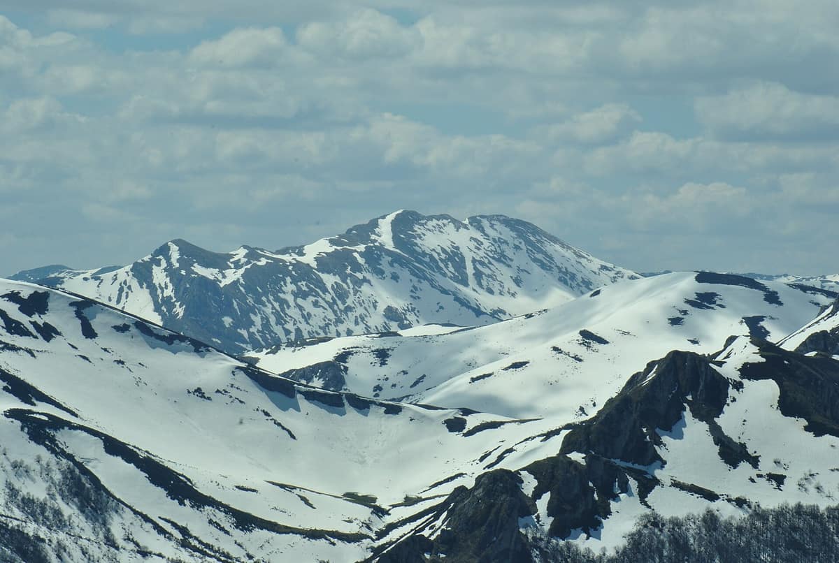
Photo: Jorgeboco · CC BY-SA 3.0 es · Wikimedia Commons
Spain's first National Park (1918), three alpine limestone massifs rising to 2,600 m just 15 km from the Cantabrian Sea.
In the Picos de Europa, rivers plunge from sky to ocean. Across the northern watershed, headwaters of the Dobra, Cares, and Sella descend more than 1000 metres over barely 10 kilometres, while Torrecerredo peak, at 2648 m, stands as the park's crowning summit, contrasting with its lowest elevation of 75 m along the Deva river. This colossal limestone mass, sculpted by water and glacial ice into jagged crests, gorges, and chasms, forms the heart of the Cantabrian Range. It was the very first protected national space established in Spain.
What makes it unique
The limestone crags of the three massifs, the surrounding Atlantic temperate forest, and the biogeographical meeting ground between northern European and Mediterranean species, all in one place.
The place
Nature
The landscape
Roughly 65 million years ago, geological uplift rejuvenated these landforms, allowing rivers and glaciers to carve deep alpine features. Quaternary glaciations and meltwater streams subsequently deepened the relief. From this emerged the Desfiladero de los Beyos and the Cares Gorge, two of Spain's most spectacular limestone canyons, alongside subterranean shafts ranking among the deepest abysses on Earth. Glacial U-shaped valleys, cirques, and tarns demonstrate past glacial forces still reflected in perennial snow patches.
Beneath the towering rock faces, climate drives diversity. A temperate oceanic macrobioclimate meets sub-Mediterranean conditions, yielding exceptional ecological richness. Winter temperatures can be severe: the Vega de Liordes recorded -35.8 °C on 7 January 2021. Deciduous Atlantic woods dominate, featuring beech, Scots pine, hazel, holly, and abundant orchids, alongside Mediterranean pockets of holm oak, Portuguese oak, juniper, and strawberry trees. Mixed woodlands harbor birch, ash, and chestnut. At Posada de Valdeón, Monte Corona preserves the only native linden woodland in Europe.
Wildlife and seasons
The park marks the southern limit for numerous northern European species and the northernmost frontier for Mediterranean flora and fauna. Among strictly protected creatures are the Cantabrian western capercaillie, the brown bear, and increasingly the bearded vulture, currently undergoing reintroduction.
High summits shelter the Cantabrian Pyrenean chamois, one of the park's most iconic inhabitants, and the Spanish ibex has been reintroduced; overhead soar the golden eagle and yellow-billed chough. Other emblematic species include the grey partridge, alpine accentor, snowfinch, middle spotted woodpecker, Iberian grey wolf, and the rare beetle Rosalia alpina.
To view wildlife, pause motionless upon arriving at a vantage point: animals quickly resume their natural habits. A pair of 7x or 8x binoculars reveals countless species, and early morning hours are ideal for bird observation. The main season extends from June to October.
Species
With a page in the atlas
Being mentioned in a source doesn't guarantee sightings: check with the people who manage the area.
Memory and protection
History and conservation
The western massif was proclaimed a national park on 24 July 1918 under the name Montaña de Covadonga. Originally covering 16 925 ha, it was expanded in 1995 and reached its current expanse of 67 127 ha on 3 December 2014. Roman causeways, historic royal transhumance tracks, old cart roads, and mountain trails once walked by anti-fascist maquis cross the terrain, alongside romanesque churches, traditional watermills, fulling mills, and medieval stone towers.
Before you set off
Visiting
How to visit
Start your visit at one of the information hubs. The oldest is Pedro Pidal at Buferrera, near the Covadonga Lakes; in Cantabria stands Sotama near Tama. Permanent offices also operate at Casa Dago (Cangas de Onís) and Posada de Valdeón (León), while seasonal information kiosks staff major access roads from 1 July to 15 September, during Easter, and on holiday weekends.
The park boasts 30 approved short-distance trails (PR), including celebrated routes like the Frassinelli trail, the Covadonga Lakes, and the Cares Gorge; other highlights include Vega de Urriellu, Horcados Rojos, the Ilces beechwood, and the Ándara massif, alongside long-distance trails GR 201 (Senda del Arcediano) and 202 (Ruta de la Reconquista). The historical footpath GR-1 crosses the park across 62.5 km in 5 stages. From El Portal de Picos at 1823 m, reached by the Fuente Dé cable car, tracks head toward Refugio Verónica or loop via Chalet Real and Refugio Áliva. Four high-mountain trails require stout physical preparation and alpine gear due to rugged terrain, distance, and exposed ledges.
Lookouts offer panoramic viewpoints. Mirador de la Reina along the Lakes road overlooks Onís, the Cuera range, and the sparkling Cantabrian Sea on clear mornings. The Urriellu lookout near Bulnes gazes straight at Picu Urriellu. The Ordiales viewpoint, 3.5 hours on foot from the Lakes, overlooks the Angón valley and shelters the tomb of Pedro Pidal. The park also provides guided hikes with interpreter rangers, while an educational geological guide details fourteen itineraries across scenic highlights.
Before you go
Wild camping is not permitted; bivouacking is allowed above 1,600 m, with tents pitched one hour before sunset and struck one hour after sunrise. The terrain is extraordinarily precipitous: never leave designated paths or take shortcuts, and carry sufficient water, as karst limestone terrain leaves high ridges completely arid. The park authority urges visitors to plan walks prudently and remain on marked footpaths.
Check access, rules and visiting conditions in the official information from the managing body before you set off.
Location
Where it is and how far it reaches
Boundary of Picos de Europa · IUCN II · © EEA, CDDA (CC-BY) The coordinate is estimated; it isn't a verified access point.
Transparency
Sources
The research data with its sources, and the official links for this place, are in the Spanish version of this page. See the Spanish version
Around it
Further west, Parque Natural de Somiedo shares with the Picos the chamois, wolf, and brown bear, while Parc Nacional d'Aigüestortes i Estany de Sant Maurici shares the chamois and griffon vulture.
If you like this place, elsewhere in Europe
Distant places with uncommon wildlife and habitats in common. The most widespread species don't count. Sharing species doesn't imply a corridor or guaranteed presence.
- Abruzzo, Lazio and Molise National Park
Abruzzo, Lazio and Molise regions (L'Aquila, Frosinone and Isernia provinces)
In common: Pyrenean chamois · Rosalia longicorn · Griffon vulture — high mountain, karst and caves
Sanctuary of the Marsican brown bear and Apennine wolf in primeval beechwoods and high alpine valleys of central Italy.
JFMAMJJASONDMay – June · October · Crowding moderate
- Pyrénées National Park
Occitanie / Nouvelle-Aquitaine (Hautes-Pyrénées / Pyrénées-Atlantiques)
In common: Pyrenean chamois · Spanish ibex · Brown bear — high mountain, glacial landscape, gorge and canyon, old-growth forest
The French slope of the central Pyrenees, twin to Ordesa: glacial cirques, bearded vultures, isards, and Pyrenean desmans.
JFMAMJJASONDJune – September · Crowding moderate
- Somiedo Natural Park
Asturias (Pola de Somiedo / Valle de Lago / Saliencia)
In common: Pyrenean chamois · Western capercaillie · Brown bear — high mountain, glacial landscape, old-growth forest
The iconic sanctuary of the Cantabrian brown bear, with deep glacial troughs, the lakes of Saliencia, and traditional thatched teito cabins.
JFMAMJJASONDMay – October · Crowding low
Entry #484 of the original atlas.