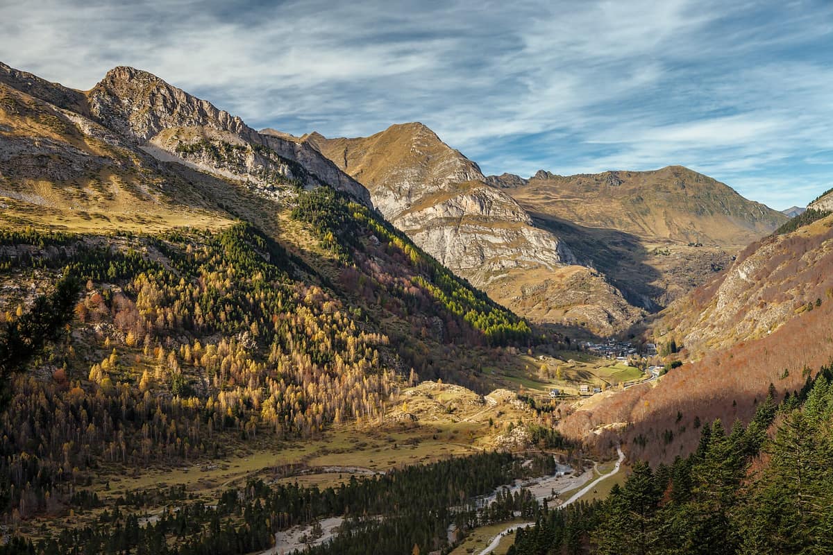
Pyrénées National Park
Parc national des Pyrénées
Occitanie / Nouvelle-Aquitaine (Hautes-Pyrénées / Pyrénées-Atlantiques) · France
Photo: Moahim · CC BY-SA 4.0 · Wikimedia Commons
The French slope of the central Pyrenees, twin to Ordesa: glacial cirques, bearded vultures, isards, and Pyrenean desmans.
Imagine an amphitheater of sheer rock walls carved by glacial ice. That is the Cirque de Gavarnie, and it is merely the most famous among those preserved by Pyrénées National Park: an east-west high-mountain belt stretching from the upper Aspe valley and Pic du Midi d'Ossau to Pic de Néouvielle, by way of Balaïtous and the Vignemale, which at 3.298 m forms the highest summit of its core. Here lie 230 high-altitude lakes, the loftiest peaks in the French Pyrenees, and pastoral landscapes where transhumant farming remains vibrant.
What makes it unique
Glaciations carved monumental amphitheaters here like the immense Cirque de Gavarnie, explored today just across the frontier from its twin park, Ordesa y Monte Perdido.
The place
Nature
The landscape
Understanding the park requires peering back into geological deep time. The limestone dominating much of these ranges originated during the Cretaceous and Eocene epochs; subsequent tectonic uplift incised profound canyons, followed by repeated glaciations that carved the present amphitheaters and broad U-shaped valleys. The park thus protects striking karst landforms, including dry limestone valleys and caves.
The cirques of Gavarnie, Estaubé, and Troumouse, alongside the Wall of Barroude, represent quintessential high-mountain sceneries, characterized by dizzying vertical precipices. The park core encompasses 45.707 ha across 15 municipalities, spanning from 1.273 m up to 3.298 m at the summit of Vignemale.
Lower down, the mountain reveals a gentler face. Mid-altitude pastures and rustic stone barns reflect living agropastoral traditions—a harmonious blend of sheer wilderness and ancestral cultural landscape recognized by UNESCO in 1997 through the World Heritage designation Pyrénées-Mont Perdu, shared with Ordesa y Monte Perdido.
Wildlife and seasons
The flora ranks among France's richest: roughly 2.500 vascular plant species, over 200 of them endemic, including Lapeyrouse's pansy and silver vetch. Wildlife is equally remarkable, numbering 4.000 animal species, 250 of them vertebrates, centered around the park's emblem: the isard, or Pyrenean chamois.
The skies belong to threatened raptors: the bearded vulture, Egyptian vulture, and golden eagle. Across screes roam the chamois and Alpine marmot, introduced from the Alps in 1948. Mountain torrents harbor the Pyrenean desman, a bizarre, elusive semi-aquatic mammal rarely observed directly. Other mammals include common genets and the Iberian ibex, reintroduced since 2013, with over two hundred and fifty individuals counted in 2020.
The brown bear represents the park's most delicate conservation saga. The last indigenous Pyrenean bears, all males, clung to the valleys of Aspe and Ossau; in the central Pyrenees, three bears from Slovenia were reintroduced: two females in 1996 and a male in 1997.
During summer, park rangers lead themed interpretive outings, including raptor walks in the Luz-Gavarnie valley.
Species
With a page in the atlas
Being mentioned in a source doesn't guarantee sightings: check with the people who manage the area.
Memory and protection
History and conservation
Conservation here predates the national park. In 1935 the National Acclimatization Society established the Néouvielle Nature Reserve, integrated in 1968 into the national park, which was formally created by decree on 23 March 1967. It was conceived as an unfenced wilderness where wildlife moves without barriers.
The park comprises two management zones: the core and the peripheral buffer zone. In the core, strict regulations safeguard natural beauty and threatened species; in the buffer zone, regulations are more flexible, designed to combat rural depopulation.
Before you set off
Visiting
How to visit
The national park and the Néouvielle lakes offer sublime terrain for hiking. Among the most popular destinations are the Cirque de Gavarnie, Lac d'Orédon, and Lac de Cap de Long, spread across valleys including Luz, Aure, Néouvielle, Cauterets, Ossau, Azun, and Aspe.
For an accessible stroll, the interpretive path at Plan d'Aste welcomes visitors of all walking abilities.
Before you go
Summer is the prime season for high-altitude trekking. Visitor numbers peak at the Cirque de Gavarnie and Pont d'Espagne, while the upper valleys of Aspe and Ossau remain peaceful. Comply with core zone regulations and check trail conditions before departure.
Check access, rules and visiting conditions in the official information from the managing body before you set off.
Location
Where it is and how far it reaches
Boundary of Pyrénées · IUCN II · © EEA, CDDA (CC-BY) The coordinate is estimated; it isn't a verified access point.
Transparency
Sources
The research data with its sources, and the official links for this place, are in the Spanish version of this page. See the Spanish version
Around it
Just 1 km away across the Spanish frontier lies Ordesa y Monte Perdido National Park, sharing the UNESCO designation and over 100 km of transboundary trails. Roughly fifteen kilometers away lies the Irati Forest.
Farther afield, Aigüestortes National Park shares chamois, marmots, and bearded vultures, while Gran Paradiso National Park and Vanoise National Park share marmots, bearded vultures, and golden eagles.
What else to explore nearby
Approximate straight-line distance between the edges of each area. It doesn't indicate access, routes or driving times.
- Ordesa y Monte Perdido National Park
Aragon (Huesca / Torla / Broto / Fanlo / Bielsa / Escalona)
About 1 km away
The 'Grand Canyon of Europe', UNESCO World Heritage Pyrénées-Mont Perdu, crowned by Monte Perdido (3,355 m) with four grand canyons: Ordesa, Añisclo, Escuaín, and Pineta.
JFMAMJJASONDMay – October · Crowding moderate
If you like this place, elsewhere in Europe
Distant places with uncommon wildlife and habitats in common. The most widespread species don't count. Sharing species doesn't imply a corridor or guaranteed presence.
- Aigüestortes and Lake Saint Maurici National Park
Catalonia (Lleida)
In common: Pyrenean chamois · Alpine marmot · Bearded vulture — high mountain, glacial landscape, old-growth forest
The only National Park in Catalonia, a glacial circus wonderland harboring over 200 tarns (estanys) beneath the iconic twin summits of Els Encantats.
JFMAMJJASONDJune – October · Crowding moderate
- Picos de Europa National Park
Asturias / Cantabria / León (Cangas de Onís / Arenas de Cabrales / Potes / Posada de Valdeón)
In common: Pyrenean chamois · Spanish ibex · Brown bear — high mountain, glacial landscape, old-growth forest, gorge and canyon
Spain's first National Park (1918), three alpine limestone massifs rising to 2,600 m just 15 km from the Cantabrian Sea.
JFMAMJJASONDJune – October · Crowding moderate
- Gran Paradiso National Park
Aosta Valley / Piedmont (Cogne / Valsavarenche / Ceresole Reale)
In common: Alpine marmot · Bearded vulture · Golden eagle — high mountain, glacial landscape, alpine meadow, old-growth forest
Italy's oldest national park (1922): the last surviving Alpine ibex population held out here and repopulated the entire range.
JFMAMJJASONDJune – September · December – January · Crowding moderate
- Vanoise National Park
Auvergne-Rhône-Alpes (Savoie)
In common: Alpine marmot · Bearded vulture · Golden eagle — high mountain, glacial landscape, alpine meadow
France's first national park (1963), created to save the Alpine ibex: glaciers, alpine grasslands, and one of the Alps' greatest ibex populations.
JFMAMJJASONDJune – September · Crowding moderate
Entry #1014 of the original atlas.