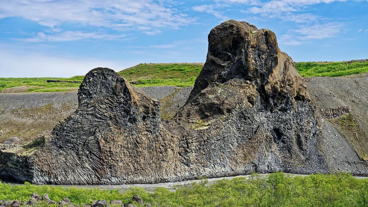
Vatnajökull National Park
Vatnajökulsþjóðgarður
East and South Iceland (Skaftafell / Jökulsárgljúfur / Askja) · Iceland
Photo: Holger Uwe Schmitt · CC BY-SA 4.0 · Wikimedia Commons
Europe's largest ice cap outside the Arctic and the volcanoes smouldering beneath it: fire and ice on a continental scale.
Beneath the ice lie active volcanoes. That simple fact encapsulates Vatnajökull better than any dry statistic: the ice cap that lends its name to the national park, covering 8,100 km², is Europe's largest outside the polar Arctic and conceals active central volcanoes, including Bárðarbunga, the highest, and Grímsvötn, the most frequently erupting. Fire and ice intertwine across the same map. The national park was established on 7 June 2008 and encompasses roughly 14,967 km²—around 14% of Iceland—making it Europe's second-largest national park after Yugyd Va. It was inscribed on the World Heritage List on 5 July 2019.
What makes it unique
Cataclysmic glacial outburst floods carved the Jökulsárgljúfur canyon, where Dettifoss waterfall still thunders.
The place
Nature
The landscape
Here geographic reality is dictated by volcanism and meltwater. The western sector witnessed two of history's greatest basalt fissure eruptions: Eldgjá in 934 and Lakagígar in 1783-1784. In 1362, the subglacial volcano beneath Öræfajökull erupted violently, obliterating the historic settlement of Öræfi. Along the snout of Skeiðarárjökull, repeated jökulhlaups—catastrophic glacial outburst floods—have deposited vast plains of glaciofluvial outwash sediments.
The climate distributes precipitation unevenly. North of the ice cap lies the most arid territory in Iceland, while the south-western, southern, and eastern margins receive the country's highest rainfall totals. Consequently, the damp volcanic slopes of the south-west are cushioned by deep moss carpets, particularly Racomitrium lanuginosum, while the barren lava fields of Krepputunga and Ódáðahraun are colonized by the lichen Stereocaulon vesuvianum.
Between desolate outwash plains lie remarkable contrasting habitats: barren sandur plains, continuous upland tundra, wetlands, verdant oases nestled at lava margins, moss heaths, and subarctic birchwoods. Eyjabakkar protects one of Iceland's largest highland wetlands. At Skaftafell, lower mountain flanks are covered in downy birch interspersed with rowan, with harebell, yellow mountain saxifrage, and alpine saxifrage blooming across rock ledges. Svartifoss waterfall tumbles over towering, symmetrical hexagonal basalt columns. Subterranean springs and fissures even shelter endemic groundwater amphipods originating from the Ice Age.
Wildlife and seasons
The wetlands encircling Snæfell provide critical habitat for wild reindeer and pink-footed geese. At Heinaberg reindeer herds are observed predominantly in winter. Eyjabakkar represents one of the world's most significant moulting gatherings for pink-footed geese.
In the south, Skeiðarársandur and Breiðamerkursandur are vital nesting territories for the great skua, red-necked phalarope, and barnacle goose. In spring and early summer, the trail leading to Svartifoss teems with breeding birds: take care to avoid disturbing nesting pairs. Beneath the south-eastern mountain margins lives Iceland's largest ground beetle, Carabus problematicus, while regional lakes and meltwater streams maintain unique relict populations of Arctic char and brown trout, isolated since the retreat of the Pleistocene ice.
Winter bird surveys in Skaftafell in January regularly document Arctic redpolls and rock ptarmigan among resident species.
Species
With a page in the atlas
Being mentioned in a source doesn't guarantee sightings: check with the people who manage the area.
Memory and protection
History and conservation
Skaftafell was an important manorial farm and local assembly site throughout the Middle Ages. Today the central challenge is ice dynamics: UNESCO underscores that glacial melting and retreat have accelerated dramatically under anthropogenic climate warming. The third edition of the park's integrated management plan entered into force on 5 July 2022.
Before you set off
Visiting
How to visit
Skaftafell serves as the primary entrance hub, situated directly beside Route 1, with the closest service communities being Kirkjubæjarklaustur and Höfn. Skaftafellsstofa visitor centre remains open year-round, offering ranger guidance and trail updates. From here departs the Jökulslóð trail, leading to the terminus of Skaftafellsjökull glacier as a living showcase of glacial recession. From 15 June to 15 August, park rangers conduct short, accessible interpretive walks suitable for all visitors.
Further hiking trails branch across the park. The Skógarstígur covers four kilometres from Gljúfrastofa, taking between one and two hours. The Hjallanes/Skálafellsjökull loop measures 8 km, requiring three to four hours with 140 m of elevation change. At Heinabergslón, a brief interpretive path details the retreat of glaciers, while the sheltered floor of Ásbyrgi features an ethnobotanical trail on traditional plant lore.
Each regional sector features a dedicated visitor facility. Gljúfrastofa in Ásbyrgi operates year-round with comprehensive interactive exhibits. Gígur in Mývatnssveit is open all year. Skaftárstofa near Kirkjubæjarklaustur pairs regional route guidance with the Life with Nature exhibition. Snæfellsstofa in Skriðuklaustur features The World's Wheel, exploring natural cycles, wildlife, and reindeer ecology, and is fully wheelchair accessible. In summer, Hrauneyjar provides real-time information for mountain tracks across Sprengisandur and Fjallabak. In addition, ranger outposts at Askja, Jökulsárlón, Eldgjá, Herðubreiðarlindir, Hvannalindir, Kverkfjöll, Laki, Nýidalur, and Snæfell act as local education and assistance stations.
Before you go
Mountain tracks in the interior highlands, including routes to Askja and Kverkfjöll, open strictly in summer. At Jökulsárlón and Fellsfjara, drone flying is prohibited between 15 April and 15 July to protect breeding bird colonies. When hiking trails in Hjallanes, always close all livestock gates after passing through. Consult official road opening conditions and weather alerts before venturing into the backcountry.
Check access, rules and visiting conditions in the official information from the managing body before you set off.
Location
Where it is and how far it reaches
Boundary of Vatnajökulsþjóðgarður · © EEA, CDDA (CC-BY) The coordinate is estimated; it isn't a verified access point.
Transparency
Sources
The research data with its sources, and the official links for this place, are in the Spanish version of this page. See the Spanish version
Around it
Vatnajökull has no directly adjacent sites in the atlas, but shares ecological traits with comparable northern landscapes. Helagsfjället Nature Reserve and Dovrefjell-Sunndalsfjella National Park share Arctic fox and wild reindeer alongside glacial and high-alpine biotopes. Fair Isle and Hermaness National Nature Reserve share nesting great skuas and Atlantic puffins.
If you like this place, elsewhere in Europe
Distant places with uncommon wildlife and habitats in common. The most widespread species don't count. Sharing species doesn't imply a corridor or guaranteed presence.
- Fair Isle Bird Sanctuary
Scotland (Shetland Islands)
In common: Great skua · Atlantic puffin
The isolated island midway between Orkney and Shetland, historic mecca for migratory vagrant birds and traditional knitwear.
JFMAMJJASONDMay – October · Crowding very low
- Hermaness National Nature Reserve
Scotland (Shetland Islands / Isle of Unst)
In common: Great skua · Atlantic puffin
The northernmost headland of the United Kingdom (facing the Muckle Flugga lighthouse), hosting the world's third largest great skua colony.
JFMAMJJASONDMay – August · Crowding very low
- Dovrefjell-Sunndalsfjella National Park
Innlandet / Trøndelag / Møre og Romsdal (Dombås / Oppdal / Sunndalsøra)
In common: Arctic fox · Caribou — glacial landscape, high mountain
The ancestral realm of the muskox (Ovibos moschatus), the only place in continental Europe holding wild herds of this Ice Age giant crowned by Mount Snøhetta (2,286 m).
JFMAMJJASONDJune – September · Crowding low
Entry #1004 of the original atlas.