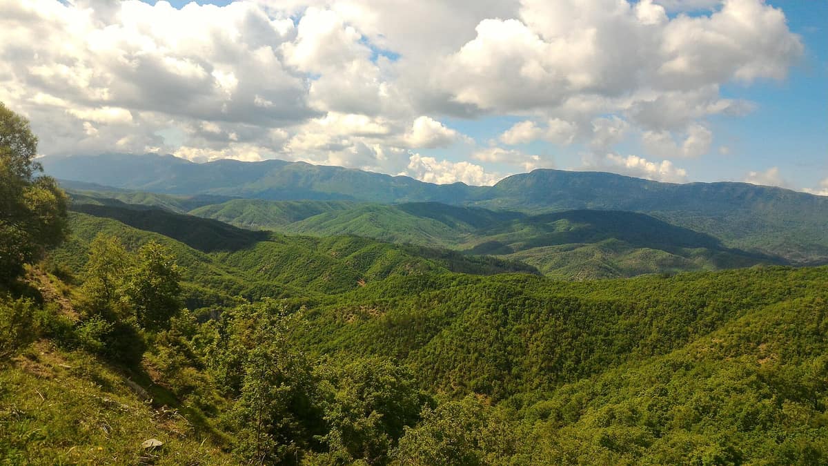
Vikos-Aoös National Park - Pindus Gorges
Vikos–Aoös National Park
Epirus (Ioannina / Zagori / Konitsa) · Greece
Photo: Johnny1337R · CC BY-SA 4.0 · Wikimedia Commons
The Vikos Gorge, recorded by the Guinness Book of Records as the world’s deepest gorge relative to its width (almost 1.000 m of sheer drop).
Imagine standing on an abyss rim peering 900 metres straight down, with the facing rock wall barely 1.100 metres away. At this dramatic point, the Vikos Gorge plunges to its maximum depth, recorded in the Guinness Book of Records as the deepest gorge in the world relative to its width, though local geographers continue to debate the measure. The Vikos-Aoös National Park in Epirus, north of Ioannina, protects this chasm alongside the rugged canyon of the Aoös River and, sandwiched between them, the formidable Mount Tymphe: 12.600 hectares of raging torrents, alpine tarns, caves, and gorges, enclosing a strictly protected core of 3.400 hectares carved out by the Voidomatis over millions of years.
What makes it unique
Two monumental gorges with a jagged mountain massif between them, where the brown bear maintains one of its southern European bastions.
The place
Nature
The landscape
The Vikos Gorge extends for some 12 kilometres through the park's core, cutting a dramatic slice into the limestone massif. The upper 200 metres of the cliff face consist of relatively young Eocene limestone, while the gorge floor is dominated by grey Jurassic dolomite. The Voidomatis River, which flows along the chasm bottom, is largely seasonal, carrying permanent water year-round only in its lower reaches. Rainwater swiftly dissolves the porous karst rock, feeding a subterranean drainage network of labyrinthine caves and conduits; consequently, surface water remains scarce. The park harbours five major vertical shafts, with the Provatina chasm descending to an impressive 407 metres in depth.
The Aoös Gorge, running for 10 kilometres, cuts between Mount Trapezitsa, Mount Tymphe, and Raidovouni, graced by historic single-arch stone bridges built between the seventeenth and nineteenth centuries and isolated cliffside monasteries. Between the two gorges towers the Tymphe massif, crowned by peaks such as Gamila (2.497 m), Astraka (2.436 m), Ploskos (2.400 m), and Lapatos (2.251 m). At 2.000 metres lies Drakolimni, the renowned "Dragon Lake" and largest alpine tarn in the park, hollowed out by retreating glaciers. The alpine newts inhabiting Tymphe's lakes, especially Drakolimni, are deeply woven into mountain legends of fire-breathing dragons.
Wildlife and seasons
In early spring, woodlands, glacial streams, alpine meadows, and cliffs burst into vibrant bloom. The park preserves more than seventeen hundred plant species and subspecies, including five local endemics and nineteen Greek endemics. In the river valleys, oriental planes form dense gallery forests along the banks of the Voidomatis; higher slopes are dominated by Grecian juniper (Juniperus foetidissima), with ancient trees exceeding 10 m in height. For centuries, herbal healers known as "Vikos doctors" harvested these mountain slopes for therapeutic herbs; in Koukouli, a natural history museum displays an extraordinary herbarium of 2.500 dried local medicinal plants.
Among wildlife, the brown bear reigns supreme: the Pindus range marks the southernmost outpost in Europe for both the brown bear and the Eurasian lynx. The woodlands also shelter wild boar, roe deer, wolf, Eurasian otter, and the agile Balkan chamois, which grazes remote ledges far from human paths in side canyons like Megas Lakos.
Look up toward the cliffs. Fifteen raptor species hunt here alongside localized cliff birds such as the hazel grouse and the elusive wallcreeper. The griffon vulture, Egyptian vulture, and peregrine falcon patrol extensive foraging territories across the ravines. The rare meadow viper inhabits subalpine screes and is regarded as highly endangered.
Species
With a page in the atlas
Being mentioned in a source doesn't guarantee sightings: check with the people who manage the area.
Memory and protection
History and conservation
From the seventeenth to the nineteenth centuries, Zagori enjoyed broad autonomous privileges under Ottoman rule, exempting its inhabitants from the crushing taxes imposed across the lowlands.
The national park was established in 1973 to safeguard wildlife between the Vikos and Aoös gorges and Mount Tymphe. Within the core zone, statutory regulations prohibit all forestry, livestock grazing, hunting, and fishing. Under the broader Northern Pindos National Park, the Vikos Gorge and Aoös Gorge constitute, alongside the Valia Calda forest, three core reserves of maximum legal protection where natural processes evolve free of human interference. Modern pressures include slope erosion, landslides, forest wildfires, and the impact of expanding tourism over recent decades.
Before you set off
Visiting
How to visit
Trekking through the Vikos Gorge takes six to seven hours and is rated of medium difficulty; you can also ascend the high trails crossing the summits of Tymphe. The village of Vikos serves as a primary trailhead for the canyon trek, perched directly above the Voidomatis springs with commanding views down the gorge. The scenic viewpoints of Oxya and Beloe, as well as the fifteenth-century Monastery of Agia Paraskevi, provide breathtaking panoramic vistas of the abyss and are reached only on foot.
Four traditional stone villages lie inside the park boundaries, with another nine nestled near its perimeter. Zagori's arched stone bridges provided the sole access to the outside world until modern roads were constructed in the fifties; sixteen of these bridges enjoy formal protection as historical monuments.
Before you go
Entry into the forest is permitted solely along designated roadways, and your stay is restricted to daylight hours between sunrise and sunset. Given the sheer drop-offs and swift currents, you are urged to remain strictly on designated trails and recreational areas. Children under 14 years of age must be accompanied by adults at all times.
All forms of wild camping are prohibited within the park core, and swimming or fishing in the streams of the core zone is strictly forbidden.
Check access, rules and visiting conditions in the official information from the managing body before you set off.
Location
Where it is and how far it reaches
Boundary of Vikos-Aoos · IUCN II · © EEA, CDDA (CC-BY) The coordinate is estimated; it isn't a verified access point.
Transparency
Sources
The research data with its sources, and the official links for this place, are in the Spanish version of this page. See the Spanish version
Around it
There are no immediate neighbours in this atlas. Further away, the Specijalni rezervat prirode Suva Planina shares the Egyptian vulture, chamois, rugged karst terrain, and high mountain wilderness.
If you like this place, elsewhere in Europe
Distant places with uncommon wildlife and habitats in common. The most widespread species don't count. Sharing species doesn't imply a corridor or guaranteed presence.
- Bucegi National Park - Western Slopes
Dâmbovița, Argeș, and Prahova Counties
In common: Alpine newt · Chamois · Brown bear — karst and caves, high mountain
Dramatic conglomerate cliffs rising toward the plateau of the Babele and Sphinx wind-sculpted rock formations.
JFMAMJJASONDJune – October · Crowding low
- Blidinje Nature Park - Čvrsnica Massif
West Herzegovina and Herzegovina-Neretva Cantons (Posušje / Jablanica)
In common: Orsinis viper · Chamois · Brown bear — karst and caves, high mountain
High karst mountains around the glacial Lake Blidinje featuring the iconic natural rock arch of Hajdučka Vrata.
JFMAMJJASONDJune – October · Crowding very low
- Rodna Mountains National Park
Bistrița-Năsăud and Maramureș Counties (Pietrosu Rodnei)
In common: Alpine newt · Chamois · Brown bear — high mountain
The highest glacial mountains in the Eastern Carpathians hosting the Pietrosu Rodnei scientific reserve.
JFMAMJJASONDJune – October · Crowding low
- Monti Sibillini National Park
Marche / Umbria (Visso / Norcia / Castelluccio di Norcia)
In common: Orsinis viper · Brown bear — gorge and canyon, karst and caves, high mountain
The legendary Apennine range of Monte Vettore (2.476 m), the Infernaccio Gorge, and the highland plateaus of Castelluccio.
JFMAMJJASONDMay – October · Crowding moderate
Entry #399 of the original atlas.