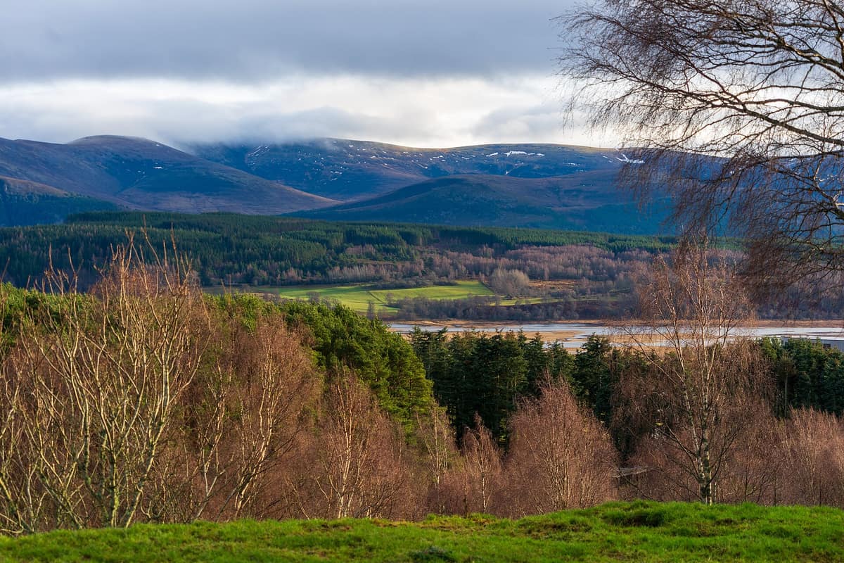
Cairngorms National Park
Scotland (Aviemore / Braemar / Speyside) · United Kingdom
Photo: TXGemGem · CC BY-SA 4.0 · Wikimedia Commons
Britain's largest national park: subarctic plateau, remnants of the ancient Caledonian pine forest, and capercaillie.
From Aviemore on a clear evening, the granite screes of the Lairig Ghru and Braeriach glow a warm, deep amber. That is no accident: the Gaelic name for this massif is Am Monadh Ruadh, "the Red Hills". Those hills form the high core of Cairngorms National Park, the largest in the United Kingdom, encompassing 4,528 km² across five Scottish council areas. It was established in 2003 in north-eastern Scotland, and extended into Perth and Kinross in 2010.
What makes it unique
An Arctic-alpine plateau holding snow patches that endure through summer, fronted below by over half of Scotland's surviving Caledonian pinewoods.
The place
Nature
The landscape
The Cairngorms are not sharp spires but an expansive upland range: three main plateaux situated around 1000–1200 m, above which rise rounded domes—eroded stumps of far taller ancestral mountains—climbing up to roughly 1300 m. Many crests bear weathered granite tors perched atop boulder-fields, while the plateau edges plunge in sheer granite precipices. The plutonic granite of the Cairngorms was emplaced some 427 million years ago, and glaciations over the past 2.5 million years completed the relief through scouring corries and morainic deposits.
On the heights, the environment is Arctic-alpine, closely resembling arctic tundra. There are no glaciers, but snow can fall in any month of the year and semi-permanent snowbeds frequently survive the summer; it is Britain's most reliable winter climbing ground. Between the plateaux cut ancient passes like the Lairig Ghru, summiting at 835 m at the Pools of Dee, where water can remain icy even in midsummer.
Below, the scene changes utterly. Three major salmon rivers rise within the park: the Spey, the Dee, and the Don; the Spey, Scotland's second-longest river, originates in the Monadhliath. Insh Marshes in upper Strathspey represents one of the largest floodplain fen and mire systems in Scotland. In the glens hides the ancient Caledonian forest: the Scots pinewood sweeping from Glen Feshie to Abernethy is its largest unbroken tract.
Wildlife and seasons
May and June belong to the birds. Across the high plateaux breed rock ptarmigan, Eurasian dotterel, snow bunting, and golden eagle. In the ancient woods live western capercaillie, black grouse, Scottish crossbill, and crested tit, while the Abernethy pinewood also shelters red squirrel, Scottish wildcat, red deer, and breeding osprey, alongside traditional capercaillie display leks.
At Insh Marshes, summer brings nesting ospreys and breeding waders; in winter wild Arctic geese arrive alongside up to 200 whooper swans. Mountain hares and red deer share the plateau with Britain's only free-ranging herd of semi-domestic reindeer. Introduced in 1952 by a Swedish Sámi herdsman, the herd today numbers around 150 animals. The entire River Dee is designated a Special Area of Conservation for Atlantic salmon, Eurasian otter, and freshwater pearl mussel.
September is the season of the red deer rut, and shifting seasons govern mountain travel: winter snowdrifts close and reopen high passes, and visitor centres like the Spittal of Glen Muick display daily weather bulletins and winter avalanche forecasts.
Species
With a page in the atlas
Being mentioned in a source doesn't guarantee sightings: check with the people who manage the area.
Memory and protection
History and conservation
It was the second national park established in Scotland, following Loch Lomond and The Trossachs. Today nine National Nature Reserves lie within its bounds: Abernethy, Corrie Fee, Craigellachie, Glen Tanar, Insh Marshes, Muir of Dinnet, Invereshie and Inshriach, Glenmore, and Mar Lodge Estate.
Abernethy encompasses some 4000 ha of woodland, just under half of which is ancient semi-natural Caledonian pinewood. The RSPB is planting 60,000 native aspens, birches, junipers, and sallows across some 590 ha to restore tree-line scrub, and experimentally blasted the crowns of nine pines aged 100 to 200 years to mimic dead wood veterans. In 2015, some 53 km of overhead 132 kV power lines were dismantled in the park's heart. In 2026, a severe wildfire scorched approximately 25 km² in the Glenmore and Abernethy area.
Rewilding projects
Before you set off
Visiting
How to visit
With 55 munros—mountains rising over 3,000 feet—the park is a hillwalker's paradise, yet tackling peaks is never obligatory: over 100 local paths, graded easy, moderate, or strenuous, wind through lower country, many clearly signposted. Two of Scotland's Great Trails cross the park: the Speyside Way and the Cateran Trail. Cycling, gravel biking, and open canoeing are equally popular.
Visitor centres open windows onto the terrain. The Glenmore visitor centre beyond Loch Morlich advises on forest trails. At Loch Garten Nature Centre, nestled in the ancient pine, exhibits interpret the reserve beside wildlife observation hides. In Nethy Bridge, the Abernethy National Nature Reserve centre is operated by community group Explore Abernethy as a gateway to local walks. The Burn O'Vat centre in Muir of Dinnet provides an ideal base for walking around Loch Kinord, while the Glen Doll ranger base interprets the flora and geology of the Angus Glens and serves as trailhead for Corrie Fee and surrounding munros.
Looking upward, Tomintoul and Glenlivet is accredited as one of the world's northernmost Dark Sky Parks.
Before you go
To protect ground-nesting birds and sensitive woodland fauna, follow signposts and keep dogs under close control on leads where requested. Strict park-wide bylaws prohibit open campfires and disposable barbecues, and following the wildfire, the Allt Mor car park and the trail from Allt Mor to Sugarbowl and Utsi's Bridge were closed: verify current status on the park website. The park receives some 2 million visitors annually, and access rights are governed by the Scottish Outdoor Access Code.
To limit summit erosion, the Cairn Gorm Mountain funicular railway strictly confines skiers to the upper slopes in season; non-skiers may only venture beyond the top station on designated guided excursions.
Check access, rules and visiting conditions in the official information from the managing body before you set off.
Location
Where it is and how far it reaches
Boundary of Cairngorms National Park · © OpenStreetMap contributors (ODbL) The coordinate is estimated; it isn't a verified access point.
Transparency
Sources
The research data with its sources, and the official links for this place, are in the Spanish version of this page. See the Spanish version
Around it
Far from the Cairngorms, other arctic-alpine regions share its specialised birdlife. Pallas-Yllästunturi National Park harbours dotterel and ptarmigan identical to the Scottish plateau. Parc Nacional d'Aigüestortes i Estany de Sant Maurici and Totes Gebirge - Karst Desert share rock ptarmigan, western capercaillie, and golden eagle, while Vindelfjällens naturreservat shares rock ptarmigan and golden eagle.
If you like this place, elsewhere in Europe
Distant places with uncommon wildlife and habitats in common. The most widespread species don't count. Sharing species doesn't imply a corridor or guaranteed presence.
- Vindelfjällen Nature Reserve
Västerbotten (Ammarnäs / Tärnaby)
In common: Charadrius morinellus · Rock ptarmigan · Osprey — high mountain, old-growth forest, wetland, river corridor
One of the largest nature reserves in Europe: high-alpine massifs, birch valleys, and the free-flowing Vindel River running wild to the Baltic.
JFMAMJJASONDMarch – April · June – September · Crowding very low
- Pallas-Yllästunturi National Park
Finnish Lapland (Enontekiö / Kittilä / Kolari / Muonio)
In common: Charadrius morinellus · Rock ptarmigan — high mountain, primary forest, wetland
Finland's most visited national park (1.020 km²), a chain of tundra fell hills (tunturi) hosting the cleanest air measuring station on Earth (Sammaltunturi).
JFMAMJJASONDJune – September · December – April · Crowding moderate
- Dachstein Nature Reserve — Gosau, Hallstatt and Obertraun
Upper Austria — Gmunden; Gosau, Hallstatt and Obertraun
In common: Rock ptarmigan · Western capercaillie · Golden eagle — high mountain, old-growth forest
Karst topography, glaciers, alpine meadows and old-growth mountain forests above the Gosau lakes.
JFMAMJJASONDMarch – November · Crowding no data
- Aigüestortes and Lake Saint Maurici National Park
Catalonia (Lleida)
In common: Rock ptarmigan · Western capercaillie · Golden eagle — high mountain, old-growth forest
The only National Park in Catalonia, a glacial circus wonderland harboring over 200 tarns (estanys) beneath the iconic twin summits of Els Encantats.
JFMAMJJASONDJune – October · Crowding moderate
Entry #1005 of the original atlas.