Hossa National Park
Hossan kansallispuisto
Finland (Suomussalmi — Kainuu) · Finland
Photo: Skoolari · CC0 · Wikimedia Commons
Clear lakes and rivers woven between glacial esker ridges and taiga pine forests, featuring rock art on the shores of Lake Somerjärvi.
Long before maps existed, people were already painting in Hossa. On a sheer rock wall rising out of Lake Somerjärvi in present-day Kainuu, Stone Age hunter-gatherers created hunting scenes and shamanic rituals some 3,500 to 4,500 years ago, depicting human figures bearing antlers on their heads. Surrounding it extends a national park of narrow gravel ridges, crystal-clear lakes, and rugged pine forests: Hossa National Park, covering 111 km², established in 2017 to celebrate the centenary of Finland's independence.
What makes it unique
Within a single park lies a Stone Age art gallery, the northernmost rock painting in Finland, and a lake canyon barely ten metres wide.
The place
Nature
The landscape
Hossa sits at the meeting point of three major watercourses, which explains its abundance of flowing streams and more than a hundred lakes and kettle ponds. Glacial eskers—lofty gravel ridges formed by meltwater torrents—and kettle holes from the Ice Age define the landscape: many ponds, like Lake Öllöri, were gouged this way, their bottoms fed by subaquatic springs filtering pure groundwater out of the ridges. The waters are naturally nutrient-poor and crystal clear, except for the dark, peat-stained waters of the bogs.
The bedrock has also left its dramatic imprint. The canyon of Julma-Ölkky is a tectonic fracture rift valley formed over hundreds of millions of years: its canyon lake stretches around three kilometres long, measures barely ten metres across at its narrowest choke point, and reaches 50 m deep, with rock walls towering another 50 m sheer above the dark water. In its northern reaches, Pirunkirkko—the Devil's Church—is a gaping rock cave where, according to local folklore, a wise shaman cast powerful spells.
The forests consist mainly of Scots pine growing on rugged slopes, with Norway spruce clothing the higher ridges, punctuated by numerous small mires and peat bogs.
Wildlife and seasons
Hossa is best experienced from the water rather than the mountain crests. The gravel and cobble river beds provide essential spawning grounds for grayling and brown trout in the foaming rapids. At Huosivirta, a swift current that never freezes even in the depths of subarctic winter, the white-throated dipper is a regular winter visitor, creating enchanting photography opportunities amidst the frost-fogged waters. The small forest brooks, natural seepage springs, and spring-fed fens remain little explored and may shelter rare mosses and benthic invertebrates.
The seasons govern access. In summer, the sandy beaches of Kokalmus offer wonderful wilderness photography with late evening light and morning mist. In winter, footpaths remain unmaintained and designated winter trails open; from January through late April, a 6 km wilderness track leads visitors to Värikallio on snowshoes, cross-country skis, fatbikes, or on foot.
Species
With a page in the atlas
Being mentioned in a source doesn't guarantee sightings: check with the people who manage the area.
Memory and protection
History and conservation
Hossa is traditional Sámi hunting and fishing territory, where the oldest dwelling sites date back nearly 10,000 years. Until the early 1950s, natural water meadows were cut for hay, leaving behind historic log hay barns. Reindeer husbandry began in the sixteenth century when only the Sámi lived here, followed by commercial logging and timber floating in the early twentieth century. At Lounatkoski, by the park's most torrential rapids, a historic water mill still stands operational.
Beside the Keihäslampi pond stands Papinpetäjä—the Priest's Pine—carved with memorial dates, the oldest legible being 1750. The park protects fragile boreal biodiversity, glacial esker geology, and a mosaic of small waters that recount ten millennia of human coexistence with northern nature.
Before you set off
Visiting
How to visit
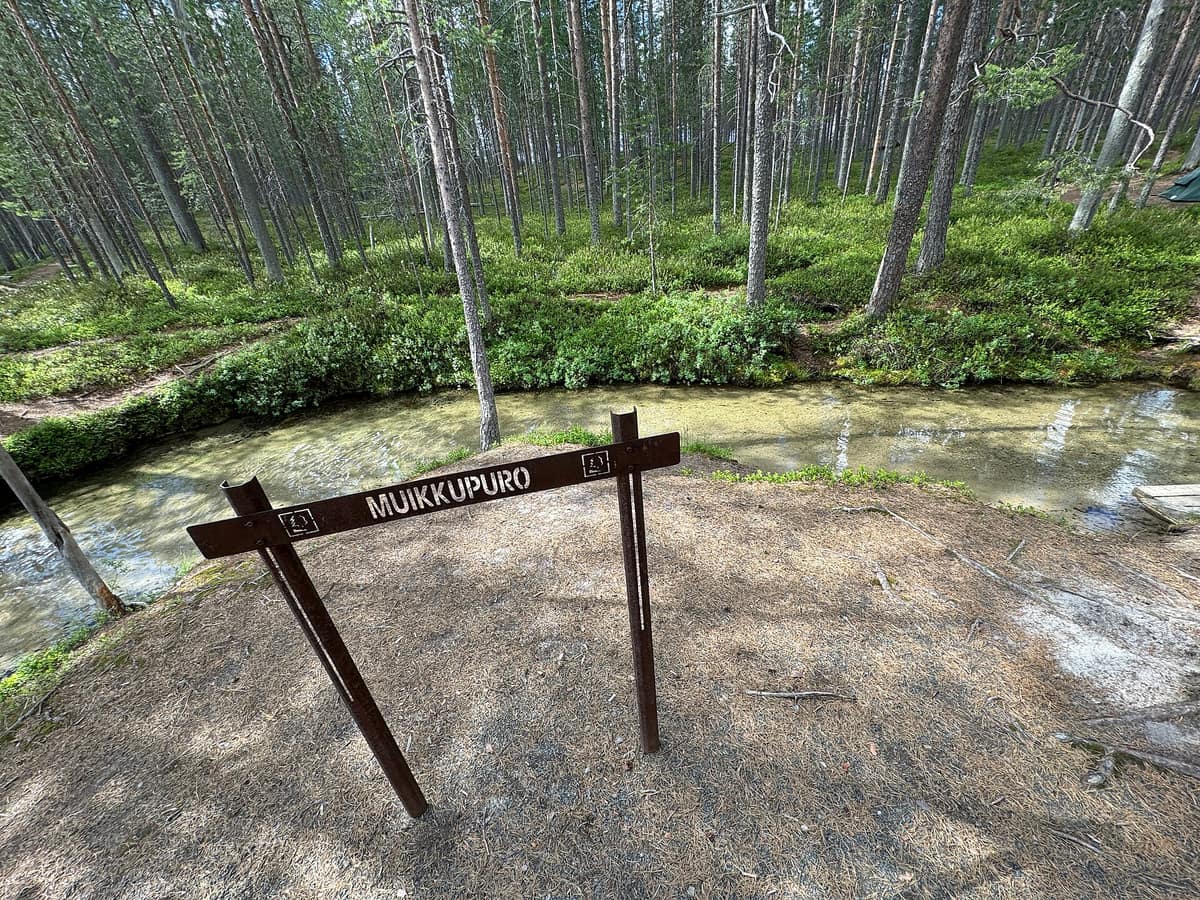
Around 90 km of well-marked trails, most of them graded easy, traverse the eskers and skirt the shores, allowing hikers to link loops and connector paths into multi-day treks. Accessible paths equipped for mobility devices are available at Huosilampi, Lihapyörre, and Muikkupuro—a crystal-clear stream between lakes Iso-Valkeainen and Keski-Valkeainen featuring an accessible boardwalk all the way to a shelter.
The crown jewel of any visit is Värikallio. In summer, you reach it along an 8-kilometre hiking trail from the Lihapyörre parking area, where a suspended steel walkway brings you directly in front of the painted cliff face. Visiting is free, open year-round, and unstaffed. The 61 figures on the rock face depict horned human figures and wildlife, with no boats depicted although they were painted from watercraft or winter ice.
The visitor centre, alongside the original state hiking area established in 1979, opened in 1991. Julma-Ölkky canyon is best explored by excursion boat: its small rock painting showing two human figures and an elk or deer is the northernmost in Finland and can only be seen from the water or winter lake ice.
Before you go
Dogs must be kept on a leash at all times. Camp only at designated camping sites, lean-to shelters, and wilderness huts; open fires are permitted exclusively in official campfire rings and strictly prohibited during forest fire warnings. There are no refuse containers: take all waste away with you. Picking edible wild berries and mushrooms is permitted, but do not disturb other flora. In snow-free seasons, mountain bikes must remain on designated cycling tracks.
Check access, rules and visiting conditions in the official information from the managing body before you set off.
Location
Where it is and how far it reaches
Boundary of Hossan kansallispuisto · © EEA, CDDA (CC-BY) The coordinate is estimated; it isn't a verified access point.
Transparency
Sources
The research data with its sources, and the official links for this place, are in the Spanish version of this page. See the Spanish version
Around it
Hossa shares northern taiga wildlife, including wolverines and reindeer, with Urho Kekkonen National Park, Vindelfjällen Nature Reserve, Femundsmarka National Park, and Jotunheimen National Park - Home of the Giants.
If you like this place, elsewhere in Europe
Distant places with uncommon wildlife and habitats in common. The most widespread species don't count. Sharing species doesn't imply a corridor or guaranteed presence.
- Urho Kekkonen National Park
Finnish Lapland (Saariselkä / Inari / Sodankylä)
In common: Wolverine · Caribou · Brown bear — wetland
Finland’s second largest national park (2.550 km²), rounded arctic tundra fell-tops (tunturi), and wild trekking under the shadow of Sokosti (718 m).
JFMAMJJASONDJune – April · Crowding low
- Vindelfjällen Nature Reserve
Västerbotten (Ammarnäs / Tärnaby)
In common: Wolverine · Caribou · Brown bear — old-growth forest, river corridor, wetland
One of the largest nature reserves in Europe: high-alpine massifs, birch valleys, and the free-flowing Vindel River running wild to the Baltic.
JFMAMJJASONDMarch – April · June – September · Crowding very low
- Jotunheimen National Park - Home of the Giants
Innlandet / Vestland (Lom / Gjendesheim / Øvre Årdal)
In common: Wolverine · Caribou — lake
The 'Home of the Giants' in Norse mythology, harboring Scandinavia's two highest peaks (Galdhøpiggen 2 469 m and Glittertind) and the legendary Besseggen ridge.
JFMAMJJASONDJune – September · Crowding moderate
- Femundsmarka National Park
Trøndelag and Innlandet Counties (Border with Sweden)
In common: Wolverine · Brown bear · Grey wolf — old-growth forest, lake
A vast Arctic-alpine wilderness of boulder fields, ancient Scots pine forest, and an intricate labyrinth of canoeing lakes.
JFMAMJJASONDFebruary – March · July – September · Crowding very low
Entry #1032 of the original atlas.