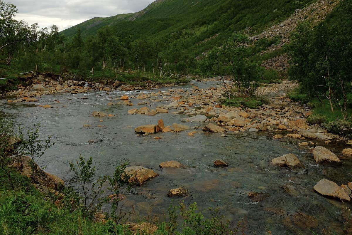
Junkerdal National Park
Nordland (Saltdal / Fauske / Junkerdal) · Norway
Photo: Frankemann · CC BY-SA 4.0 · Wikimedia Commons
Renowned internationally for harboring one of the richest arctic-alpine and karst floras in the entire Arctic, thanks to its soft limestone bedrock.
Junkerdal lies in the rain shadow east of Svartisen, and that geographical quirk shifts everything. Here the summer is pleasantly warm and continental, which over lime-rich mica schists translates into a botanical explosion. Flowers abound in exceptional profusion and rarity: multiple high-arctic species reach their southernmost planetary limit on these slopes. The national park, encompassing some 682 km² between Sulitjelma and Junkerdal in the municipalities of Saltdal and Fauske, is in essence a wild botanical alpine garden bordering Sweden.
What makes it unique
Limestone, dry summers, and rain-shadow climate have made Junkerdal the southern terminus for several rare arctic plant species.
The place
Nature
The landscape
The landscape was chiseled by the Ice Age. To the north spread rolling upland plateaus studded with lakes, the largest being Lake Balvatnet; in the central sector, tabular massifs open wide around the basin, with the razor crest of Solvågtinden rising as an unmistakable landmark. To the south, the terrain assumes an interior character of broad U-shaped troughs and massive granite-and-gneiss summits. The entire complex forms part of one of Northern Europe's largest roadless, intact wilderness areas.
Bedrock explains the plant life. Friable limestone, sunny rain-shadow climate, and dry summers nurture diverse floral communities, with selected massifs presenting extraordinarily long rosters of arctic and alpine specialists. Among the jewels is the white Arctic mountain-heather (Cassiope tetragona), while the white mountain saxifrage (Saxifraga paniculata) occurs in only three areas in Norway, reaching its widest distribution in Junkerdal. Northern sedge, Tromsø poppy, cushion whitlow-grass, black-headed fleabane, and alpine arnica all reach their southern distribution frontier here. For that reason, botanical reserves were designated in eastern sectors as early as 1928, expanded in 1935.
Wildlife and seasons
This is established predator territory: the wolverine and Eurasian lynx maintain stable resident populations, while brown bears make seasonal appearances. Moose and semi-domestic reindeer are common across the valleys, with reindeer grazing the fells year-round.
Avian life offers another compelling motive to explore. Rare Norwegian breeders include the gyrfalcon, golden eagle, red-throated loon, common loon, and long-tailed duck. Known breeding sites of the booted eagle have been documented, and Junkerdal is an essential breeding haven for waterfowl, waders, raptors, and passerines. Notable diurnal arctic butterflies also occur, such as the northern blue and alpine sulphur. Complex palsa bogs, meltwater tarns, and fen complexes sustain diverse invertebrate and shorebird assemblages.
Species
With a page in the atlas
Being mentioned in a source doesn't guarantee sightings: check with the people who manage the area.
Memory and protection
History and conservation
Junkerdal is fundamentally a living Sami cultural landscape: reindeer husbandry has been practiced continuously since the sixteenth or seventeenth century, leaving traces of traditional seasonal camps, turf huts (goahti), hunting blinds, pitfalls, and hearths, along with ruins of permanent Sami homesteads along the upper tree line. Evidence also endures of alpine haymaking, traditional lake fishing, trapping, historical forestry, and mineral prospecting. Legend attributes the valley's name to Danish nobleman Preben von Ahnen, «the junker», who traversed the valley in 1658 to attack and raze the Swedish silver mine at Nasa.
The national park was formally protected on 9 January 2004, designed to safeguard a vast wilderness ensuring biodiversity, geodiversity, and cultural heritage, with top priority given to its unique flora. It operates under a 2008 management plan alongside an updated visitor strategy. Botanist Søren Christian Sommerfelt, vicar of Saltdal during the 1820s, was the first scientist to document this alpine flora.
Before you set off
Visiting
How to visit
The historic Nordlandsruta trail traverses the park along well-marked DNT footpaths, serviced by serviced and self-service cabins inside and adjacent to the park, the most renowned being Argaladhytta; four large tourist lodges and multiple unstaffed shelters operate within the boundary. North of the park lies Jakobsbakken, a former copper-mining settlement whose historic buildings dating from the early twentieth century evoke its mining past.
To begin with orientation, the Nordland National Park Center (Besøkssenter nasjonalpark Nordland) in Storjord (Saltdal) serves as the main gateway to Nordland's national parks. Featuring the permanent exhibition «Uerstattelig» (Irreplaceable) on regional ecology, fauna, and culture, it opened in 2005 and hosts outdoor interpretive activities on its grounds. Authorized by the Norwegian Environment Agency, it oversees five national parks, positioned strategically between Saltfjellet-Svartisen and Junkerdal.
Before you go
Reindeer represent an active cultural and pastoral livelihood: park authorities ask hikers not to approach herds actively and to show utmost consideration. Hiking cabins line marked routes, but check their status and mountain conditions before setting out.
Check access, rules and visiting conditions in the official information from the managing body before you set off.
Location
Where it is and how far it reaches
Boundary of Junkerdal · IUCN II · © EEA, CDDA (CC-BY) The coordinate is estimated; it isn't a verified access point.
Transparency
Sources
The research data with its sources, and the official links for this place, are in the Spanish version of this page. See the Spanish version
Around it
Saltfjellet-Svartisen National Park lies roughly eight kilometres away, Padjelanta National Park about twenty-one kilometres, and Rago National Park roughly twenty-nine kilometres distant. Further south, Jotunheimen National Park shares with Junkerdal wolverines and golden eagles soaring over high-altitude fell terrain.
What else to explore nearby
Approximate straight-line distance between the edges of each area. It doesn't indicate access, routes or driving times.
- Saltfjellet-Svartisen National Park
Nordland (Rana / Saltdal / Beiarn / Meløy)
About 8 km away
Gigantic coastal glaciers cascading from the Svartisen ice cap nearly to fjord level, across Saltfjellet alpine plateaus on the Arctic Circle.
JFMAMJJASONDJuly – September · Crowding very low
- Padjelanta National Park
Swedish Lapland / Norrbotten (Jokkmokk / Kvikkjokk)
About 21 km away
Sweden's largest national park (198.000 ha), featuring vast alpine lakes Vastenjaure and Virihaure and ancestral Sami grazing lands.
JFMAMJJASONDJuly – September · Crowding very low
- Rago National Park
Nordland (Sørfold / Nordfold)
About 29 km away
An extremely dramatic bare-granite alpine canyon adjoining Padjelanta and Sarek in Sweden, forming a wild transboundary complex of 7,400 km².
JFMAMJJASONDJuly – September · Crowding very low
If you like this place, elsewhere in Europe
Distant places with uncommon wildlife and habitats in common. The most widespread species don't count. Sharing species doesn't imply a corridor or guaranteed presence.
- Jotunheimen National Park - Home of the Giants
Innlandet / Vestland (Lom / Gjendesheim / Øvre Årdal)
In common: Wolverine · Golden eagle — high mountain
The 'Home of the Giants' in Norse mythology, harboring Scandinavia's two highest peaks (Galdhøpiggen 2 469 m and Glittertind) and the legendary Besseggen ridge.
JFMAMJJASONDJune – September · Crowding moderate
- Urho Kekkonen National Park
Finnish Lapland (Saariselkä / Inari / Sodankylä)
In common: Wolverine · Golden eagle — high mountain
Finland’s second largest national park (2.550 km²), rounded arctic tundra fell-tops (tunturi), and wild trekking under the shadow of Sokosti (718 m).
JFMAMJJASONDJune – April · Crowding low
Entry #586 of the original atlas.