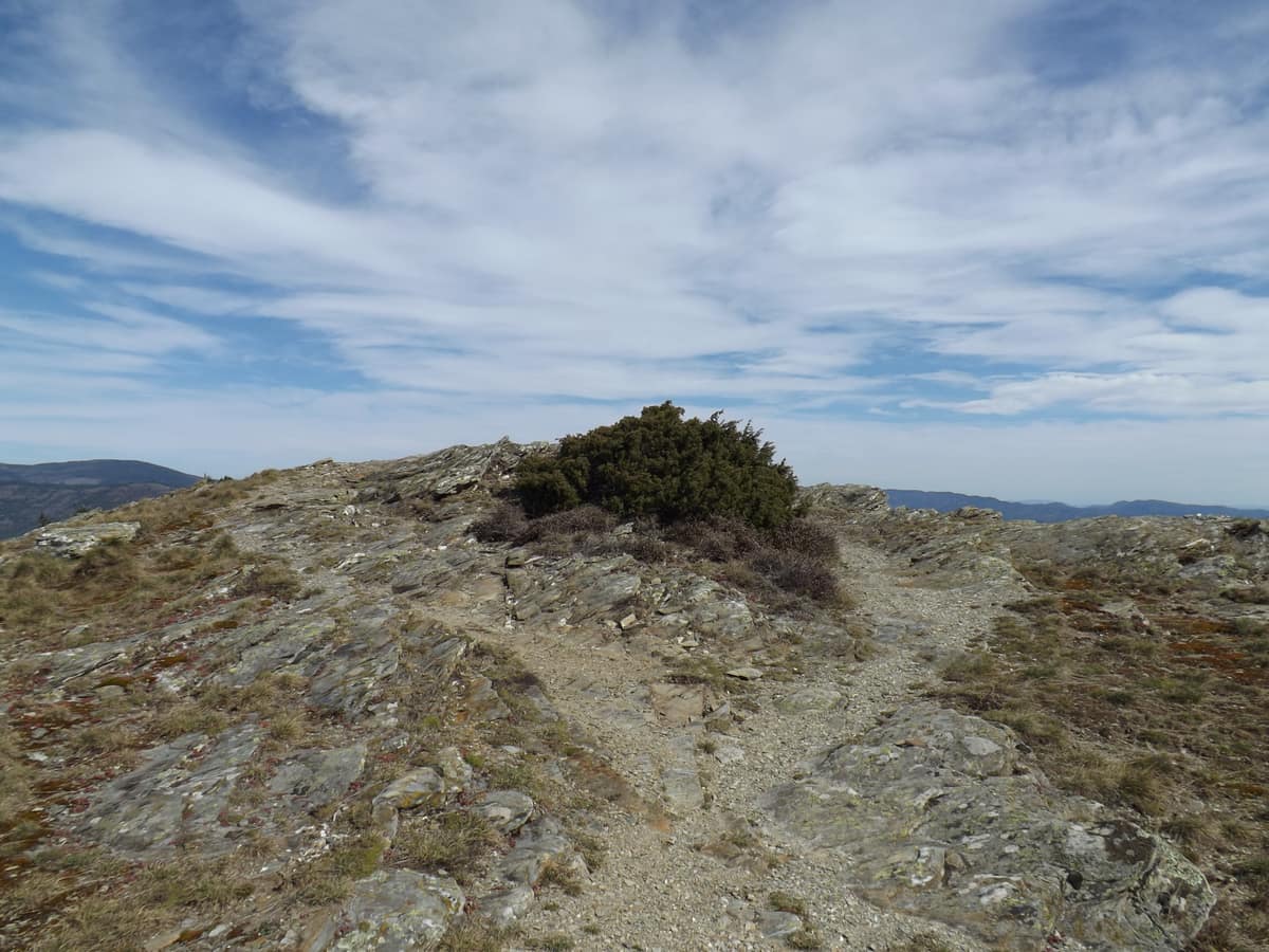
Cévennes National Park
Parc national des Cévennes
Occitania (Lozère / Gard — Florac / Mont Lozère / Mont Aigoual) · France
Photo: Fotelise22 · CC BY-SA 4.0 · Wikimedia Commons
Limestone plateaus (causses), granite uplands and chestnut valleys with reintroduced vultures: a pastoral landscape protected as an inhabited national park.
In 1879, a Scotsman with a donkey took twelve days to cross the Lozère: 195 km. Robert Louis Stevenson told the story in «Travels with a Donkey in the Cévennes», and his route is today the GR70. The Cévennes National Park, created by decree on 2 September 1970 as the fourth French national park after the Vanoise, Port-Cros and the Western Pyrenees, is the only mid-mountain park in the country and the only one in metropolitan France whose core has permanent residents, mostly farmers. Here nature and people care for the landscape together, and the headquarters is in the castle of Florac.
What makes it unique
The national park where residents live and work, so the terraces, chestnut groves and gorges are both nature and human work, under the largest International Dark Sky Reserve in Europe.
The place
Nature
The landscape
The park is a mid-mountain territory with four units: the Aigoual massif, the Causse Méjean with the Tarn and Jonte gorges, Mont Lozère and the Cévennes valleys. To the west stretch the Grands Causses, limestone plateaus; to the east, the schistose Cévennes valleys, cut into steep slopes; to the north, the granite Mont Lozère. The granites, more resistant to erosion, form the highest summits; the Aigoual and Mont Lozère are about 300 million years old. The altitude ranges from 117 m at Anduze to 1,699 m at Finiels, the summit of Lozère, and the vegetation shifts from the meso-Mediterranean floor in the south-western gorges to the subalpine at the top of Lozère. The Tarn and Jonte gorges have «serrated» cliffs falling 500 or 600 m in near-vertical walls.
Water and sky do the rest. Rainfall ranges from about 1,100 mm at Alès to more than 2,000 mm on Mont Lozère, nearly 1,000 mm of difference in a span of roughly thirty kilometres. In what are called Cévennes episodes, torrential rain falls in highly localised thunderstorms, as cold Atlantic air collides with warm Mediterranean air. The park straddles the Garonne basin, towards the Atlantic, and those of the Rhône and other small rivers, towards the Mediterranean. Forest covers more than 70 % of the territory, and coppiced chestnut groves from old orchards are the emblem of the landscape.
Wildlife and seasons
There are about 70 mammals, 195 birds (135 breeding), 16 amphibians, 15 reptiles and 23 fish. But the scene of the year comes at the beginning of autumn. In mid-September, as night falls, a hoarse roar resounds in the forests: the rut of the red deer. The park has numerous rutting sites, September and October are the prime season, and the calls are usually most intense at dawn and dusk. The rut is heard more than seen, so stay on authorised tracks and paths, use no light sources, bring binoculars and position yourself downwind. September and October are also hunting season: check that the place you are heading to has no driven hunt.
In the gorges live three vultures: the griffon vulture, the black vulture and the Egyptian vulture, reintroduced since 1980 by the park with the LPO. They breed happily in the lower reaches of the Jonte gorge, near Le Rozier, where the «Maison des vautours» allows close viewing from a lookout. And in the forests, the greater noctule bat, the largest in Europe, has gone from «suspected» in a single massif to being known in three populations, mostly males, sleeping in old hollow trees, especially the cavities excavated by the black woodpecker in beeches.
Species
With a page in the atlas
Being mentioned in a source doesn't guarantee sightings: check with the people who manage the area.
Memory and protection
History and conservation
The Cévennes were the cradle of the Camisard uprising after the revocation of the Edict of Nantes, and the Rouve Bas, in Saint-André-de-Lancize, has a permanent exhibition dedicated to them. The park was born of a pact with residents: the Mazerot contracts paid farmers to maintain dry-stone walls, terraces and irrigation channels, to prevent depopulation. The core is governed by specific regulations set by decree 2009-1677, demarcated by panels on roads and paths and a green band on IGN maps.
Rewilding projects
Before you set off
Visiting
How to visit
The park has about 5,000 km of marked trails: nearly 300 loop routes of half a day or less, averaging 8.5 km, and 43 short, accessible discovery trails for all the family. There are also 62 mountain-bike circuits at all levels, and some 500 km of tracks around the Aigoual and Florac-Sud Lozère. For long-distance routes, the GR trails start with the Stevenson Way.
Most trails cross private land, so stay on the marked paths. And a specific request: trekking poles degrade the soil; use rubber tips or poles without metal points.
For orientation, the maisons du tourisme et du Parc combine park visitor services and tourist office, with advice on discovery trails, museums and outings; they have permanent displays at Florac and at La Serreyrède on the Aigoual. And look up: the park received the International Dark Sky Reserve label on 13 August 2018, the largest in Europe, and the Milky Way is visible to the naked eye, something impossible for more than a third of the world's population.
Before you go
The road network is winding and narrow, so measure distances in time, not kilometres. Some passes and roads close in winter, and the park recommends the car for getting around.
Check access, rules and visiting conditions in the official information from the managing body before you set off.
Location
Where it is and how far it reaches
Boundary of Cévennes · © EEA, CDDA (CC-BY) The coordinate is estimated; it isn't a verified access point.
Transparency
Sources
The research data with its sources, and the official links for this place, are in the Spanish version of this page. See the Spanish version
Around it
Within the park itself, the Gorges du Tarn are 0 km away and the Gorges de la Jonte are 3 km away. Further afield, the park shares vultures with the Ports Natural Park, the Verdon Regional Nature Park, Monfragüe and the Dadia-Lefkimi-Soufli Forest National Park.
What else to explore nearby
Approximate straight-line distance between the edges of each area. It doesn't indicate access, routes or driving times.
- Tarn Gorges
Occitania (Lozère / Aveyron)
Borders this area
Spectacular limestone canyon 500 m deep carved by the Tarn between the karstic plateaus of the Causses.
JFMAMJJASONDMay – October · Crowding moderate
If you like this place, elsewhere in Europe
Distant places with uncommon wildlife and habitats in common. The most widespread species don't count. Sharing species doesn't imply a corridor or guaranteed presence.
- Els Ports Natural Park
Catalonia / Aragon / Valencian Community (Tarragona / Teruel / Castellón / Roquetes / Tortosa)
In common: Cinereous vulture · Griffon vulture · Eurasian otter — old-growth forest, gorge and canyon, karst and caves
A rugged karst massif between Catalonia, Aragon, and the Valencian Community featuring limestone cliffs, southern beech groves, and the Iberian ibex.
JFMAMJJASONDApril – June · September – November · Crowding low
- Verdon Regional Natural Park - Grand Canyon
Alpes-de-Haute-Provence / Var (Castellane / Moustiers-Sainte-Marie)
In common: Cinereous vulture · Griffon vulture — gorge and canyon, karst and caves
The 'Grand Canyon of Europe', sheer limestone cliffs plunging 700 m carved out by the turquoise waters of the Verdon River.
JFMAMJJASONDApril – June · September – October · Crowding moderate
- Monfragüe National Park
Extremadura (Cáceres / Villarreal de San Carlos / Torrejón el Rubio)
In common: Cinereous vulture · Griffon vulture — old-growth forest, gorge and canyon
The European mecca for raptor watching, holding the largest cinereous vulture (Aegypius monachus) colony in the world and the dramatic Tagus breach at Salto del Gitano.
JFMAMJJASONDMarch – May · October – November · Crowding low
Entry #1016 of the original atlas.