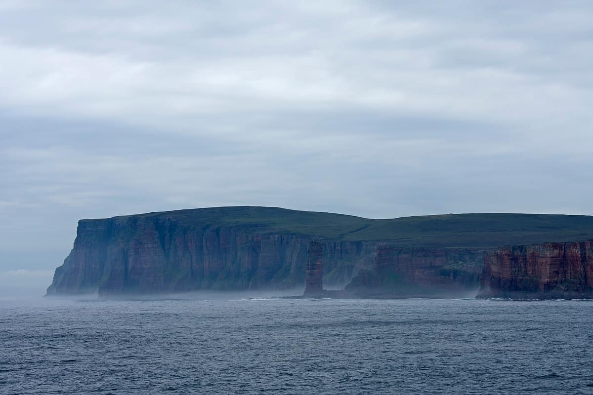
Isle of Hoy and the Old Man of Hoy
Hoy - Old Man of Hoy
Scotland (Orkney Islands / Stromness) · United Kingdom
Photo: Ymblanter · CC BY-SA 4.0 · Wikimedia Commons
The world's most famous sea stack (137 m of red sandstone standing isolated from the sea cliffs) on the wild and dramatic Isle of Hoy.
The Old Man of Hoy was not always a lone pillar. In 1819 it was already separated from the main island, and contemporary sketches depict it resting on a twin-legged arch that gave the stack its name; subsequently a ferocious storm swept away one leg, leaving the 137 m red sandstone monolith you see today. Reaching it means traversing Hoy, Orkney's high island of heather moorland, peat bogs, and towering sea cliffs. The RSPB nature reserve protects precisely this wild tapestry and the seabirds nesting along its precipices.
What makes it unique
A 137 m sandstone sea stack carved away from the island's coast by the sea only a few centuries ago.
The place
Nature
The landscape
Hoy is the highest, wildest, and wettest island in Orkney, soaked by some 1,500 mm of annual rainfall. Its summit, Ward Hill at 481 metres, is the highest point in the entire archipelago. The name stems from Old Norse Háey, meaning "high island". Glacial ice scoured the resistant sandstone strata into the dramatic hills and valleys visible today.
The Old Man rises beside Rackwick Bay on the western coast, forming a red sandstone pillar rooted upon a basaltic plinth, separated from the cliff edge by a 60-metre chasm. Alternating beds of soft sandstone and pebbles with harder slabs of Old Red Sandstone give its sheer flanks their stepped and notched profile. Formed by coastal cliff collapse sometime after 1750, the stack is only a few centuries old at most and may eventually collapse into the sea.
Nearby towers St John's Head, boasting the highest vertical sea cliffs in the United Kingdom, alongside the imposing mass of Bre Brough. In slanted afternoon light, the sandstone cliffs glow in shades of pink, orange, yellow, and purple.
Rackwick beach features golden sand and colossal rounded boulders under pink cliffs. In the sheltered valley, Berriedale preserves an ancient native woodland, among the northernmost in the British Isles.
Wildlife and seasons
In June, the calls of thousands of northern fulmars, common guillemots, razorbills, and puffins reverberate between the Old Man and St John's Head.
Inland, the RSPB manages a mosaic of blanket bog, dry heath, and wet moorland where white-tailed eagles, hen harriers, merlins, and red-throated divers nest. Wardens monitor their breeding success every year. The divers nest along the quiet moorland lochans of Sui Fea and take fright easily: in spring and early summer, skirt these pools via the northern slopes.
Around Cuilags you can spot mountain hares, brown in spring and summer and turning white in winter. This coat makes them easy prey for golden eagles and white-tailed eagles that have reclaimed the skies of Hoy. Protected flora includes great sundew, alpine bearberry, fragrant orchid, and dwarf cornel. Great skuas and northern wheatears also breed across the reserve.
Species
With a page in the atlas
Being mentioned in a source doesn't guarantee sightings: check with the people who manage the area.
Memory and protection
History and conservation
In 1966 Chris Bonington, Rusty Baillie, and Tom Patey completed the first ascent of the sea stack. A celebrated climb in July 1967 was broadcast live by the BBC, captivating around 15 million television viewers. The island forms part of the Hoy and West Mainland National Scenic Area, one of 40 across Scotland.
Since the RSPB acquired the Berriedale estate, grazing sheep have been excluded from the glen, allowing native trees such as rowan and birch to regenerate naturally along the valley slopes.
Before you set off
Visiting
How to visit
The trail from Rackwick to the Old Man is the gentler option and well-signposted: it sets off from the hamlet of Rackwick. Walkers can loop back from Rackwick to Moaness along the glen, a hike of about two hours on foot.
The grander alternative is the demanding Cuilags, Old Man, and Rackwick traverse: 21 km, grade five, taking around eight hours. It begins with the passenger ferry crossing from Stromness to Moaness pier, and is intended strictly for experienced hillwalkers: pathless, exposed moorland terrain with little or no mobile phone reception. It crosses the crest of Cuilags, Sui Fea, and St John's Head. Near Rackwick there is a small local museum and visitor point.
Before hiking, the Hoy Kirk and Heritage Centre, open daily, offers insights into island heritage and flora and fauna guides. North of Rackwick glen lies the Dwarfie Stane, a rock-cut tomb dating back to around 3000 BC. On Enegars you can see wreckage of a Royal Navy Corsair: Hoy holds four World War II aircraft crash sites.
Before you go
Keep dogs on a short lead between 1 April and 15 August to protect ground-nesting birds. Barbecues and open fires are strictly prohibited throughout the reserve due to peat fire hazard. Maintain a safe distance from cliff edges: the sandstone rock is crumbly and unstable. Long hikes require competent map navigation and mountain gear. Parking is available at the Dwarfie Stone and Rackwick beach, both situated outside the RSPB reserve boundary.
Check access, rules and visiting conditions in the official information from the managing body before you set off.
Location
Where it is and how far it reaches
Boundary of Hoy · © OpenStreetMap contributors (ODbL) The coordinate is estimated; it isn't a verified access point.
Transparency
Sources
The research data with its sources, and the official links for this place, are in the Spanish version of this page. See the Spanish version
Around it
Around 19 km to the north lies the Marwick Head Nature Reserve. Further afield, nesting fulmars link Hoy with the Kalsoy Island and Kallur Lighthouse, the St Kilda Archipelago, the Hornstrandir Nature Reserve, and Lundy Island.
What else to explore nearby
Approximate straight-line distance between the edges of each area. It doesn't indicate access, routes or driving times.
- The Flow Country — Caithness and Sutherland Peatlands
Scotland (Caithness and Sutherland — Forsinard)
About 19 km away
Europe's largest blanket bog expanse, World Heritage site since 2024: an intricate expanse of pool complexes and sphagnum moss locking up carbon since the last Ice Age.
JFMAMJJASONDMay – July · Crowding none
If you like this place, elsewhere in Europe
Distant places with uncommon wildlife and habitats in common. The most widespread species don't count. Sharing species doesn't imply a corridor or guaranteed presence.
- Kalsoy Island and Kallur Lighthouse
Faroe Islands (Trøllanes / Mikladalur)
In common: Northern fulmar — wild coast, high mountain, marine
Narrow flute-shaped island 18 km long with 13 mountain peaks and the iconic Kallur Lighthouse perched above 200 m sea cliffs.
JFMAMJJASONDMay – September · Crowding low
- St Kilda Archipelago - Hirta and Dùn
Scotland (Outer Hebrides / Hirta)
In common: Northern fulmar — wild coast, high mountain, marine
The only Dual (Cultural and Natural) UNESCO World Heritage Site in the UK, with sheer sea cliffs and sea stacks hosting the world's largest gannet colony (Stac an Armin 196 m).
JFMAMJJASONDJune – August · Crowding very low
- Hornstrandir Nature Reserve
Westfjords (Ísafjörður)
In common: Northern fulmar — wild coast, high mountain
An arctic peninsula abandoned in the fifties, without roads, where the arctic fox lives without hunting and without fear.
JFMAMJJASONDJune – August · Crowding none
- Lundy Island
England (Devon / Bristol Channel / Ilfracombe)
In common: Northern fulmar — wild coast, marine
Granite plateau 5 km in length in the Bristol Channel, the first designated Marine Conservation Zone in the United Kingdom.
JFMAMJJASONDMay – September · Crowding low
Entry #613 of the original atlas.