Kornati National Park
Nacionalni park Kornati
Šibenik-Knin (Kornati Archipelago — Murter) · Croatia
Photo: Ivan25 · CC BY-SA 4.0 · Wikimedia Commons
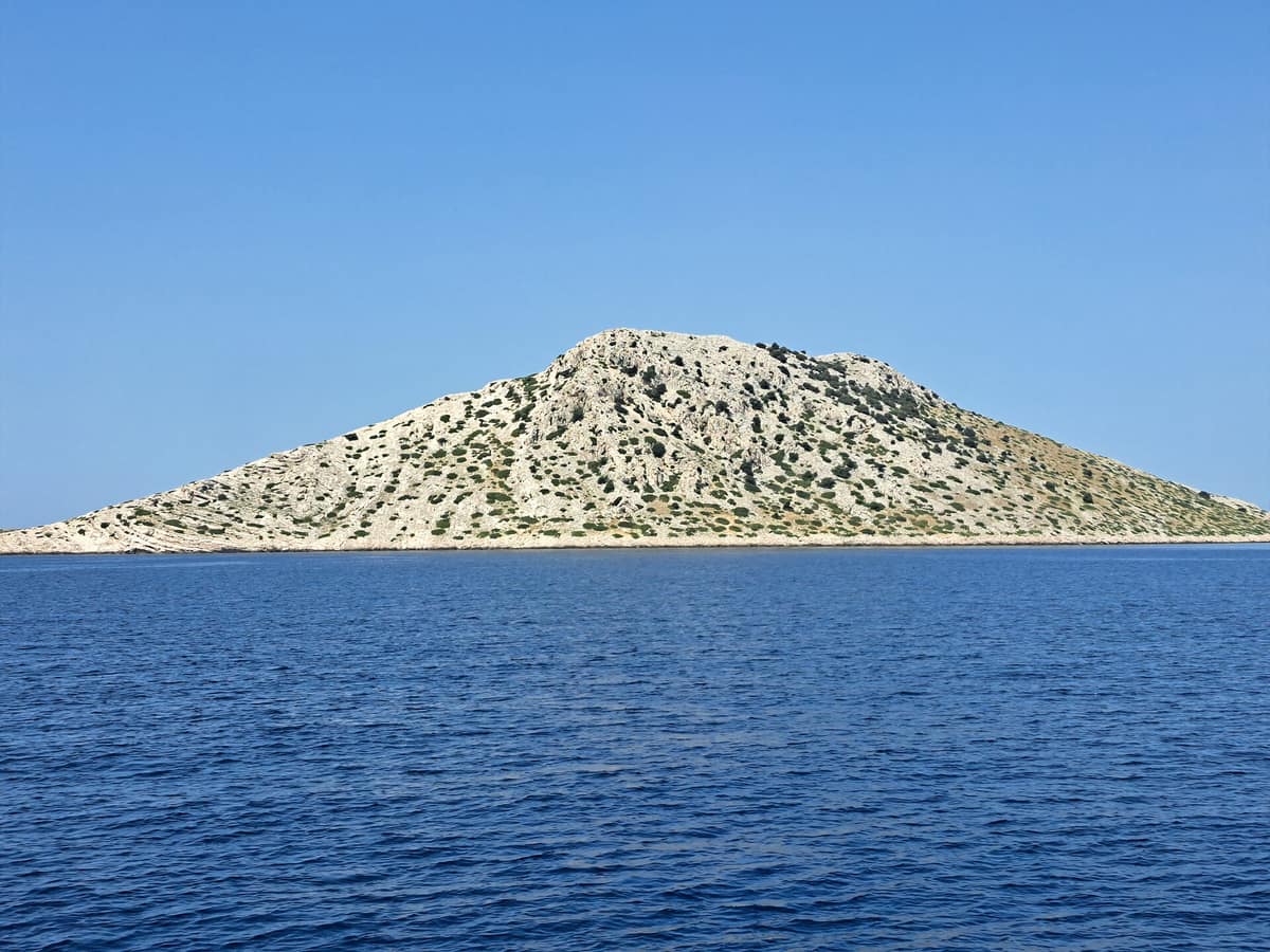
A labyrinth of nearly ninety barren limestone islands, featuring sheer sea cliffs ("crowns") plunging into the open Adriatic.
A labyrinth of white stone floating upon the azure sea. The Kornati archipelago gathers 89 islands, islets, and reefs, stretching over 35 kilometres across some 320 square kilometres of marine waters: it forms the densest island archipelago in the Mediterranean. There are no permanent towns or settlements: landowners, originating primarily from Murter and Dugi Otok, maintain rustic stone cottages in sheltered inlets as seasonal retreats. What exists is pure karst limestone and a national park preserving both the arid islands and their surrounding waters. The park is accessed by sea: it lies some seven nautical miles from Murter and roughly fifteen nautical miles from Šibenik and Zadar.
What makes it unique
An archipelago of stark, bare islands and vertical cliffs, where the stony landscape was forged by pastoral fire and lush posidonia meadows thrive just beneath the surface.
The place
Nature
The landscape
Almost the entire archipelago is karst: limestones and dolomites deposited some one hundred million years ago, riddled with fossils of crustaceans and prehistoric fish. The rock is porous and dry, which is why numerous rainwater cisterns supply water to humans and sheep. Every characteristic karst landform appears, crowned by dramatic cliffs.
The "crowns", vertical cliffs rimming the outer islands facing the open sea, follow a major geological fault line: on Piškera they plummet over 90 metres beneath the sea, while on Klobučar they soar more than 80 metres above the waves. Facing the open Adriatic, these submerged drop-offs host coralligenous biocoenoses, a marine habitat dominated by calcareous red algae, sponges, solitary corals, and bryozoans.
The islands were not always barren. Kornati was once clothed in dense holm oak forests, which islanders gradually converted into rocky pastures over centuries; deforestation, erosion, and overgrazing depleted terrestrial fauna and depopulated the islands. A core objective in establishing the national park is safeguarding this cultural pastoral landscape, born of deliberate burning for sheep grazing. Today, these stony pastures constitute Natura 2000 dry grassland habitats sustained by traditional sheep husbandry.
Kornat, covering 32,44 km², is the largest island and accounts for two-thirds of the park’s land area; it measures 25,2 km in length while never exceeding 2,5 km in width.
Wildlife and seasons
The marine realm is the crowning asset. Across sandy and muddy seabeds thrive extensive meadows of Neptune grass, a marine flowering plant endemic to the Mediterranean that enriches coastal waters with oxygen while serving as a nursery, feeding area, and sanctuary. In the park’s waters, researchers have documented 353 seaweed taxa, 3 marine phanerogams, and roughly 850 animal species, including 61 corals, 177 molluscs, and 185 fishes. When cruising through the archipelago, one frequently encounters the bottlenose dolphin, the most widespread and only resident dolphin species in the Adriatic; its local population numbers around 147 individuals, mainly congregating in the southern waters. Sea turtles appear with reasonable frequency: the loggerhead sea turtle enters the Adriatic to feed and overwinter, finding abundant nourishment and tranquil bays. The noble pen shell (Pinna nobilis), a rare bivalve, inhabits Kornati under strict legal protection.
Ashore, seabirds represent the most conspicuous fauna. There are two major breeding colonies of yellow-legged gulls, one numbering 400 to 500 pairs and another of 200 to 300 pairs; an important colony of around 150 pairs of European shags nests on the cliffs, alongside colonies of swifts and scattered eyries of peregrine falcon, Eurasian eagle-owl, and raven. The rocky pastures, prevalent throughout the islands, form prime hunting grounds for the eagle-owl, with the park supporting an estimated 5 to 7 breeding pairs. During seasonal migrations, species such as common crane, black-winged stilt, and grey heron pause across the archipelago.
Reptiles include four snake species, none venomous. The giant peacock moth (Saturnia pyri), Europe’s largest butterfly, displays a wingspan of up to 15 cm and can be seen on spring nights in April and May. Among flora, tree spurge flowers in autumn and winter, sheds foliage in late spring, and stands virtually bare in summer like North African xerophytes; in cliff fissures grows Centaurea ragusina, a rare Illyrian-Adriatic endemic knapweed.
Species
With a page in the atlas
Being mentioned in a source doesn't guarantee sightings: check with the people who manage the area.
Memory and protection
History and conservation
The earliest shepherds from Murter and Betina arrived in the thirties of the seventeenth century to graze flocks belonging to Zadar nobility. In 1885 Murter islanders purchased the island of Žut, and in 1896 they acquired Kornat along with its archipelago, gaining ownership of more than 90 % of the archipelago’s landmass. Consequently, virtually all terrestrial property remains in private hands today.
In 1980, 89 islands and islets were proclaimed a national park alongside their surrounding waters. In 1988 the north-western sector was separated to establish Telašćica Nature Park. Local boatmen famously amused themselves at the expense of nineteenth-century Austrian cartographers by inventing cheeky toponyms, resulting in whimsical island names like Babina Guzica and Kurba Vela.
Fishing is strictly regulated to facilitate the regeneration of heavily exploited fish stocks.
Before you set off
Visiting
How to visit
Kornati is reached exclusively by sea. Numerous commercial excursion boats operate day tours: during July and August boats depart daily, while in May, June, September, and October excursions cater predominantly to pre-booked groups, which individual travellers may join.
Once in the park, regulations are straightforward. On land you may only walk along designated trails and footpaths, as the entire land area is private property. The outer sea cliffs and marine waters represent the primary highlight: scuba diving is permitted solely in organised groups with licensed diving operators and prior permits, whereas snorkelling requires no special authorisation.
For visitors arriving on private yachts, anchoring and overnight stays aboard are permitted only within officially designated bays. The park maintains ecological mooring fields across sixteen locations, providing 164 mooring buoys securely anchored to protect delicate seabed posidonia. The park remains open to visitors year-round.
Before you go
There are four strict nature reserve zones—centred around Purara, Klint and Volić, Mrtenjak, Kolobučar, and Mali and Veliki Obručan—where all visitor access is prohibited. Damaging or uprooting flora and hunting, harassing, injuring, or taking wild animals is outlawed. Stacking balanced stone cairns is forbidden due to the ecological harm it inflicts on microflora.
Summer brings high visitor traffic from tour boats and pleasure yachts.
Check access, rules and visiting conditions in the official information from the managing body before you set off.
Location
Where it is and how far it reaches
Boundary of Kornati · © EEA, CDDA (CC-BY) The coordinate is estimated; it isn't a verified access point.
Transparency
Sources
The research data with its sources, and the official links for this place, are in the Spanish version of this page. See the Spanish version
Around it
Telašćica Nature Park borders Kornati to the north-west: until 1988 it was part of the same national park. Further afield, Cap de Creus Natural Park, Scandola Nature Reserve, and Port-Cros National Park share bottlenose dolphins and peregrine falcons, while La Mola (Formentera) shares posidonia meadows and bottlenose dolphins.
What else to explore nearby
Approximate straight-line distance between the edges of each area. It doesn't indicate access, routes or driving times.
- Telašćica Nature Park
Zadar (Dugi Otok Island)
Borders this area
Sea cliffs rising over 150 metres above the open Adriatic and the saltwater Lake Mir, at the southern tip of Dugi Otok.
JFMAMJJASONDMay – June · September – October · Crowding moderate
If you like this place, elsewhere in Europe
Distant places with uncommon wildlife and habitats in common. The most widespread species don't count. Sharing species doesn't imply a corridor or guaranteed presence.
- Cap de Creus Natural Park
Catalonia (Girona / Cadaqués / El Port de la Selva / Roses)
In common: European shag · Posidonia oceanica · Common bottlenose dolphin — marine, wild coast
The easternmost point of the Iberian Peninsula, where the Pyrenees plunge into the sea in a labyrinth of metamorphic schists sculpted by the tramontana.
JFMAMJJASONDApril – June · September – October · Crowding moderate
- Atlantic Islands of Galicia National Park
Galicia (Cíes / Ons / Sálvora / Cortegada)
In common: Yellow-legged gull · European shag · Common bottlenose dolphin — marine, wild coast
Four granitic archipelagos guarding the mouth of the Rías Baixas, with seabird nesting cliffs facing west and sheltered sand dunes facing east.
JFMAMJJASONDApril – June · September – October · Crowding high
- Mljet National Park
Dubrovnik-Neretva (Island of Mljet — Pomena / Polače)
In common: Pinna nobilis · Posidonia oceanica · Eurasian eagle-owl — wild coast
The western end of the island of Mljet: Mediterranean forests of Aleppo pine and holm oak embracing two saltwater lakes with an island monastery.
JFMAMJJASONDMay – June · September – October · Crowding moderate
- Cape Kamenjak
Istria (Premantura)
In common: Pinna nobilis · Posidonia oceanica · Common bottlenose dolphin — wild coast
The southern tip of Istria: an undeveloped peninsula of coves, scrubland, and wild orchids.
JFMAMJJASONDApril – June · September – October · Crowding moderate
Entry #1049 of the original atlas.