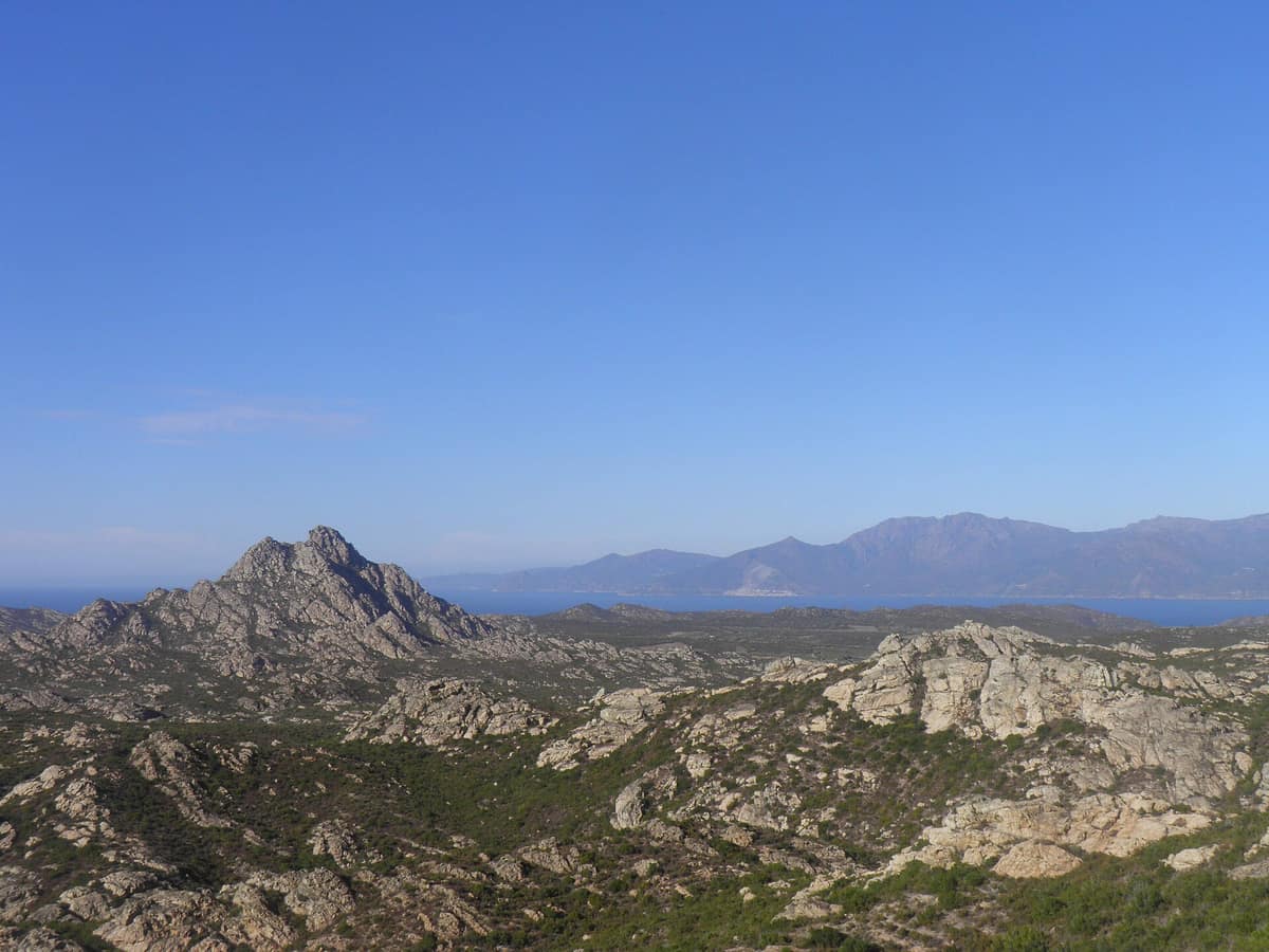
Cap Corse and Agriate Marine Natural Park
Parc Naturel Marin du Cap Corse et de l'Agriate
Corsica (Bastia / Saint-Florent / Centuri) · France
Photo: Gzen92 · CC BY-SA 4.0 · Wikimedia Commons
The largest Marine Natural Park in metropolitan France (6.800 km²), safeguarding the pristine scrubland of the Agriates Desert and the Genoese towers of Cap Corse.
This park is scarcely stepped upon: you observe it from the headlands, sail across its waters, or explore its depths with mask and snorkel. The Cap Corse and Agriate Marine Natural Park was established on 15 July 2016 as the eighth marine park of its kind in France, stretching from the shorelines of Cap Corse and the Agriates nearly a hundred kilometres offshore facing the Balagne. Encompassing 6.830 km², it is the largest in metropolitan France, spanning waters whose moods shift sharply between the eastern and western coasts of the peninsula.
What makes it unique
A seascape of seagrass meadows and coralligenous atolls, with Audouin's gulls nesting on islets and, ashore, a celebrated «desert» that is anything but.
The place
Nature
The landscape
The essential wealth lies beneath the waves. East of the cape facing La Giraglia stretches a broad continental shelf; to the west, submarine canyons plunge into the abyss. This contrast fosters an exceptional array of marine habitats: meadows of posidonia and cymodocea, maerl beds, Lithophyllum rims, and coralligenous reefs, including formations as rare as coralligenous atolls. These habitats shelter and nourish Mediterranean red spiny lobster, common dentex, and European lobster, while open pelagic corridors see the transit of Atlantic bluefin tuna, greater amberjack, and swordfish.
Ashore, Cap Corse is a schist peninsula extending roughly 40 km from north to south and 10 to 15 km across. To the north, a massive intrusion of gabbros and peridotites produces the characteristic green rock known as serpentinite, sculpting jagged crests and sea promontories. Farther west between Saint-Florent and the Balagne lie the Agriates: 37 km of untamed, roadless coastline. Mont Genova, a distinctive gneiss inselberg, owes its silhouette to Tertiary-era tectonic forces compressing the Hercynian granite basement.
The terrestrial vegetation is classic Corsican maquis: strawberry tree, tree heath, myrtle, cistus, mastic, holm oak, and wild olive, supplemented by maritime pines planted in the middle of the twentieth century. Summers are arid and scorching, swept by warm, desiccating winds, with rainfall arriving largely as violent thunderstorms.
Wildlife and seasons
The underwater fauna encompasses brown grouper, brown meagre, spiny lobster, Mediterranean slipper lobster, violet sea urchin, short-snouted seahorse, bottlenose dolphin, and fin whale, while deep shelf breaks provide a refuge for the angelshark. Great cetaceans regularly migrate through park waters; when encountering marine mammals, respectful observation is mandatory: never approach animals deliberately or impede their trajectory when swimming, paddleboarding, or kayaking.
Above, the sky hosts a vibrant story. In spring, migratory flyways and the northern islets of Cap Corse offer sanctuary, feeding, and breeding grounds for marine avifauna. The northern tip sustains nesting colonies of Audouin's gull, European shag, Scopoli's shearwater, and the osprey. When observing them, remain quiet and maintain distance, observing peace perimeters around osprey eyries.
The Îles du Cap Corse encompass 66 hectares, comprising three rocky islets to the northeast and two offshore islands. Here breeds Audouin's gull, endemic to the Mediterranean, alongside the Tyrrhenian wall lizard and the European leaf-toed gecko. From 1 March to 31 August, all landing is prohibited.
Species
With a page in the atlas
Being mentioned in a source doesn't guarantee sightings: check with the people who manage the area.
Memory and protection
History and conservation
The Agriates were not always a «desert». The moniker was coined by British travellers during the Belle Époque, despite the land having sustained productive agriculture for centuries. Following the 1914-1918 war, Corsica suffered heavy casualties among its young rural workforce; cultivated terraces were abandoned and the land gradually reverted to scrub, becoming «deserted» in the social sense. Today it represents a prized biodiversity reservoir sheltering rare species.
The coast preserves a defensive network: three Genoese watchtowers, now ruined, guarded coastal extremities—Mortella and Fornali to the east, and Ostriconi to the west—while Cap Corse numbered ten watchtowers in 1530 and thirty in 1730. Near Monte Rivincu stand two megalithic dolmens, one of which, a Casa di l'Orcu («the ogre's house»), is a classified historic monument. At Canari, open-cast asbestos mining operated between 1935 and 1965.
The marine park anchors a regional strategy to protect 15 % of Corsican coastal waters. Its management board convenes 49 representatives from local authorities, state agencies, maritime professions, environmental bodies, and scientific institutions, steering six core priorities that include protecting flagship species, enhancing water quality, and promoting sustainable maritime heritage.
Before you set off
Visiting
How to visit
The Agriates are best explored on foot along the shoreline. The coastal customs trail (sentier des douaniers) follows the wild coast, taking between two and three days to complete. Traditional shepherd dry-stone huts (pagliaghji) provide basic shelter at Alga Putrica and Ghignu. If you wish to reach a specific beach, an unpaved 12 km track leads from Casta to Saleccia, while water taxis depart Saint-Florent for Lotu and Saleccia beaches.
Educational outings are also offered: under the Amparà u mare initiative, the park ran a youth snorkelling excursion in Miomu following three classroom marine education sessions. May through October offers the best conditions.
Before you go
Along the unpaved tracks of the Agriates, wildfire is the primary danger. Information boards at each trailhead display current fire hazard levels, which can lead to complete track closures. Around the Îles du Cap Corse, beyond the seasonal landing ban from 1 March to 31 August, all unauthorized landing is banned, and maritime anchoring is prohibited year-round within 200 m of the islands.
Check access, rules and visiting conditions in the official information from the managing body before you set off.
Location
Where it is and how far it reaches
Boundary of Cap Corse Et Agriate · IUCN V · © EEA, CDDA (CC-BY) The coordinate is estimated; it isn't a verified access point.
Transparency
Sources
The research data with its sources, and the official links for this place, are in the Spanish version of this page. See the Spanish version
Around it
The Parc naturel régional de Corse lies approximately 19 km away. Farther afield, Parc national de Port-Cros, Parco Nazionale dell'Arcipelago Toscano, and Parc Natural del Cap de Creus share coastal waters and species such as the yelkouan shearwater and common bottlenose dolphin.
What else to explore nearby
Approximate straight-line distance between the edges of each area. It doesn't indicate access, routes or driving times.
- Corsica Regional Nature Park
Corsica (Corte / Ajaccio / Bastia / Porto)
About 19 km away
Covers more than 40 % of the island of Corsica (375,000 ha), encompassing the backbone of Monte Cinto (2,706 m) and the canyons of the Restonica and Tavignano.
JFMAMJJASONDMay – October · Crowding moderate
If you like this place, elsewhere in Europe
Distant places with uncommon wildlife and habitats in common. The most widespread species don't count. Sharing species doesn't imply a corridor or guaranteed presence.
- Port-Cros National Park
Provence-Alpes-Côte d'Azur (Var / Hyères)
In common: Yelkouan shearwater · Scopoli's shearwater · Common bottlenose dolphin — wild coast, marine
One of the oldest marine parks in Europe (1963): an island cloaked in Mediterranean forest and posidonia seabed protected for sixty years.
JFMAMJJASONDMay – June · September – October · Crowding moderate
- Lastovo Archipelago Nature Park
Dubrovnik-Neretva (Lastovo Island)
In common: Yelkouan shearwater · Scopoli's shearwater · Common bottlenose dolphin — wild coast, marine
One of Croatia's most remote inhabited islands and dozens of islets, with pristine night skies and largely undisturbed seabed ecosystems.
JFMAMJJASONDMay – June · September – October · Crowding very low
- Cap de Creus Natural Park
Catalonia (Girona / Cadaqués / El Port de la Selva / Roses)
In common: Yelkouan shearwater · Common bottlenose dolphin — wild coast, marine, steppe and grassland
The easternmost point of the Iberian Peninsula, where the Pyrenees plunge into the sea in a labyrinth of metamorphic schists sculpted by the tramontana.
JFMAMJJASONDApril – June · September – October · Crowding moderate
- Selvagens Islands Nature Reserve
Autonomous Region of Madeira (Selvagem Grande / Selvagem Pequena)
In common: Scopoli's shearwater · Common bottlenose dolphin — wild coast, marine, steppe and grassland
Portugal's southernmost territory and one of Europe's oldest strict marine reserves (1971), harbouring the world's densest colony of Cory's shearwater (Calonectris diomedea).
JFMAMJJASONDMay – September · Crowding none
Entry #633 of the original atlas.